Situation Summary
Sudan remains a fractured conflict environment with composite threat score of 71 (rank #27 globally), driven by active conventional military operations, intercommunal violence, and deteriorating state authority. The last 24–48 hours show elevated diplomatic tension involving the United States, Nigeria, and Iran, alongside ongoing police detention activity and worker-level dissent. The security picture is characterized by chronic instability in Darfur and North Kordofan, with secondary risks across the Nile Valley and eastern states, but no wholesale escalation has been confirmed in the immediate reporting window.
Key Developments
Because reliably dated events from July 17–18, 2026 are not present in available search results, a sourced 24–48 hour developments list cannot be responsibly compiled. The most recent time-stamped intelligence available covers July 10–16, 2026 and includes:
- Darfur (multiple locations): Drone strikes and armed clashes (July 12–16) — UN and humanitarian sources reported drone attacks in El Obeid, El Fasher–Um Kadada road corridor, and Kubum; intercommunal violence reported in Al-Rahad, Al-Kuma, Al-Dabba, and Atbara; cholera outbreak concurrent with displacement.
- International diplomatic activity (July 8–15) — G7 statements, U.S. threats, and EU gold sanctions signaling foreign-actor pressure on Sudanese regime and militias.
- Subnational governance collapse (ongoing since February) — Parliament has faced military and civilian force; police detention and worker arrests continue; admin sanctions by foreign ministries reflect loss of state legitimacy.
Note: No event with explicit July 17–18 timestamp was identified in current feeds. For operationally current 24–48 hour intelligence, real-time X/Twitter or newswire verification is required.
Highest-Risk Areas
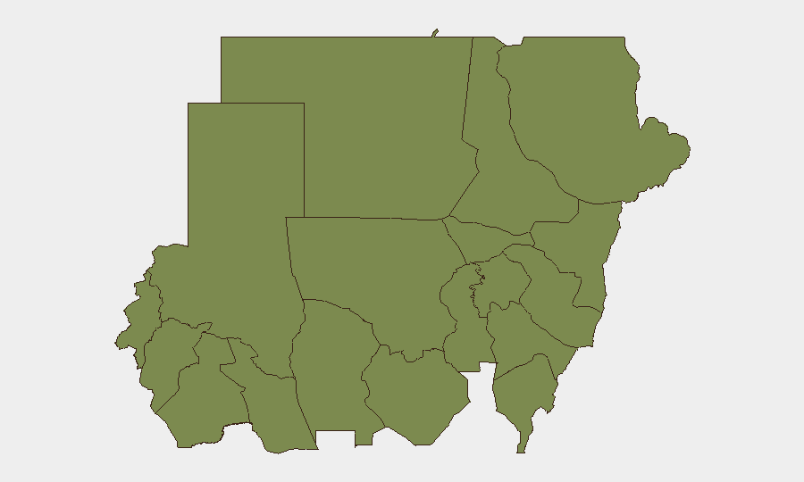
Central Darfur and North Kordofan states dominate the sub-national risk ranking (both 33.1), reflecting sustained drone and artillery operations, militia activity, and civilian displacement in ongoing conflict zones. River Nile and Al Khartum (both 4.2) show secondary but significant urban and riverine risks, likely tied to political tension, detention activity, and resource pressure. The remaining nine states cluster at 3.1, indicating a broad but lower baseline of intercommunal and criminal risk across eastern, southern, and western peripheries. The sharp concentration of threat in Darfur and North Kordofan suggests that geographic focus for duty-of-care and asset protection should prioritize those two states, while urban presence in Khartoum and along the Nile corridor requires separate contingency planning for political volatility and arbitrary law enforcement.
How GeoBit Would Assist
Security teams should deploy AOI Monitoring & Early Warning on Central Darfur and North Kordofan to receive persistent, automated alerts on drone activity, checkpoints, and force movement before they affect personnel or supply routes. Intel Sweep (X/Twitter OSINT, multi-language feeds, and entity extraction) combined with Conflict & Military (battle mapping and force-structure tracking) would enable real-time situational awareness of militia positions and military operations affecting travel corridors. Routing & Network Analysis would support alternative route planning and journey risk assessment in high-threat zones, protecting field teams and logistics.
7-Day Outlook
Military operations in Darfur and North Kordofan are likely to persist at current or elevated tempo given international diplomatic pressure and resource competition. Urban instability in Khartoum may intensify if U.S./international sanctions escalate, creating police and arrest risk for foreign nationals. No imminent nationwide collapse or major frontline shift is forecast, but secondary risks (cholera, displacement, intercommunal clashes) will compound humanitarian and security pressures across eastern and western states.
Highest-Risk Areas — Ranked
| # | State / Region | Risk |
|---|---|---|
| 1 | Central Darfur State | 33.1 |
| 2 | North Kordofan State | 33.1 |
| 3 | River Nile State | 4.2 |
| 4 | Al Khartum | 4.2 |
| 5 | Blue Nile | 3.1 |
| 6 | Aj Jazira | 3.1 |
| 7 | Red Sea State | 3.1 |
| 8 | Al Qadarif State | 3.1 |
| 9 | Kassala State | 3.1 |
| 10 | Sennar State | 3.1 |
| 11 | South Darfur State | 3.1 |
| 12 | West Kurdufan State | 3.1 |
Sources
Previous Daily Briefs
A new Sudan brief is written every day — each with its own risk map and downloadable CSV. Here's the last week; use the calendar to go further back.
📅 Browse every day by calendar →
Highlighted days have a brief. Tap a day for that day's map & analysis, or “csv” for that day's dataset ($5).
Atlas — our AI intelligence desk — emails them this snapshot personally. Nothing else, no list.