Situation Summary
Syria remains in a state of volatile transition following the collapse of the Assad regime in late 2024. The country faces overlapping threats from residual terrorist activity (particularly Islamic State), renewed armed-group friction in the northeast, localized unrest tied to foreign fighter populations, and persistent urban insecurity in Damascus. A café bombing in the capital on 11 July killing at least 5–6 people and injuring 16–22 signals that terrorism and factional violence remain acute risks despite interim government stabilization efforts.
Key Developments
- Damascus, central city café, 11 July 2026 – An explosion killed 5–6 people and injured 16–22, according to Syrian state media and cross-checked reporting. Casualty variance reflects typical early-incident reporting inconsistency, but confirms a lethal bombing in central Damascus within the past 24 hours.
- Deir ez-Zor region, Conoco gas plant, 11 July 2026 – The Syrian government completed takeover of the strategic gas facility following withdrawal of the Syrian Democratic Forces (SDF). The shift in control of key energy infrastructure may intensify friction among armed actors in the northeast and affect security posture around Deir ez-Zor.
- Eastern Syria, unspecified location, 11 July 2026 – Islamic State claimed responsibility for an attack that killed two Syrian army soldiers, marking IS's first lethal operation against Syrian government forces since February 2026. The claim signals renewed operational capacity and threat to military and civilian targets in eastern areas.
- Northwestern Syria, government security facility, 11 July 2026 – Syrian forces detained several Uzbek fighters during a security operation; a dispute escalated into protests outside the facility. The incident reflects tensions around foreign fighter populations and potential flashpoints for further localized unrest or state response.
- Damascus and countrywide political centers, 11 July 2026 – Interim President Ahmed al-Sharaa announced government changes via presidential decrees. Political restructuring may affect internal security force coordination, intelligence operations, and the state's ability to counter terrorism and enforce law and order.
- Damascus and urban centers, recent days through 11 July 2026 – Multiple bomb attacks have rattled the capital. Al Jazeera reporting indicates ongoing explosions amid sustained security concerns, suggesting the café blast is part of a pattern rather than an isolated incident.
Highest-Risk Areas
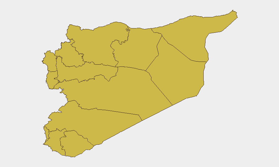
Damascus Governorate (risk 91.3) dominates the threat landscape, driven by urban bombings, political volatility, and concentration of state and international actors. Hama Governorate (66.7) and Homs Governorate (63.3) remain elevated due to residual armed-group presence and territorial disputes. Aleppo and the northwestern corridor (Lattakia, Tartus, Idleb at 61.3) face compounded risk from foreign fighter activity, SDF-government friction, and IS operational cells. Eastern regions including Ar-Raqqa (61.3) and the broader Deir ez-Zor area face IS resurgence and competition for control of energy infrastructure; the UNDOF zone (61.3) and Al-Quneitra reflect ongoing Israeli-Syrian tensions and strategic vulnerability.
How GeoBit Would Assist
Security teams should deploy AOI Monitoring & Early Warning on Damascus, Deir ez-Zor, and Idleb to detect emerging protest activity, armed-group movement, and bombing patterns in near-real time. Intel Sweep and multi-language OSINT (X/Twitter, Telegram, local media) will track IS claims, foreign fighter networks, and government security operations. Network & Actor Analysis will map relationships among SDF, interim government forces, IS cells, and Uzbek fighter contingents to anticipate friction points and secondary incidents.
7-Day Outlook
Expect continued elevated threat in Damascus from bombing incidents and potential secondary attacks. The IS claim of a lethal operation suggests a testing phase; further attacks on military or infrastructure targets in the northeast are plausible. Political decrees and foreign fighter tensions may trigger localized unrest or crackdowns in the northwest, further complicating security force operations and civilian protection.
Highest-Risk Areas — Ranked
| # | State / Region | Risk |
|---|---|---|
| 1 | Damascus Governorate | 91.3 |
| 2 | Hama Governorate | 66.7 |
| 3 | Homs Governorate | 63.3 |
| 4 | Aleppo Governorate | 61.8 |
| 5 | Lattakia Governorate | 61.3 |
| 6 | Tartus Governorate | 61.3 |
| 7 | UNDOF | 61.3 |
| 8 | Al-Quneitra Governorate | 61.3 |
| 9 | Dar'a Governorate | 61.3 |
| 10 | Idleb Governorate | 61.3 |
| 11 | Ar-Raqqa Governorate | 61.3 |
| 12 | Rif Dimashq Governorate | 61.3 |
Previous Daily Briefs
A new Syria brief is written every day — each with its own risk map and downloadable CSV. Here's the last week; use the calendar to go further back.
📅 Browse every day by calendar →
Highlighted days have a brief. Tap a day for that day's map & analysis, or “csv” for that day's dataset ($5).
Atlas — our AI intelligence desk — emails them this snapshot personally. Nothing else, no list.