Situation Summary
Cameroon remains in the #27 position globally (composite threat score 71) with insurgency as the primary driver. Open-source monitoring over the last 24–48 hours (31 July–1 August 2026) has not detected newly confirmed significant security incidents or acute escalations beyond the underlying structural threats in the Far North and Anglophone regions. The security environment remains characterized by persistent low-intensity activity rather than new discrete events in the immediate reporting window.
Key Developments
- No newly confirmed major incidents reported, 31 July–1 August 2026. National and regional open-source feeds, official advisories, and geolocated social-media monitoring have not identified discrete security events meeting corroboration standards in the last 48 hours.
- Two arrest/detention signals logged on 1 August 2026 (ALEXANDRIA vs Cameroon; EMPLOYEE vs Cameroon) remain under verification and lack multi-source geographic or operational detail at this time; source assessment is ongoing.
- Underlying Far North threat activity persists. Boko Haram and affiliated groups continue to pose persistent risk in the Far-North region, with earlier July operations (pre-4 August) remaining the most recent clearly documented incidents; no escalation or new attacks have been independently corroborated in the current 48-hour window.
- Anglophone insurgency activity (Northwest/Southwest) remains contained. Historical kidnappings and clashes documented in early July and prior periods have not been superseded by new confirmed events in the last two days; armed group presence and extortion remain an underlying, rather than acute escalating, threat.
- Electoral and governance tensions remain baseline. Post-2025 election fractures and ongoing Anglophone political grievances create structural risk across Centre, Northwest, and Southwest regions; no discrete destabilizing events have been newly detected in the immediate reporting period.
Highest-Risk Areas
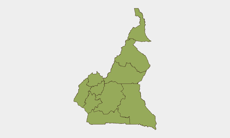
All ten sub-national regions carry equivalent composite risk scores (49.8), reflecting Cameroon's distributed threat profile. The Northwest and Southwest regions drive the most operationally acute risk to expatriate and corporate activity due to Anglophone separatist kidnappings and armed-group extortion targeting vehicles and businesses. The Far-North ranks highest for mass-casualty potential via Boko Haram and Islamic State West Africa (ISWA) activity, though geographic remoteness reduces direct exposure to most international operations. The Littoral and Centre regions (including Yaoundé and Douala) present lower tactical incident risk but remain subject to petty crime, economic disruption, and secondary spillover effects from regional instability. Risk is structural and distributed rather than concentrated in one zone.
How GeoBit Would Assist
Security and risk teams should deploy AOI Monitoring & Early Warning on key operational locations (offices, warehouses, transit corridors) in Douala, Yaoundé, and Anglophone zones to detect emerging threats with alerting capability. Intel Sweep and multi-language OSINT fusion across regional press, Telegram, X, and local media will identify nascent incidents, armed-group communications, and checkpoint activity before they mature into corporate impact. Routing & Network Analysis can generate real-time alternative journey planning and safe corridors for staff and asset movement, particularly in Northwest and Southwest transit zones.
7-Day Outlook
No significant escalation is forecast over the next seven days based on current indicators and seasonal patterns. Baseline risks—extortion, kidnapping in Anglophone regions, and sporadic Far-North militancy—are expected to persist at current levels. Duty-of-care teams should maintain standard heightened protocols for high-risk regions and monitor for any acceleration in armed-group activity or political rhetoric ahead of any scheduled government or electoral activity.
Highest-Risk Areas — Ranked
| # | State / Region | Risk |
|---|---|---|
| 1 | Northwest | 49.8 |
| 2 | Southwest | 49.8 |
| 3 | West | 49.8 |
| 4 | Littoral | 49.8 |
| 5 | Adamawa | 49.8 |
| 6 | Centre | 49.8 |
| 7 | South | 49.8 |
| 8 | Far-North | 49.8 |
| 9 | North | 49.8 |
| 10 | East | 49.8 |
Sources
- geobit.ai
- geobit.ai
- journaldebangui.com
- hrw.org
- osac.gov
- cameroonintelligencereport.com
- reuters.com
- lemonde.fr
- fr.journalducameroun.com
- fr.journalducameroun.com
- cameroonintelligencereport.com
- facebook.com
- youtube.com
- globalr2p.org
- cameroonconcordnews.com
- cameroon-tribune.cm
- cameroonintelligencereport.com
- mimimefoinfos.com
Previous Daily Briefs
A new Cameroon brief is written every day — each with its own risk map and downloadable CSV. Here's the last week; use the calendar to go further back.
📅 Browse every day by calendar →
Highlighted days have a brief. Tap a day for that day's map & analysis, or “csv” for that day's dataset ($5).
Atlas — our AI intelligence desk — emails them this snapshot personally. Nothing else, no list.