Situation Summary
Canada's composite threat score remains low globally (rank #106, score 8), but sub-national concentration in Ontario and Nunavut—driven by organized crime, conventional crime, and localized enforcement activity—requires targeted attention. The past 24–48 hours show routine criminal arrests, fraud cases, and traffic enforcement across Ontario's Greater Toronto Area, with no indicators of systemic destabilization or imminent national-level disruption. Recent public statements and investigative signals suggest ongoing law-enforcement response to organized crime and smuggling activity, with no escalation to critical infrastructure or mass-casualty events.
Key Developments
- Toronto Pearson International Airport, Ontario (July 18): Canada Border Services Agency intercepted 37+ kg of undeclared food and animal products, reflecting active biosecurity enforcement and potential supply-chain vulnerability to import-control breach.
- Greater Toronto Area, Ontario (July 18): Durham Regional Police Service arrested suspects in violent sexual assault (Whitby), issued fraud warrant for elder exploitation (Clarington, $33,000 loss), and charged a male following drug-and-firearm investigation (Pickering), signalling elevated personal-crime and weapons activity.
- Mississauga, Ontario (July 18): Peel Regional Police arrested a male youth on sexual assault charges, part of broader personal-safety enforcement across the Region of Peel.
- Region of Peel, Ontario (July 18): Peel Regional Police announced Project ERASE, resulting in 92 arrests for street racing and high-risk driving offences; enforcement activity reducing collision and travel risk on regional highways.
- Online Fraud, Ontario (July 18): Durham Regional Police charged a 15-year-old male and 17-year-old female for counterfeit currency fraud and fraudulent cell-phone purchases via online marketplaces, indicating emerging juvenile cyber-enabled crime.
- Central Alberta (July 18): Environment Canada lifted a red tornado warning covering three counties; severe weather risk was active but resolved without reported major incident.
Highest-Risk Areas
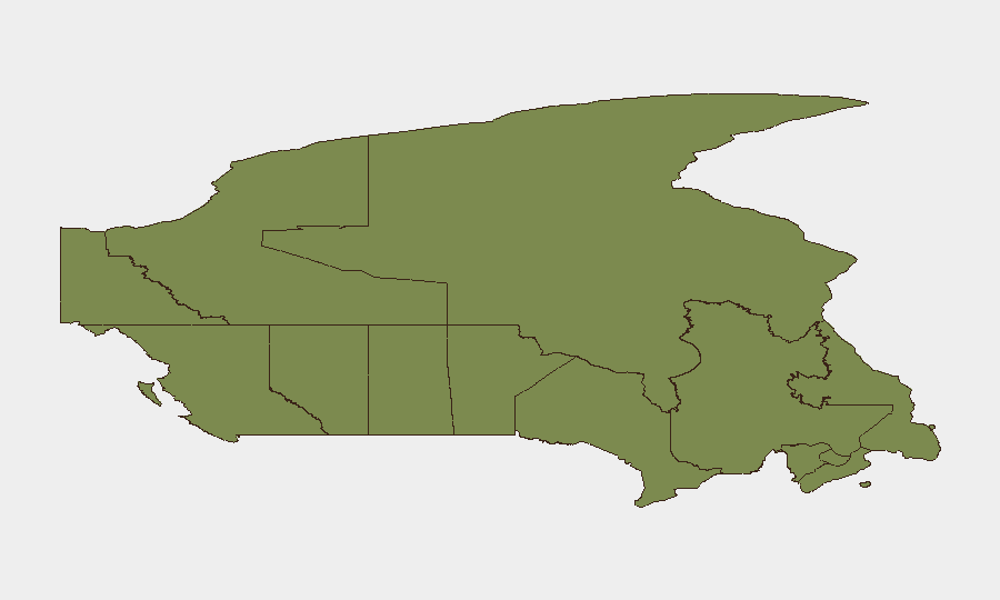
Ontario dominates the sub-national ranking (risk 31.9), reflecting high concentration of organized crime, conventional criminal enforcement, and fraud activity, particularly in the Greater Toronto Area and surrounding regions (Durham, Peel). Nunavut (risk 27), geographically isolated and with constrained law-enforcement reach, carries elevated risk from smuggling and resource-sector vulnerabilities. British Columbia (risk 17.1) and Quebec (risk 12) show moderate but meaningful risk profiles tied to transnational crime and organized-crime networks. Western and Atlantic provinces remain substantially lower-risk, suggesting geographic concentration of threat drivers in central Canada and the north.
How GeoBit Would Assist
Security teams protecting people or assets in Ontario and Nunavut should deploy AOI Monitoring & Early Warning on high-risk postal codes and transportation hubs (e.g., Toronto Pearson, regional police jurisdictions) to detect emerging crime clusters in near-real time. Network & Actor Analysis combined with Search & Research (crime, smuggling, organized-crime keywords) would enable continuous correlation of localized arrests, fraud patterns, and enforcement signals to anticipate where next incidents may concentrate. Routing & Network Analysis supports duty-of-care teams in identifying safer travel corridors and alternative routes during enforcement sweeps or elevated local crime activity.
7-Day Outlook
No indicators suggest rapid escalation or national-level instability. Localized enforcement activity in Ontario and Peel Region is likely to persist as police project momentum; fraud and youth cyber-crime cases will continue appearing in public records. Monitoring for any linkage between organized-crime signals (July 18 event: "PREMIER vs ORGANIZED CRIME") and elevated street crime, weapons seizures, or supply-chain disruption will be critical to early detection of broader destabilization.
Highest-Risk Areas — Ranked
| # | State / Region | Risk |
|---|---|---|
| 1 | Ontario | 31.9 |
| 2 | Nunavut | 27 |
| 3 | British Columbia | 17.1 |
| 4 | Quebec | 12 |
| 5 | Alberta | 6.7 |
| 6 | Manitoba | 4.1 |
| 7 | New Brunswick | 3.3 |
| 8 | Saskatchewan | 2.9 |
| 9 | Prince Edward Island | 2.3 |
| 10 | Yukon | 2.1 |
| 11 | Newfoundland and Labrador | 2.1 |
| 12 | Nova Scotia | 2.1 |
Sources
Previous Daily Briefs
A new Canada brief is written every day — each with its own risk map and downloadable CSV. Here's the last week; use the calendar to go further back.
📅 Browse every day by calendar →
Highlighted days have a brief. Tap a day for that day's map & analysis, or “csv” for that day's dataset ($5).
Atlas — our AI intelligence desk — emails them this snapshot personally. Nothing else, no list.