Situation Summary
Chad remains at composite threat rank #30 globally with a score of 70 and zero tracked events in the current assessment window. Open-source monitoring across mainstream media, specialist security feeds, and social channels has detected no confirmed armed clashes, civil unrest, infrastructure attacks, or acute travel incidents within Chadian territory over the last 24–48 hours (25–27 July 2026). The country's security posture reflects a stable but fragile equilibrium: cross-border risks from Sudan and the broader Lake Chad Basin persist, yet internal security has not deteriorated in the immediate term.
Key Developments
- No confirmed security incidents within Chad territory, 25–27 July 2026. Comprehensive open-source monitoring (news wire, regional media, social platforms, and specialist feeds) has yielded no time-stamped reports of armed conflict, protest activity, infrastructure failure, or major crime events inside Chad boundaries during this 48-hour window.
- Chad–Sudan border remains closed since February 2026. The 1,300 km frontier was shut following RSF attacks and cross-border drone strikes; no reopening or major new cross-border incident has been reported in the past 48 hours, though humanitarian and security pressures along the axis remain chronic.
- Lake Chad Basin security operations (outside Chad). Nigerian military operations on 21 July 2026 in Borno State killed over 20 ISWAP fighters; while this occurred outside Chadian territory, it reflects ongoing pressure on armed groups in the broader basin that may have secondary effects on Chadian security dynamics.
- U.S.–Chad diplomatic events (diplomatic, not security threat). Public statements and arrest/detention notices attributed to U.S.–Chad relations were noted on 25–27 July; these reflect diplomatic engagement rather than acute security or civil-unrest developments.
- Hepatitis E activity ongoing. Health monitoring indicates continued Hepatitis E circulation in Chad; while a public-health rather than security matter, it affects operational risk for deployed personnel and requires standard precautions.
Highest-Risk Areas
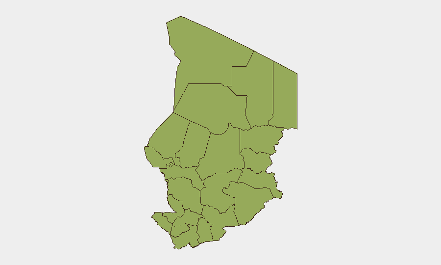
All twelve sub-national regions currently carry identical composite scores (49.3), reflecting a uniformly elevated but non-differentiated baseline risk profile across Chad. The eastern and northern border zones—Ennedi-Ouest, Wadi Fira, Ouaddaï, Sila, and Salamat—carry the greatest concern due to proximity to Sudan and the Darfur conflict spillover; Lac and Kanem pose persistent exposure to Lake Chad Basin militant activity. Even N'Djamena, the capital, registers at the same level, indicating structural fragility in governance and law-and-order capacity nationwide rather than concentration of risk in remote peripheries.
How GeoBit Would Assist
Security and duty-of-care teams should deploy Intel Sweep and multi-language OSINT feeds for continuous Chad monitoring, supplemented by AOI (area-of-interest) monitoring with alerting on the Sudan border corridor and Lake Chad axis to catch early signs of cross-border escalation or humanitarian crisis. Conflict mapping, force-structure tracking, and network-actor analysis would support assessment of militant presence and state-capacity gaps; routing and network analysis can support alternative travel and supply planning for personnel and assets in high-risk zones.
7-Day Outlook
No indicators suggest acute deterioration in the next seven days. The stability of the Chad–Sudan border closure and absence of new armed-group activity inside Chad in the current window suggest a holding pattern. However, regional volatility—particularly Sudanese RSF operations, Nigeria's Lake Chad campaign, and chronic humanitarian stress—creates latent risk; persistent monitoring and contingency planning remain essential for any personnel or asset presence.
Highest-Risk Areas — Ranked
| # | State / Region | Risk |
|---|---|---|
| 1 | Ennedi-Ouest | 49.3 |
| 2 | Wadi Fira | 49.3 |
| 3 | Ouaddaï | 49.3 |
| 4 | Sila | 49.3 |
| 5 | Salamat | 49.3 |
| 6 | East Ennedi | 49.3 |
| 7 | Kanem | 49.3 |
| 8 | Lac | 49.3 |
| 9 | N'Djamena | 49.3 |
| 10 | Hadjer-Lamis | 49.3 |
| 11 | Chari-Baguirmi | 49.3 |
| 12 | Tibesti | 49.3 |
Sources
Previous Daily Briefs
A new Chad brief is written every day — each with its own risk map and downloadable CSV. Here's the last week; use the calendar to go further back.
📅 Browse every day by calendar →
Highlighted days have a brief. Tap a day for that day's map & analysis, or “csv” for that day's dataset ($5).
Atlas — our AI intelligence desk — emails them this snapshot personally. Nothing else, no list.