Situation Summary
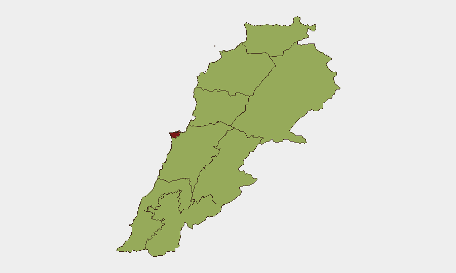
Lebanon is experiencing acute military tensions along its southern border following the commencement of a U.S.-brokered pilot-zone arrangement in which the Lebanese Armed Forces (LAF) are deploying into territory previously under Israeli control. As of 22–23 July, Israeli forces have conducted warning shots, artillery fire, and drone strikes in areas where LAF units are simultaneously establishing positions, indicating implementation friction and persistent Israeli military presence despite announced withdrawal timelines. The political consensus required to sustain the arrangement is fragile, with Hezbollah and Amal figures publicly challenging Israeli compliance. Overall threat ranking places Lebanon at #20 globally; Beirut Governorate dominates the sub-national risk profile at 81.7, driven by political volatility and the capital's role in state negotiations.
Key Developments
- Zawtar al-Gharbiyeh, Nabatieh District (22 July): LAF units entered day two of pilot-zone deployment; Israeli forces fired warning shots near LAF positions, signaling tactical friction over territorial boundaries and Israeli security-zone definitions.[6][4]
- Ali al-Taher hill, Nabatieh Governorate (22 July): Israeli artillery and drone strikes targeted the outskirts of Nabatieh al-Fawqa, with Lebanese National News Agency reporting continued Israeli military operations in designated withdrawal zones.[3][4]
- Froun and Srifa, Southern Lebanon (22 July): LAF units maintained deployment in these villages as part of pilot-zone takeover operations, though Israeli withdrawal remained incomplete according to local Lebanese officials.[2][5]
- Lebanon–Israel border massing (22–23 July): Social media video evidence shows Israeli tank concentrations near the frontier ahead of scheduled negotiations in early August, indicating sustained Israeli military readiness and potential escalation posture.[10][9]
- Political dissent on Israeli compliance (22 July): Hezbollah and Amal representatives publicly stated that Israeli forces have not fully withdrawn from occupied southern areas, undermining domestic confidence in the U.S.-brokered framework and signaling political risk to the arrangement's sustainability.[8][2][9]
- Beirut-level military mobilization (22 July): Lebanese military mobilization orders and presidential directives on conventional force deployment suggest state-level coordination of the LAF transition, with potential spillover risk if northern or eastern tensions escalate.[7]
Highest-Risk Areas
Beirut Governorate dominates the risk landscape at 81.7, reflecting its status as the political and diplomatic epicenter where agreement implementation, elite consensus, and media narrative are contested. The Nabatieh Governorate (54.1) and South Governorate (52.4) are second-order drivers, hosting the active pilot zones and Israeli military presence; artillery, drone, and small-arms incidents in these areas represent the most immediate kinetic risk to personnel and infrastructure. Keserwan-Jbeil, Baalbek-Hermel, and the northern and Akkar regions all score 51.7–53.8, indicating potential secondary escalation risk if border or factional tensions activate those areas.
How GeoBit Would Assist
Corporate and duty-of-care teams should deploy persistent Area-of-Interest (AOI) Monitoring on Beirut, Nabatieh, and the southern border corridor to receive real-time alerts on military movements, air activity, and force concentrations. Conflict & Military battle mapping and force-structure tracking would allow teams to distinguish routine LAF deployment from escalatory Israeli repositioning. OSINT feeds, social media intelligence (X, Telegram, Instagram), and sentiment analysis provide early warning of political fracture within the Lebanese consensus and public statements signaling intent to escalate or withdraw from the pilot arrangement.
7-Day Outlook
Scheduled negotiations in early August present a critical decision point; if Israeli forces do not materially withdraw or if LAF-Israeli incidents proliferate, domestic political support for the arrangement will erode rapidly. Risk of unintended escalation—from warning shots to artillery exchanges—remains elevated in the 50–70 km range south of Beirut through at least 30 July. Personnel movement into or within southern Lebanon should be treated as elevated-risk pending visible Israeli force reduction and formal political reaffirmation of the framework.
Highest-Risk Areas — Ranked
| # | State / Region | Risk |
|---|---|---|
| 1 | Beirut Governorate | 81.7 |
| 2 | Nabatieh Governorate | 54.1 |
| 3 | Keserwan-Jbeil Governorate | 53.8 |
| 4 | Baalbek-Hermel Governorate | 52.7 |
| 5 | South Governorate | 52.4 |
| 6 | North Governorate | 51.7 |
| 7 | Akkar Governorate | 51.7 |
| 8 | Mount Lebanon Governorate | 51.7 |
| 9 | Beqaa Governorate | 51.7 |
Sources
Previous Daily Briefs
A new Lebanon brief is written every day — each with its own risk map and downloadable CSV. Here's the last week; use the calendar to go further back.
📅 Browse every day by calendar →
Highlighted days have a brief. Tap a day for that day's map & analysis, or “csv” for that day's dataset ($5).
Atlas — our AI intelligence desk — emails them this snapshot personally. Nothing else, no list.