Situation Summary
Mali remains in a heightened state of insecurity following coordinated multi-site insurgent assaults on July 4–5, 2026, targeting military positions across the north, centre, and south of the country. No new attacks have been documented in the last 24–48 hours, but security assessments indicate the junta is operationally stretched and isolated, with ongoing armed-group pressure on key towns and supply corridors. The U.S. State Department maintains a "Do Not Travel" advisory for the country; countrywide risk remains high, with particular concentration in the north and central regions.
Key Developments
- Anefis military base, Kidal region (July 4–5, situation still contested as of July 7–8): Azawad Liberation Front (FLA) forces claimed control of the base following engagement with Malian Armed Forces and Russian Africa Corps personnel. Media and analyst updates on July 7–8 describe ongoing combat and contested control, with FLA claiming destruction of two Russian helicopters and interdiction of a reinforcement convoy from Gao.
- Coordinated multi-location assault wave (July 4, impacts continuing through July 7–8): Insurgent forces attacked at least five military positions spanning Anefis, Aguelhok, and Gao (north), Sévaré (centre), and Kenioroba (south of Bamako). Malian Armed Forces broadcast assertions of "control" on July 4, but subsequent analyst reporting on July 7 indicates the junta faces elevated threat and resource constraints.
- Gao–Anefis corridor (July 5 ambush, road-safety impact ongoing through July 8): FLA-linked sources report destruction of military and Russian contractor vehicles and blocking of reinforcement movement between Gao and Anefis on July 5. Follow-up reporting on July 7–8 emphasizes continued disruption of this critical northern supply and movement corridor.
- Prison attack, Bamako vicinity (July 4–5, capital-area tension elevated through July 7–8): Insurgent forces attacked a major prison facility south of the capital and targeted nearby military positions as part of the July 4 assault wave. Analyst assessments on July 7 note heightened junta vulnerability and isolation in Bamako/Kati, with potential for secondary incidents in and around the capital.
- Northern Mali siege-like conditions (July 4–7, ongoing resource and logistics pressure): JNIM and FLA forces continue to pressure government-held positions around Gao, Anefis, Aguelhok, and Sévaré, stretching supply lines and forcing reliance on Russian-backed reinforcement and resupply. Updates through July 8 reference persistent threat to overland movement and infrastructure in the north and centre.
Highest-Risk Areas
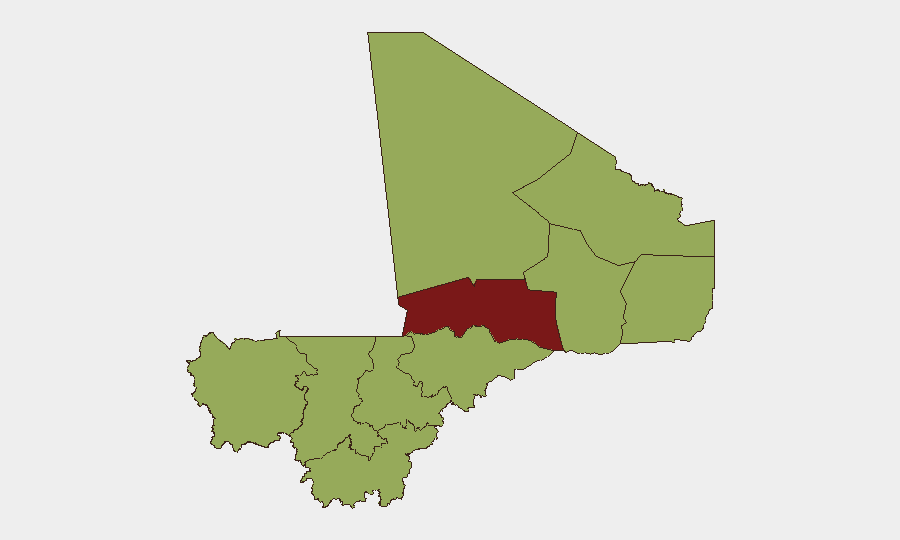
Timbuktu dominates the sub-national ranking (81.4), driven by sustained insurgent activity and fragmented government control. The northern cluster—Ménaka, Taoudénit, Kidal, and Gao—all register 51.4 risk, reflecting active armed-group presence, ongoing military clashes, and disrupted logistics. Notably, Bamako itself ranks 51.4, reflecting the July 4–5 attacks near the capital and the junta's operational isolation; Koulikoro, Ségou, Mopti, and Sikasso (south and centre) equally rank 51.4, indicating that insurgent reach and instability are no longer confined to the north.
How GeoBit Would Assist
Security teams with personnel or assets in Mali would deploy AOI Monitoring & Early Warning on Timbuktu, Kidal, Gao, and the Bamako/Kati corridor to detect renewed militant activity and military reinforcement movements. Intel Sweep and OSINT fusion (X/Telegram, radio SIGINT, multi-language search) would track FLA and JNIM tactical communications and claims in near real-time. Routing & Network Analysis would identify safe alternative routes and pinch-points around the Gao–Anefis and Bamako supply corridors, and battle mapping and force-structure tracking would clarify contested zones and junta vulnerability.
7-Day Outlook
Absent a ceasefire or significant military reversal, the north and centre will remain under active insurgent pressure, with the junta relying on Russian reinforcements to hold key towns. Bamako and surrounding areas will likely see heightened security measures and checkpoints, increasing corporate movement friction. Overland travel and logistics routes should be considered high-risk through at least mid-July.
Highest-Risk Areas — Ranked
| # | State / Region | Risk |
|---|---|---|
| 1 | Timbuktu | 81.4 |
| 2 | Ménaka | 51.4 |
| 3 | Kayes | 51.4 |
| 4 | Taoudénit Region | 51.4 |
| 5 | Kidal | 51.4 |
| 6 | Gao | 51.4 |
| 7 | Bamako | 51.4 |
| 8 | Koulikoro | 51.4 |
| 9 | Ségou Region | 51.4 |
| 10 | Sikasso Region | 51.4 |
| 11 | Mopti | 51.4 |
Sources
Previous Daily Briefs
A new Mali brief is written every day — each with its own risk map and downloadable CSV. Here's the last week; use the calendar to go further back.
📅 Browse every day by calendar →
Highlighted days have a brief. Tap a day for that day's map & analysis, or “csv” for that day's dataset ($5).
Atlas — our AI intelligence desk — emails them this snapshot personally. Nothing else, no list.