Situation Summary
Venezuela is experiencing acute political and security instability driven by institutional crisis, armed-group activity, and U.S. military and diplomatic intervention. The capital (Federal District/Caracas) has seen multiple violent incidents within the past 24–48 hours, including armed-civilian roadblocks, military-zone explosions, and forcible dispersal of student protests. The combination of domestic political fracture, external pressure, and non-state-actor mobilization is elevating risk across key urban centers and remote resource-extraction zones.
Key Developments
- Caracas (Federal District) – July 30, 0600h–1400h local – Armed civilian groups established informal roadblocks throughout multiple sectors, conducting vehicle checks reportedly aimed at identifying U.S.-aligned individuals. This reflects mobilization of non-state enforcers and heightened surveillance risk for foreign nationals.
- Caracas (Federal District) – July 30–31, ~0200h local – Series of explosions reported near La Carlota Air Base and Fuerte Tiuna military complex, accompanied by low-flying aircraft, power outages, and smoke columns. Authorities attributed events to U.S. military action; independent damage and casualty figures remain unconfirmed.
- Caracas (Federal District) – July 30, daytime – Student demonstrations escalated with tear gas and water cannons deployed by security forces in central city zones. Street closures and protest-concentration near university areas created acute travel disruption.
- Caracas (Federal District) – July 30, daytime – U.S. State Department officials confirmed present in capital, conducting meetings and diplomatic engagement amid the crisis. Presence heightens sensitivity around diplomatic compounds and foreign-national visibility.
- Caracas (Federal District) – July 30, evening – Heightened institutional and diplomatic tension documented, including critical public statements from foreign governments (notably Spain) and Venezuelan officials. Tension increases likelihood of retaliatory protests targeting foreign facilities and personnel.
- Caribbean maritime zone – July 30 – U.S. authorities seized a fifth sanctioned Venezuelan oil tanker, continuing blockade operations linked to current crisis. Action exacerbates economic pressure and may trigger domestic protests and military escalation.
- Bolívar state (Orinoco mining belt) – July 30, ongoing – Venezuelan Armed Forces continued operations against illegal miners in gold-rich concessions, with armed confrontations and movement restrictions in remote areas affecting overland logistics and personnel safety.
- National (Deportation operations) – July 30 – Interior Minister Diosdado Cabello announced suspension/reprogramming of Friday U.S. deportation flight due to adverse weather, leaving migrants and reception infrastructure in operational limbo.
Highest-Risk Areas
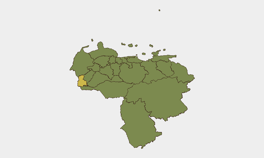
Tachira State (60.1) and Federal District/Caracas (57.7) dominate the risk profile; both face compounded threats from organized armed groups, state-security operations, and political-instability dynamics. Tachira, bordering Colombia, remains vulnerable to spillover violence, trafficking, and cross-border militant activity. Federal District concentrates diplomatic, military, and civilian-protest nodes, amplifying risk of sudden confrontation and collateral exposure to foreign nationals. Secondary clusters in Monagas, Carabobo, and Vargas States reflect ongoing criminality, resource-competition, and proximity to key infrastructure (ports, refineries). Remote mining zones in Bolívar State continue to generate armed-group activity and irregular-warfare risk despite formal military presence.
How GeoBit Would Assist
AOI Monitoring & Early Warning and Intel Sweep (X/Twitter, Telegram OSINT, multi-language feeds) enable real-time alerting of roadblocks, protest escalation, and explosions in monitored city districts. GIS & Spatial Analysis, Satellite & Imagery analysis, and Network & Actor Analysis support damage assessment at military installations, mapping of protest zones, and tracking of armed-civilian-group movements. Routing & Network Analysis delivers alternative-route planning for personnel and supply chains to bypass blocked corridors and high-risk checkpoints.
7-Day Outlook
Immediate escalation risk remains elevated; diplomatic presence, military activity, and non-state-actor mobilization are likely to sustain protest cycles and ad hoc security operations through early August. Likelihood of further explosions, roadblock expansion, or confrontations involving foreign nationals is assessed as moderate-to-high. Personnel and asset teams should expect continued service disruptions, travel restrictions, and heightened scrutiny by armed actors and state security.
Highest-Risk Areas — Ranked
| # | State / Region | Risk |
|---|---|---|
| 1 | Tachira State | 60.1 |
| 2 | Federal District | 57.7 |
| 3 | Monagas State | 36.1 |
| 4 | Carabobo State | 33.7 |
| 5 | Vargas State | 33.7 |
| 6 | Trujillo State | 32.5 |
| 7 | Cojedes State | 32.5 |
| 8 | Zulia State | 31.3 |
| 9 | Sucre State | 31.3 |
| 10 | Falcon State | 30.1 |
| 11 | Federal Dependencies | 30.1 |
| 12 | Nueva Esparta State | 30.1 |
Sources
Previous Daily Briefs
A new Venezuela brief is written every day — each with its own risk map and downloadable CSV. Here's the last week; use the calendar to go further back.
📅 Browse every day by calendar →
Highlighted days have a brief. Tap a day for that day's map & analysis, or “csv” for that day's dataset ($5).
Atlas — our AI intelligence desk — emails them this snapshot personally. Nothing else, no list.