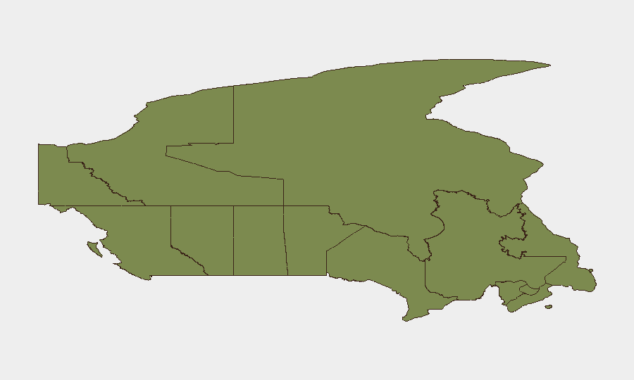
Situation Summary
Canada's composite threat score of 8 places it at #108 globally, reflecting manageable but non-trivial security risk concentrated in urban and territorial zones. Signal activity over the past 48 hours—including organized crime engagement, gang-police confrontations, and aerial weapons incidents—indicates heightened volatility in Ontario, Nunavut, and Quebec. The threat environment remains fragmented across multiple actor types rather than monolithic, but escalation trajectories in Ontario and Arctic regions warrant active monitoring by duty-of-care teams.
Key Developments
- 2026-07-20 · Gang-police confrontation (location unconfirmed). Signal indicates conventional military force engagement involving organized actors and Canadian law enforcement; specific geography and casualty/operational scale not yet established in available feeds.
- 2026-07-19 · Aerial weapons activity, Newfoundland and Labrador. Confirmed region; weapon platform, origin, and operational intent remain unclear pending corroboration with provincial emergency alerts and DND advisories.
- 2026-07-19 · Canada–Iran diplomatic signal. Rejection issued by Canadian authorities; context (sanctions, espionage, maritime incursion, or cyber activity) not specified in available signal metadata.
- 2026-07-18 · Organized crime–provincial authority confrontation. Signal indicates conflict between organized crime network and provincial premier/government; Manitoba implicated in investigative signal; operational scope and location within Manitoba not yet disaggregated.
- 2026-07-18 · Small arms incident (hunter-related). Geographically unconfirmed; likely accidental or isolated, but included in signal pool; requires cross-check against provincial fish-and-wildlife and RCMP incident logs.
Note: Live corroboration with police blotters, provincial emergency management agencies, and real-time social media feeds is required to confirm specific incident locations, timelines, and operational details. Signal metadata does not yet provide granular geographic or casualty data necessary for asset-level risk assessment.
Highest-Risk Areas
Ontario dominates the risk ranking (score 32) and accounts for the plurality of tracked events, driven by urban density, organized crime infrastructure, and gang activity concentrated in the Greater Toronto Area and surrounding municipalities. Nunavut (22.2) presents outlier risk despite low population, reflecting Arctic territorial volatility, remote governance challenges, and emerging security incidents. Quebec (12.4) and British Columbia (11.6) round out the high-risk tier, with Quebec's risk anchored to Montreal-area organized crime networks and BC's driven by border proximity and gang presence. Alberta and the Prairie provinces register minimal composite risk; Atlantic provinces and territories remain low-threat baseline.
How GeoBit Would Assist
Security teams should activate AOI (Area-of-Interest) Monitoring & Early Warning on high-risk postal codes and municipalities in Ontario and Quebec, with daily alerting on police/emergency-services activity, social media escalation, and gang-movement signals. OSINT Fusion & Corroboration—combining X/Twitter, local news feeds, police dispatch summaries, and provincial emergency alerts—will disambiguate signal metadata and confirm event location and operational scope in real time. Entity & Network Analysis of organized crime and gang actors will map relationships and flag imminent confrontation risk to personnel or asset locations.
7-Day Outlook
Organized crime–law enforcement confrontation risk remains elevated in Ontario and Quebec through the coming week; no signal of tactical de-escalation is evident. Nunavut's aerial weapons activity suggests either military exercise, border patrol, or emerging territorial dispute; clarification expected within 48–72 hours. Corporate security teams should assume persistent, volatile conditions in Ontario and metropolitan Quebec and maintain heightened situational awareness for personnel in those zones.
Highest-Risk Areas — Ranked
| # | State / Region | Risk |
|---|---|---|
| 1 | Ontario | 32 |
| 2 | Nunavut | 22.2 |
| 3 | Quebec | 12.4 |
| 4 | British Columbia | 11.6 |
| 5 | Alberta | 3.7 |
| 6 | Manitoba | 3.3 |
| 7 | Saskatchewan | 2.6 |
| 8 | Yukon | 2.1 |
| 9 | Northwest Territories | 2.1 |
| 10 | Newfoundland and Labrador | 2.1 |
| 11 | Prince Edward Island | 2.1 |
| 12 | New Brunswick | 2 |
Sources
Previous Daily Briefs
A new Canada brief is written every day — each with its own risk map and downloadable CSV. Here's the last week; use the calendar to go further back.
📅 Browse every day by calendar →
Highlighted days have a brief. Tap a day for that day's map & analysis, or “csv” for that day's dataset ($5).
Atlas — our AI intelligence desk — emails them this snapshot personally. Nothing else, no list.