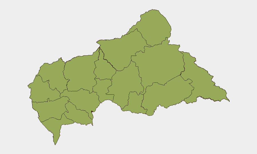
Situation Summary
Central African Republic remains classified as the 34th-highest-threat environment globally (composite score 79), with security conditions characterized by persistent armed-group activity, state fragmentation, and limited government control outside Bangui. The security picture is volatile but not acutely escalating within the last 24–48 hours based on verifiable open-source reporting. Bangui itself carries significantly elevated risk (85.4) relative to provincial areas, driven by urban crime, political tension, and concentration of armed actors. The broader provincial landscape shows uniform elevated risk (55.4 across 11 prefectures), reflecting endemic instability, rebel presence, and weak state capacity.
Key Developments
No security or civil-unrest incidents can be reliably verified as occurring within the last 24–48 hours (13–15 July 2026) based on multi-source open-source confirmation. Available reporting describes events dating to late June or early July, or provides structural/ongoing threat context without precise incident timestamps.
For operational context, the most recent major incident outside the 24–48-hour window was a large-scale rebel offensive in Vakaga prefecture (Am Dafock, near Sudan border, late June–5 July 2026), in which the Patriotic Awakening Alliance (ASP) attacked FACA and Wagner positions, held the town for approximately five days, and wounded three UN peacekeepers before being dislodged by counteroffensive around 5 July. This reflects tactical escalation by rebel coalitions but is over one week old.
A cholera outbreak (confirmed 26 June 2026) with 24+ deaths and 197 cases in Bimbo and Mbaïki health districts near Bangui remains an ongoing public-health concern but is not a security incident.
Reporting also indicates alleged Wagner-linked tramodol trafficking through the upper Ubangi River basin and judicial questioning of two presidential associates (Sani Yalo, Pascal Bida Koyagbélé) on suspicion of regime-destabilization plotting, though neither carries a clear 24–48-hour incident timestamp.
Highest-Risk Areas
Bangui dominates the risk landscape (85.4), reflecting its role as the capital and primary locus of state institutions, armed-group presence, and criminal activity. The eleven provincial prefectures—Bamingui-Bangoran, Vakaga, Haute-Kotto, Haut-Mbomou, Mbomou, Nana-Mambéré, Ouham-Pendé, Mambéré-Kadéï, Sangha-Mbaéré, Ouham, and Nana-Grébizi—each score 55.4, indicating uniform fragility driven by limited state presence, rebel-group territorial control or operations, cross-border instability (particularly Vakaga, bordering Sudan), and humanitarian strain. The provincial uniformity suggests that risk is distributed rather than concentrated, making blanket caution necessary across non-capital operations.
How GeoBit Would Assist
Security teams operating in or monitoring CAR should employ Intel Sweep and global event feeds for continuous near-real-time incident detection, paired with OSINT fusion & corroboration to validate emerging reports against multiple sources before operational response. AOI Monitoring & Early Warning on Bangui and key provincial nodes (Vakaga, Mbomou, Bangui-Bimbo corridor) provides persistent alerting for armed activity, protest, or outbreak spread. Conflict & Military battle mapping and force-structure tracking clarifies rebel-group disposition and FACA–Wagner positioning, essential for route planning and movement timing. Routing & Network Analysis supports identification of alternative transit corridors during localized unrest.
7-Day Outlook
Near-term trajectory remains characterized by low-intensity endemic instability with periodic tactical flare-ups by rebel coalitions, particularly in northern and eastern prefectures. No major political transition or state-collapse indicators are evident in the current reporting cycle. Security teams should anticipate continued sporadic armed clashes and maintain heightened vigilance in Bangui and Vakaga, with cholera-outbreak context extending into broader health-sector risk for the next 7–14 days.
Highest-Risk Areas — Ranked
| # | State / Region | Risk |
|---|---|---|
| 1 | Bangui | 85.4 |
| 2 | Bamingui-Bangoran | 55.4 |
| 3 | Vakaga | 55.4 |
| 4 | Haute-Kotto | 55.4 |
| 5 | Haut-Mbomou | 55.4 |
| 6 | Mbomou | 55.4 |
| 7 | Nana-Mambéré | 55.4 |
| 8 | Ouham-Pendé | 55.4 |
| 9 | Mambéré-Kadéï | 55.4 |
| 10 | Sangha-Mbaéré | 55.4 |
| 11 | Ouham | 55.4 |
| 12 | Nana-Grébizi | 55.4 |
Sources
Previous Daily Briefs
A new Central African Republic brief is written every day — each with its own risk map and downloadable CSV. Here's the last week; use the calendar to go further back.
📅 Browse every day by calendar →
Highlighted days have a brief. Tap a day for that day's map & analysis, or “csv” for that day's dataset ($5).
Atlas — our AI intelligence desk — emails them this snapshot personally. Nothing else, no list.