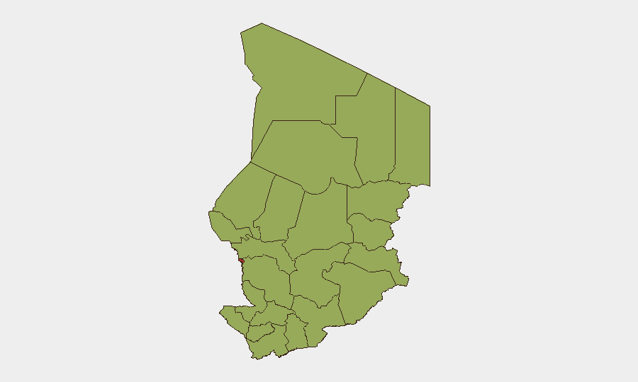
Situation Summary
Chad's internal security environment remains stable with no confirmed armed clashes, civil unrest, or infrastructure attacks reported inside the country in the past 48 hours. However, cross-border drone strikes from Sudan's Rapid Support Forces (RSF) continue to pose a direct threat to civilian populations and local administration in eastern frontier zones, most recently in the Bamna region where multiple incidents have killed civilians and damaged civilian infrastructure. Concurrent political developments—including Chad's announced withdrawal from the ICC and renewed military cooperation with France—signal shifting strategic alignments but do not immediately alter the acute threat picture. Overall risk remains moderate but concentrated geographically, with N'Djamena and border regions bearing the highest exposure.
Key Developments
- Bamna border area (Sudan–Chad frontier), 21 July 2026: RSF drone strike hit civilian and administrative targets on both sides of the frontier, killing 2 civilians and injuring 7 others (including children); casualties evacuated into Chad for treatment. Reported damage includes a drinking-water well and multiple vehicles.
- Bamna region, eastern Chad, 25–27 July 2026: A second drone strike allegedly originating from Sudanese territory struck a local executive director's vehicle and damaged civilian market infrastructure; described as the fifth such cross-border drone incident in recent months, indicating a pattern of sustained RSF incursions.
- N'Djamena, 27 July 2026: Chad's military government announced withdrawal from the International Criminal Court, citing limited and uneven effectiveness; decision may affect international legal cooperation and accountability mechanisms but does not constitute an immediate security incident.
- N'Djamena, recent days (last week): France and Chad initiated rebuilding of military cooperation, including training, intelligence sharing, and limited deployments, focused on counter-terrorism and border security in the Lake Chad Basin following France's 2024 exit.
- Regional political statements, 26–28 July 2026: Multiple cross-border diplomatic statements recorded from Nigeria, the United States, Italy, and Indonesia; no new violence or unrest reported domestically as a result, though monitoring of intentions remains warranted.
Highest-Risk Areas
N'Djamena (76.8 composite risk) dominates the threat landscape as Chad's capital and primary nexus of political decision-making, administrative infrastructure, and expatriate concentration. The remaining 11 provinces cluster at risk 46.8, reflecting a structural belt of chronic instability across the eastern and northern frontier zones—Ennedi-Ouest, Wadi Fira, Ouaddaï, Sila, Salamat, East Ennedi, Kanem, Lac, Hadjer-Lamis, Chari-Baguirmi, and Tibesti—where state presence is weak, cross-border smuggling and militant transit routes persist, and RSF incursions from Sudan directly threaten civilians. The 30-point gap between the capital and provincial areas indicates risk concentration rather than dispersal; security teams should treat N'Djamena's political and administrative risks as distinct from the dispersed frontier violence pattern.
How GeoBit Would Assist
Security teams should deploy AOI Monitoring & Early Warning on the Bamna border corridor and Lake Chad Basin to detect patterns in RSF drone activity and provide real-time alerting on new strikes. Network & Actor Analysis combined with OSINT fusion & corroboration (leveraging X/Twitter, Telegram, and regional media feeds) will disambiguate incident reports, confirm casualties, and track diplomatic escalation. GIS & Spatial Analysis and satellite imagery assessment enable precise location confirmation of strikes and damage assessment, while routing & network analysis supports contingency planning for staff movements in frontier regions.
7-Day Outlook
Cross-border RSF drone strikes are likely to continue at current frequency (approximately one incident per week in the Bamna area) absent a change in Sudan's military posture. Internal instability remains low, and renewed French military presence may marginally improve counter-terrorism capacity in the north. However, the ICC withdrawal decision may signal reduced international accountability pressure and could embolden domestic security-force actions; monitor for any shift in civil-liberties reporting or arrest patterns in N'Djamena.
Highest-Risk Areas — Ranked
| # | State / Region | Risk |
|---|---|---|
| 1 | N'Djamena | 76.8 |
| 2 | Ennedi-Ouest | 46.8 |
| 3 | Wadi Fira | 46.8 |
| 4 | Ouaddaï | 46.8 |
| 5 | Sila | 46.8 |
| 6 | Salamat | 46.8 |
| 7 | East Ennedi | 46.8 |
| 8 | Kanem | 46.8 |
| 9 | Lac | 46.8 |
| 10 | Hadjer-Lamis | 46.8 |
| 11 | Chari-Baguirmi | 46.8 |
| 12 | Tibesti | 46.8 |
Sources
Previous Daily Briefs
A new Chad brief is written every day — each with its own risk map and downloadable CSV. Here's the last week; use the calendar to go further back.
📅 Browse every day by calendar →
Highlighted days have a brief. Tap a day for that day's map & analysis, or “csv” for that day's dataset ($5).
Atlas — our AI intelligence desk — emails them this snapshot personally. Nothing else, no list.