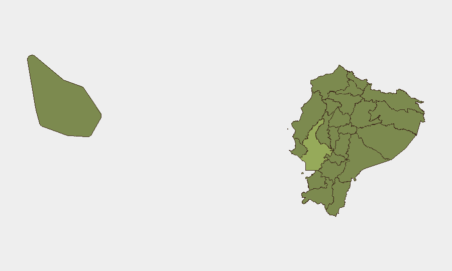
Situation Summary
Ecuador's composite threat score of 45 places it at #35 globally, with 106 tracked events reflecting mounting institutional and security-sector friction. Over the past 48 hours, heightened border enforcement, municipal–national police tensions, and a declared state of emergency in Esmeraldas Province signal deteriorating conditions in specific zones. The security picture is mixed: centralized enforcement actions are active, but coordination between municipal and national authorities is strained, and armed violence in border regions is accelerating.
Key Developments
- San Lorenzo, Esmeraldas Province – 21–22 July 2026
The Emergency Operations Committee (COE) declared a local state of emergency following a surge in armed attacks, indicating serious security deterioration and enabling extraordinary response measures in this border region.
- Nationwide entry/exit points – 22 July 2026
Migration and security authorities executed reinforced controls at major border posts and airports (Mariscal Sucre in Quito, José Joaquín de Olmedo in Guayaquil, and Mariscal La Mar in Cuenca), resulting in 94 foreigners inadmitted, 54 exit bans, 14 warrant arrests, and 65 expulsions/extraditions in a single operational cycle.
- Guayaquil, Guayas Province – 22 July 2026
Municipal authorities issued public criticism of recent national police operations, demanding greater transparency and signaling institutional tension between local and national security mandates in Ecuador's largest city and highest-risk zone.
- Quito, Pichincha Province – 22 July 2026
Interior Ministry conducted a targeted migration/security operation resulting in expulsion of three foreign nationals identified as repeat public-transport thieves, demonstrating sustained focus on street-level crime.
- National institutional level – 22 July 2026
University representatives and National Assembly members issued public disapproval statements regarding current government security policies, reflecting political friction over law-enforcement strategies.
- José Joaquín de Olmedo Airport, Guayas – 22 July 2026
Border control inadmitted an entire foreign family with irregular documentation, consistent with hardened entry protocols across the country.
Highest-Risk Areas
Guayas Province (risk 55.1) dominates the threat landscape, driven by concentrated gang activity, contraband trafficking, and institutional friction in Guayaquil. Ten provinces cluster at risk scores between 25.1 and 25.7, indicating distributed secondary-tier threats across the Amazon (Orellana, Sucumbíos, Napo), northern border zones (Carchi, Esmeraldas), and coastal regions (Manabí, Santa Elena). The state of emergency in San Lorenzo (Esmeraldas) and the intensity of border enforcement suggest that Esmeraldas, Sucumbíos, and Carchi—northern and northeastern frontier provinces—are experiencing acute armed violence and trafficking pressure, likely connected to transnational organized crime and Colombian armed groups.
How GeoBit Would Assist
Security teams should deploy AOI Monitoring & Early Warning on Guayaquil, San Lorenzo, and key border crossings to track escalation signals and law-enforcement operations in near-real time. Network & Actor Analysis and OSINT fusion (X/Twitter, Telegram, local news) will clarify the identity and intentions of armed groups operating in Esmeraldas and Sucumbíos, while Routing & Network Analysis can identify safer transport corridors around active threat zones for personnel movement.
7-Day Outlook
The declaration of a state of emergency in Esmeraldas and sustained border enforcement suggest the government is responding to transnational armed-group activity rather than retreating. Institutional discord between municipal and national authorities may complicate response effectiveness. The next 7 days will likely see continued high-intensity enforcement operations and potential escalation in border provinces; Guayas remains the persistent focal point for personnel and asset risk.
Highest-Risk Areas — Ranked
| # | State / Region | Risk |
|---|---|---|
| 1 | Guayas Province | 55.1 |
| 2 | Manabí Province | 25.7 |
| 3 | Santa Elena Province | 25.7 |
| 4 | Sucumbíos Province | 25.1 |
| 5 | Orellana Province | 25.1 |
| 6 | Galápagos | 25.1 |
| 7 | Esmeraldas Province | 25.1 |
| 8 | Carchi Province | 25.1 |
| 9 | Imbabura Province | 25.1 |
| 10 | Santo Domingo de los Tsáchilas Province | 25.1 |
| 11 | Pichincha Province | 25.1 |
| 12 | Napo Province | 25.1 |
Sources
Previous Daily Briefs
A new Ecuador brief is written every day — each with its own risk map and downloadable CSV. Here's the last week; use the calendar to go further back.
📅 Browse every day by calendar →
Highlighted days have a brief. Tap a day for that day's map & analysis, or “csv” for that day's dataset ($5).
Atlas — our AI intelligence desk — emails them this snapshot personally. Nothing else, no list.