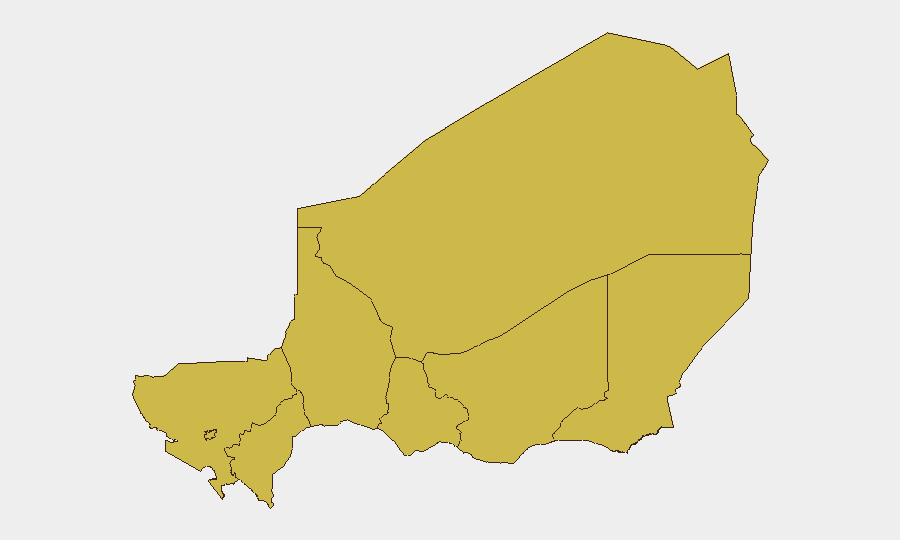
Situation Summary
Niger maintains a composite threat score of 92 (rank #24 globally) with no corroborated security incidents recorded in the last 24–48 hours. Structural risk remains elevated across all eight administrative regions due to ongoing Sahel-wide insurgency, trafficking networks, and cross-border militant activity, particularly in northern and eastern zones. The absence of reported discrete incidents does not reflect reduced underlying vulnerability; rather, it reflects a current operational pause in observable events. Risk posture remains steady but not improving.
Key Developments
No new, location-specific, corroborated security incidents have been confirmed in Niger in the last 24–48 hours.
Professional security bulletins dated 14–17 July 2026 explicitly report absence of discrete attacks, protests, kidnappings, infrastructure disruptions, or significant civil unrest in that window. Regional reporting on the Sahel and neighboring Nigeria documents structural instability and ongoing insurgency but does not place new events inside Niger with specific dates and locations in the most recent 48-hour period.
This does not indicate reduced threat; rather, it reflects a reporting gap consistent with the operational tempo of non-state actors and the irregular nature of incident occurrence in low-density regions. Teams should maintain standard vigilance protocols rather than interpret silence as all-clear.
Highest-Risk Areas
All eight administrative regions score identically (64.5), indicating uniform sub-national risk distribution driven by the same underlying drivers: weak state capacity, porous borders, active militant sanctuary zones, and trafficking corridors. Tillabéri, Agadez, Diffa, and Zinder regions face elevated specific concern due to proximity to Nigeria (Boko Haram/ISWAP activity), Mali (JNIM/ISIS-Sahel presence), and Libya (arms/militant transit). Niamey, despite lower absolute violent-incident density, scores equivalently due to urbanized attack surface, diplomatic presence, and critical-infrastructure concentration. The uniform scoring masks genuine geographic variation in incident type: remote areas see more militant/trafficking activity; the capital and secondary cities face urban crime, kidnapping-for-ransom, and targeting of Western interests.
How GeoBit Would Assist
Security teams operating in Niger should employ Area-of-Interest (AOI) Monitoring & Early Warning to track persistent risk in Tillabéri, Diffa, and border-crossing zones, with automated alerting on new incidents, roadblock activity, or militant movement. Intel Sweep and multi-language OSINT fusion (news, regional media, embassy feeds, X/Telegram) provide real-time event corroboration and distinguish signal from noise—critical in environments where rumor, disinformation, and delayed reporting complicate duty-of-care assessment. Routing & Network Analysis supports dynamic journey planning around confirmed incident zones and trafficking choke points, while GIS & Spatial Analysis maps safe corridors, curfew boundaries, and humanitarian/security infrastructure for operational decision-making.
7-Day Outlook
No imminent, specific threat spike is indicated; however, the Sahel's seasonal calendar (July marks peak militant activity in some zones due to terrain conditions and logistics) and regional tensions (Nigeria's Niger Delta unrest, Mali's ongoing instability) create persistent background pressure. Expect continued operational tempo in remote areas; monitor for any incident cluster or cross-border spillover. Standard elevated alertness protocols should remain in effect.
Report Date: 2026-07-18 | Next Update: 2026-07-19
Highest-Risk Areas — Ranked
| # | State / Region | Risk |
|---|---|---|
| 1 | Agadez Region | 64.5 |
| 2 | Zinder Region | 64.5 |
| 3 | Diffa Region | 64.5 |
| 4 | Tillabéri Region | 64.5 |
| 5 | Niamey | 64.5 |
| 6 | Tahoua Region | 64.5 |
| 7 | Dosso Region | 64.5 |
| 8 | Maradi Region | 64.5 |
Sources
Previous Daily Briefs
A new Niger brief is written every day — each with its own risk map and downloadable CSV. Here's the last week; use the calendar to go further back.
📅 Browse every day by calendar →
Highlighted days have a brief. Tap a day for that day's map & analysis, or “csv” for that day's dataset ($5).
Atlas — our AI intelligence desk — emails them this snapshot personally. Nothing else, no list.