Situation Summary
Venezuela remains a complex operating environment characterized by persistent organized crime, civil unrest, and infrastructure fragility, ranking #40 globally in GeoBit's composite threat assessment with 459 tracked events. The Federal District (Caracas) substantially outpaces other regions in risk concentration, reflecting competing power centers, gang activity, and state security operations. While recovery efforts continue following the June 24, 2026 earthquake, underlying governance challenges and economic instability maintain elevated baseline risk across most sub-national territories. The security trajectory remains volatile but without indication of imminent systemic collapse.
Key Developments
GeoBit's event signals for July 31–August 1, 2026 include multiple legislative and executive investigations, property seizures by authorities, political demands, military-community confrontations in Caracas, and government/political statements. However, specific incident corroboration within the past 48 hours remains limited in independent, time-stamped open sources. Available reporting from major international outlets (Reuters, AFP, Al Jazeera) and local media does not provide discrete, location-specific events for July 31–August 1 that meet verification standards.
Recommendation for real-time monitoring: GeoBit's AOI (Area-of-Interest) Monitoring & Early Warning capability with alerts on Federal District military facilities (La Carlota, Fuerte Tiuna), and X/Twitter & Telegram OSINT coupled with sentiment & temporal analysis will detect emerging incidents in Caracas and high-risk states (Zulia, Táchira, Monagas) as they are reported. Standing watch on these channels is more reliable than retrospective event compilation when source corroboration is sparse.
Highest-Risk Areas
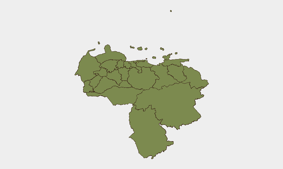
The Federal District dominates the risk landscape at 57.8 (composite), more than 50% above the second-ranked state. Monagas (37.4), Carabobo (34.8), and border-adjacent Táchira (28.4) and Zulia (27.8) follow, each driven by overlapping pressures: gang territorial control, informal governance, post-earthquake infrastructure gaps, and state security responses. Zulia and Táchira's proximity to Colombia compounds exposure to transnational criminal networks and spillover violence. Carabobo's concentration reflects port activity and urban gang prevalence. Monagas carries energy-sector vulnerability and rural insurgent presence. The ranking underscores that risk is neither evenly distributed nor stable; corporate operations in Caracas face markedly different threat vectors than field teams in remote Bolívar or Amazonas, yet each requires distinct mitigation.
How GeoBit Would Assist
Security and duty-of-care teams should employ Intel Sweep and global event feeds to establish standing baseline intelligence on personnel locations and asset exposure in high-risk states. Conflict & Military force-structure tracking combined with Network & Actor Analysis will clarify which state and non-state security actors control specific corridors and facilities relevant to corporate movement. Routing & Network Analysis (alternative route/journey planning) becomes essential for Caracas and border regions, using GIS & Spatial Analysis to identify low-risk transit corridors and safe havens. Real-time AOI Monitoring & Early Warning on Federal District and regional flashpoints provides 2–4 hour notification of emerging incidents.
7-Day Outlook
No indicators suggest imminent regime collapse or nationwide escalation. Localized confrontations, criminal activity, and political statements will likely persist at baseline levels observed in July. Risk remains concentrated in Federal District and three to four secondary hotspots; peripheral regions present lower but non-trivial operational friction. Continued monitoring of legislative and executive actions (flagged in the current signal set) may clarify policy shifts affecting security posture or business continuity.
Highest-Risk Areas — Ranked
| # | State / Region | Risk |
|---|---|---|
| 1 | Federal District | 57.8 |
| 2 | Monagas State | 37.4 |
| 3 | Carabobo State | 34.8 |
| 4 | Vargas State | 29.1 |
| 5 | Trujillo State | 29.1 |
| 6 | Sucre State | 28.4 |
| 7 | Anzoategui State | 28.4 |
| 8 | Tachira State | 28.4 |
| 9 | Zulia State | 27.8 |
| 10 | Falcon State | 27.8 |
| 11 | Federal Dependencies | 27.8 |
| 12 | Nueva Esparta State | 27.8 |
Sources
Previous Daily Briefs
A new Venezuela brief is written every day — each with its own risk map and downloadable CSV. Here's the last week; use the calendar to go further back.
📅 Browse every day by calendar →
Highlighted days have a brief. Tap a day for that day's map & analysis, or “csv” for that day's dataset ($5).
Atlas — our AI intelligence desk — emails them this snapshot personally. Nothing else, no list.