Situation Summary
Chad remains a fragile security environment ranked #28 globally with a composite threat score of 64. While open-source monitoring reports no confirmed intra-Chad armed incidents or civil unrest in the last 24–48 hours, the country faces persistent cross-border drone strikes from Sudan's Rapid Support Forces, large-scale displacement in the Lake Chad basin driven by non-state armed groups, and ongoing political volatility including a newly announced ICC withdrawal. The security picture is one of sustained underlying risk with episodic acute events rather than continuous active conflict.
Key Developments
- Bamna border zone (Sudan–Chad frontier), 21 July 2026: RSF drone attack struck multiple locations including Chadian territory, killing 2 civilians, injuring 7, and damaging civilian vehicles and water infrastructure. Wounded were evacuated into Chad for medical treatment.
- Eastern Chad (unspecified localities, Sudan border), 22–23 July 2026: Chadian officials reported a drone attack from Sudanese territory striking civilian positions, described as the fifth such cross-border incident in recent months, injuring civilians and destroying vehicles and shops.
- N'Djamena (national announcement), 27 July 2026: Military authorities announced Chad's formal process to withdraw from the International Criminal Court, citing concerns over its effectiveness and geographic focus. This political move carries implications for rule of law and international relations.
- Lac Province (Fouli and Kaya departments), latest assessment within 48 hours: UN Humanitarian Coordinator, government ministers, and UN agency heads completed a field mission documenting over 60,000 newly displaced persons since May 2026 in western Lake Chad basin areas, prompting a US$2 million humanitarian fund allocation for urgent relief.
- National security monitoring, last 24–48 hours: No confirmed armed clashes, civil unrest, or infrastructure attacks inside Chad recorded; however, security environment remains fragile with persistent militant and criminal networks active in Lake Chad region.
Highest-Risk Areas
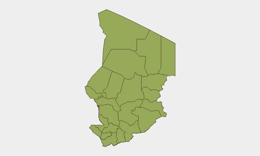
N'Djamena dominates the sub-national risk ranking at 74.7, driven by concentration of political institutions, international presence, and proximity to displacement pressures and militant networks. All remaining tracked regions cluster at 44.7, reflecting the widespread, distributed nature of underlying threats—non-state armed groups, cross-border militia activity, banditry, and displacement—rather than localized hotspots. The eastern border regions (Ennedi-Ouest, Wadi Fira, Ouaddaï, Sila, East Ennedi) and the Lake Chad basin (Lac, Kanem, Hadjer-Lamis) face direct exposure to RSF drone strikes and Boko Haram–linked attacks respectively, while Tibesti remains remote and poorly monitored.
How GeoBit Would Assist
Security teams should employ AOI Monitoring & Early Warning to track N'Djamena and border zones for sudden incident activity, Conflict & Military tracking to monitor RSF drone patterns and non-state armed group movements in the Lake Chad basin, and OSINT fusion across multi-language feeds, social media, and specialist security bulletins to corroborate emerging incidents before they affect personnel. GIS & Spatial Analysis combined with Satellite & Imagery analysis would enable real-time assessment of displacement zones and cross-border threat vectors. Routing & Network Analysis supports contingency planning for personnel movement in high-risk provinces.
7-Day Outlook
Cross-border RSF drone strikes are likely to continue episodically along the Sudan–Chad frontier, with eastern Chad remaining vulnerable to attack. Humanitarian displacement will likely persist or expand in the Lake Chad basin given the absence of near-term security improvements. No major political or security escalation is anticipated in the immediate term, though the ICC withdrawal announcement may slowly shift Chad's international standing and future accountability mechanisms.
Highest-Risk Areas — Ranked
| # | State / Region | Risk |
|---|---|---|
| 1 | N'Djamena | 74.7 |
| 2 | Ennedi-Ouest | 44.7 |
| 3 | Wadi Fira | 44.7 |
| 4 | Ouaddaï | 44.7 |
| 5 | Sila | 44.7 |
| 6 | Salamat | 44.7 |
| 7 | East Ennedi | 44.7 |
| 8 | Kanem | 44.7 |
| 9 | Lac | 44.7 |
| 10 | Hadjer-Lamis | 44.7 |
| 11 | Chari-Baguirmi | 44.7 |
| 12 | Tibesti | 44.7 |
Sources
Previous Daily Briefs
A new Chad brief is written every day — each with its own risk map and downloadable CSV. Here's the last week; use the calendar to go further back.
📅 Browse every day by calendar →
Highlighted days have a brief. Tap a day for that day's map & analysis, or “csv” for that day's dataset ($5).
Atlas — our AI intelligence desk — emails them this snapshot personally. Nothing else, no list.