Situation Summary
Lebanon remains at composite threat level #22 globally (score 66) with a fragile security posture driven by sustained Israeli–Hezbollah cross-border military activity, political friction between government and military institutions, and contested territorial control in the south. The overnight strikes into 29 July on Ali al-Taher hill and villages near Beit Yahoun reflect ongoing operational tempo rather than major escalation, but the environment remains one of "cautious calm rather than all-clear." Diplomatic efforts around Rome-format talks and south Lebanon "pilot zones" for Israeli withdrawal are proceeding against a backdrop of active shelling and unresolved territorial disputes, creating acute risk for civilians and business continuity in southern and eastern regions.
Key Developments
- Ali al-Taher Hill & Southern Villages, overnight 28–29 July: Israeli artillery and warplanes struck Ali al-Taher hill (cited as containing Hezbollah tunnel positions) and the Beit Yahoun–Kounine–Baraashit cluster during overnight operations, signaling continued cross-border military activity and elevated civilian/travel risk in these southern localities.
- South Lebanon "Pilot Zones," ongoing through 29 July: Israeli forces continue shelling and operating within areas designated as potential withdrawal zones in upcoming Rome-format negotiations; Lebanese sources condition further diplomatic participation on Israeli pullback from two specific pilot zones, underscoring contested control and fragile ceasefire mechanics.
- Government–Military Institutional Friction, 27 July: Public statements and threats between Lebanese government and military institutions signal internal institutional tension, compounding coordination challenges during active cross-border operations.
- Regional Diplomatic Pressure, 27–28 July: Saudi Arabia issued public statements; Washington rejected Lebanese positions; the UN and domestic Lebanese actors publicly disapproved of government actions—indicating isolation and international skepticism regarding Lebanon's capacity or willingness to enforce border security or manage Hezbollah presence.
- Syrian National Arrest, 27 July: Lebanese authorities detained a Syrian national, potentially reflecting heightened border screening or counter-smuggling operations amid cross-border tensions.
- Sectarian Messaging, 28 July: Catholic and Maronite church figures issued competing public statements, suggesting religious-community positioning on national security or political outcomes.
- Domestic Civil Unrest, 28 July: A physical assault incident involving Lebanese nationals was reported, consistent with broader pattern of civil friction in high-stress environment.
Highest-Risk Areas
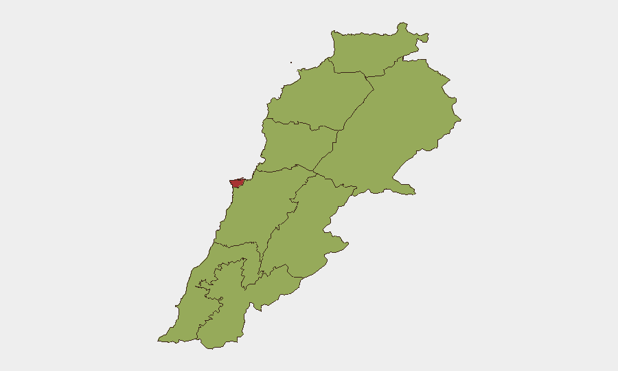
Beirut Governorate (76.1) dominates composite risk and reflects capital concentration of political, administrative, and security decision-making; instability there ripples across national institutions and international engagement. Nabatieh Governorate (57.5) ranks second due to direct proximity to Israeli operations and Hezbollah presence; the villages and hill positions under active fire (Ali al-Taher, Beit Yahoun cluster) sit within or near Nabatieh's borders. The remaining seven governorates cluster at 46–46.1, indicating baseline elevated risk across North, Akkar, Keserwan-Jbeil, Mount Lebanon, South, Beqaa, and Baalbek-Hermel—driven by south–Beqaa structural exposure to cross-border conflict, smuggling networks, and weak state control outside Beirut.
How GeoBit Would Assist
Security teams would employ AOI Monitoring & Early Warning with persistent satellite and OSINT watch on Ali al-Taher, pilot-zone villages, and Beqaa border crossings to detect shelling, force movement, and checkpoint activity in near-real time. Routing & Network Analysis would map safe and alternative transit corridors around active fire zones and contested territories, and Conflict & Military battle mapping would track Israeli and Hezbollah positions to inform duty-of-care risk assessments for staff in the south and east. Intel Sweep and multi-language OSINT would triangulate diplomatic developments and sectarian messaging to forecast escalation or de-escalation windows.
7-Day Outlook
Israeli shelling and military operations are expected to continue at current tempo through early August pending movement in Rome-format talks; any Israeli withdrawal from pilot zones could reduce southern risk, but failure to demarcate or enforce those zones will sustain volatility. Domestic political friction and international isolation suggest weak Lebanese state capacity to broker or enforce stability, prolonging the cautious-calm posture in Beirut while south and Beqaa remain operationally contested.
Highest-Risk Areas — Ranked
| # | State / Region | Risk |
|---|---|---|
| 1 | Beirut Governorate | 76.1 |
| 2 | Nabatieh Governorate | 57.5 |
| 3 | North Governorate | 46.5 |
| 4 | Akkar Governorate | 46.1 |
| 5 | Keserwan-Jbeil Governorate | 46.1 |
| 6 | Mount Lebanon Governorate | 46.1 |
| 7 | South Governorate | 46.1 |
| 8 | Beqaa Governorate | 46.1 |
| 9 | Baalbek-Hermel Governorate | 46.1 |
Sources
Previous Daily Briefs
A new Lebanon brief is written every day — each with its own risk map and downloadable CSV. Here's the last week; use the calendar to go further back.
📅 Browse every day by calendar →
Highlighted days have a brief. Tap a day for that day's map & analysis, or “csv” for that day's dataset ($5).
Atlas — our AI intelligence desk — emails them this snapshot personally. Nothing else, no list.