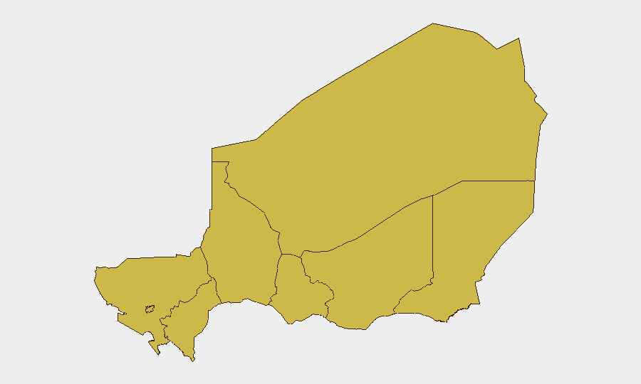
Situation Summary
Niger remains at composite threat rank #25 globally with a stable threat score of 94. No confirmed, location-specific security incidents have been recorded in the last 24–48 hours across open-source media, regional feeds, or embassy advisories. The security environment continues to be shaped by structural threats—primarily terrorist kidnapping risk, armed group activity in border regions, and localized violent crime—concentrated in the Sahel north and along frontiers, while most urban and southern zones remain operationally stable.
Key Developments
No discrete, corroborated security incidents (attacks, protests, kidnappings, civil unrest, or infrastructure disruptions) were recorded in Niger during the 24–48-hour window ending 2026-07-19. Open-source monitoring across regional media, conflict databases, and official channels confirms absence of location-specific events meeting recency and corroboration thresholds for this reporting cycle.
Note on regional context: Multiple armed attacks were confirmed in Nigeria's Niger State (not the Republic of Niger) between 12–14 July 2026, with fatalities reported in Borgu LGA and surrounding communities. These fall outside Niger's borders and are cited for situational awareness only.
Highest-Risk Areas
All eight sub-national regions in Niger carry identical composite risk scores (65.5), reflecting a relatively uniform threat distribution. However, operational risk concentrates in the northern border belt—Agadez, Tillabéri, Diffa, and Zinder regions—where terrorist groups maintain kidnapping intent, smuggling networks operate, and cross-border militant activity persists. Tahoua and Maradi face secondary risk from banditry and violent crime. Niamey and Dosso carry lower operational incident frequency but remain subject to broader countrywide structural threats. The uniform scoring reflects systematic vulnerability rather than acute localized crises; organizations should calibrate responses by operational footprint and asset exposure rather than rank alone.
How GeoBit Would Assist
Security and risk teams operating in Niger should employ AOI Monitoring & Early Warning to establish persistent watch on high-exposure facilities, supply routes, and border crossing points in Agadez, Tillabéri, and Diffa; configure alerting thresholds to detect emerging activity patterns before incident onset. Intel Sweep and multi-language OSINT fusion across regional media, Telegram/radio channels, and cross-border sources provide real-time situational awareness and early signal detection in areas where official reporting lags. Routing & Network Analysis supports contingency journey planning and alternative supply-chain routing to mitigate kidnapping and armed ambush risk on primary corridors. Conflict & Military tracking and entity analysis enable monitoring of armed group repositioning and force-structure changes that may signal heightened risk in specific zones.
7-Day Outlook
No acute security crisis indicators have emerged in the 24–48-hour window; the threat environment is expected to remain consistent with baseline structural vulnerabilities over the next 7 days. Seasonal factors (rainy-season logistics constraints) and ongoing low-level militant activity in northern regions should be monitored for cumulative impact on supply chains and border security. Organizations with critical operations in northern regions should maintain heightened vigilance on intelligence feeds and pre-positioned contingency protocols.
Highest-Risk Areas — Ranked
| # | State / Region | Risk |
|---|---|---|
| 1 | Agadez Region | 65.5 |
| 2 | Zinder Region | 65.5 |
| 3 | Diffa Region | 65.5 |
| 4 | Tillabéri Region | 65.5 |
| 5 | Niamey | 65.5 |
| 6 | Tahoua Region | 65.5 |
| 7 | Dosso Region | 65.5 |
| 8 | Maradi Region | 65.5 |
Sources
Previous Daily Briefs
A new Niger brief is written every day — each with its own risk map and downloadable CSV. Here's the last week; use the calendar to go further back.
📅 Browse every day by calendar →
Highlighted days have a brief. Tap a day for that day's map & analysis, or “csv” for that day's dataset ($5).
Atlas — our AI intelligence desk — emails them this snapshot personally. Nothing else, no list.