Situation Summary
Canada's composite threat environment remains below the global median (rank #null, score 24/316 events tracked), but three provinces—Ontario, British Columbia, and Quebec—account for the majority of tracked security signals. Current activity is dominated by localized criminal incidents in Ontario, wildfire-driven evacuations in British Columbia, and an active child-safety alert, none of which indicate systemic instability. The trajectory shows dispersed, province-level operational challenges rather than coordinated national security pressure.
Key Developments
- Boston Bar, British Columbia – 21 July: Fraser Valley Regional District ordered immediate evacuation of all remaining residents due to a new wildfire south of the community, citing escalating danger and active fire spread.
- West Kelowna, British Columbia – 21 July: RCMP issued a province-wide Amber Alert for 4-year-old Atlas Andrews, missing since 11:20 a.m. on Ridge Boulevard West; active search operations ongoing.
- Toronto, Ontario (east end) – 20–21 July: Toronto police opened an investigation after officers discovered evidence of gunfire in a motel room in the city's east end; circumstances under review.
- Oshawa & Clarington, Ontario – 20–21 July: Durham Regional Police reported at least three suspects sought in connection with eight separate break-ins at businesses and restaurants across both communities.
- Markham, Ontario – 20–21 July: York Regional Police charged four suspects and are seeking a fifth following an attempted theft of shopping carts containing power tools from a retail location.
- Whitby, Ontario – 20–21 July: Two individuals sustained serious injuries in a head-on collision; emergency response and police investigation triggered.
Highest-Risk Areas
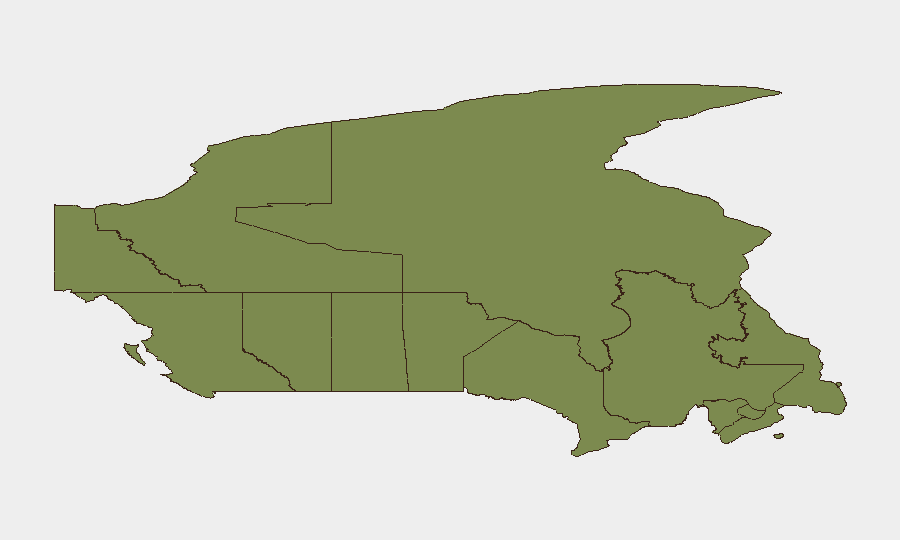
Ontario dominates the risk profile (31.3), driven by a clustering of property crimes, violent incidents, and ongoing investigations across the Greater Toronto Area, Durham Region, and York Region. British Columbia (19.2) ranks second primarily due to active wildfire evacuation operations and the current missing-child alert, both creating acute duty-of-care exposure. Quebec (18.9) rounds the top three but shows lower incident density in the current 48-hour window. Together, these three provinces account for approximately 69% of Canada's tracked threat signals; organizations with personnel or assets in Ontario's urban corridors face the highest near-term exposure to property crime and investigation-related disruption.
How GeoBit Would Assist
Security teams in Canada should employ AOI Monitoring & Early Warning to establish persistent watches over high-risk sub-national zones (Ontario, British Columbia) and receive automated alerts on police investigations, evacuation orders, and incident clustering in real time. Intel Sweep and multi-language OSINT capabilities enable continuous scanning of local news, police releases, and social media for emerging threats in specific cities (Toronto, Vancouver, Montreal) before they escalate. GIS & Spatial Analysis supports dynamic routing and alternative journey planning for personnel in affected regions, particularly around active fire zones and areas under police investigation.
7-Day Outlook
Wildfire conditions in British Columbia are likely to persist or intensify, sustaining evacuation orders and restricting travel in the Fraser Valley and Okanagan regions. Ontario's property crime incidents show no sign of escalation to organized activity, but fragmented break-ins and robbery attempts may continue across the GTA and surrounding municipalities. No signal currently suggests national-level policy disruption or cross-border escalation; monitoring should remain focused on localized operational resilience.
Highest-Risk Areas — Ranked
| # | State / Region | Risk |
|---|---|---|
| 1 | Ontario | 31.3 |
| 2 | British Columbia | 19.2 |
| 3 | Quebec | 18.9 |
| 4 | Manitoba | 7.1 |
| 5 | Alberta | 6.7 |
| 6 | Nunavut | 6.1 |
| 7 | Northwest Territories | 2.7 |
| 8 | Saskatchewan | 2.3 |
| 9 | Nova Scotia | 1.7 |
| 10 | Newfoundland and Labrador | 1.6 |
| 11 | Yukon | 1.4 |
| 12 | Prince Edward Island | 1.4 |
Sources
Previous Daily Briefs
A new Canada brief is written every day — each with its own risk map and downloadable CSV. Here's the last week; use the calendar to go further back.
📅 Browse every day by calendar →
Highlighted days have a brief. Tap a day for that day's map & analysis, or “csv” for that day's dataset ($5).
Atlas — our AI intelligence desk — emails them this snapshot personally. Nothing else, no list.