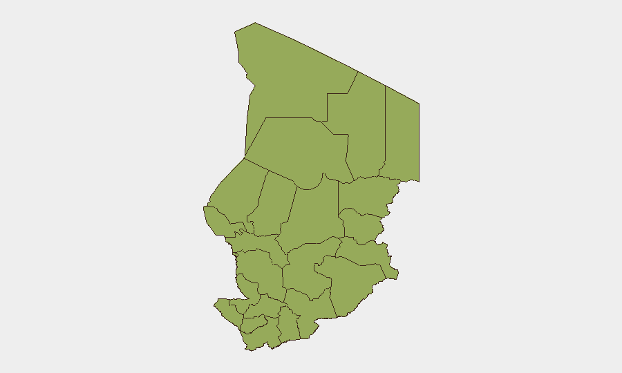
Situation Summary
Chad remains at composite threat rank #27 globally with no confirmed security incidents, armed clashes, or civil unrest recorded within Chad's borders over the last 24–48 hours. However, cross-border tension with Sudan's Rapid Support Forces (RSF)—evidenced by late-July drone strikes and detentions at the Adré crossing—sustains baseline risk, particularly in eastern border zones. The security environment is currently quiet but fragile, with border volatility and regional instability posing latent risk to operations and personnel in vulnerable areas.
Key Developments
- No intra-Chad incidents (last 48h): Open-source security monitoring confirms an absence of confirmed armed attacks, clashes, protests, or infrastructure disruptions inside Chad territory as of 01 August 2026.
- Adré crossing remains closed (as of 28 July): Chadian authorities have kept the Sudan border crossing closed following RSF detention of two Chadian nationals in West Darfur; Chadian nationals blocked truck traffic to demand their release, preventing normal cross-border commerce.
- Bamna border zone (21 July): RSF drone strikes hit both Sudanese and Chadian territory near Bamna, killing 2 civilians and injuring 7 (including children); damage to civilian vehicles and a water well on the Chadian side highlights spillover risk from Sudanese conflict.
- N'Djamena security operation (date unclear): Local media reported 447 arrests—including 315 foreign nationals—during a large-scale public security sweep; timing is not verifiably within the last 48 hours, and the operation's scope and rationale require further verification.
- ICC withdrawal announced (prior week): Chad announced its formal withdrawal from the International Criminal Court, citing limited effectiveness and geographic bias; this political action reflects international positioning but does not directly alter near-term security risk.
Highest-Risk Areas
All twelve of Chad's regions carry an identical composite risk score of 47, indicating that GeoBit's current sub-national model does not differentiate threat severity across provinces. However, field reality and recent events indicate that border regions—particularly Lac, Sila, Ouaddaï, and Wadi Fira (eastern and northeastern zones)—warrant heightened operational vigilance owing to proximity to RSF activity in Sudan and documented cross-border strikes. N'Djamena, as the capital and economic hub, also carries baseline crime and irregular-migration risks, as reflected in recent arrest operations. The uniformity of the risk ranking suggests that granular, real-time area-of-interest monitoring is essential for distinguishing micro-level variation across regions.
How GeoBit Would Assist
Security teams should employ Intel Sweep and multi-language OSINT (X/Twitter, Telegram, YouTube) with entity extraction and temporal analysis to detect emerging cross-border incidents and RSF activity before they escalate. AOI Monitoring & Early Warning on the Sudan–Chad border (Adré, Bamna, Sila) with persistent alerting would provide 24–48 hour advance notice of drone strikes, clashes, or closure actions. Routing & Network Analysis should be used to identify alternative supply and personnel routes if the Adré crossing remains closed or instability widens, and GIS & Spatial Analysis combined with satellite imagery can track displacement patterns or force concentrations near vulnerable zones.
7-Day Outlook
No imminent escalation is forecast for the next seven days within Chad territory based on current reporting. However, sustained RSF pressure on the Sudan–Chad border and the ongoing Adré crossing closure suggest that cross-border incidents may recur; operations in eastern border regions should maintain heightened alert posture. The absence of recent intra-Chad violence does not reduce the need for continuous monitoring of northern and eastern zones.
Highest-Risk Areas — Ranked
| # | State / Region | Risk |
|---|---|---|
| 1 | Ennedi-Ouest | 47 |
| 2 | Wadi Fira | 47 |
| 3 | Ouaddaï | 47 |
| 4 | Sila | 47 |
| 5 | Salamat | 47 |
| 6 | East Ennedi | 47 |
| 7 | Kanem | 47 |
| 8 | Lac | 47 |
| 9 | N'Djamena | 47 |
| 10 | Hadjer-Lamis | 47 |
| 11 | Chari-Baguirmi | 47 |
| 12 | Tibesti | 47 |
Sources
Previous Daily Briefs
A new Chad brief is written every day — each with its own risk map and downloadable CSV. Here's the last week; use the calendar to go further back.
📅 Browse every day by calendar →
Highlighted days have a brief. Tap a day for that day's map & analysis, or “csv” for that day's dataset ($5).
Atlas — our AI intelligence desk — emails them this snapshot personally. Nothing else, no list.