Situation Summary
Mali remains in a state of elevated instability marked by sustained conventional military operations in the north, geopolitical friction at the national level, and persistent insurgent activity across multiple regions. The expulsion of French military and diplomatic personnel on 12 July has reduced external security cooperation capacity at a moment when air-ground campaigns against northern insurgents are ongoing. The security environment is volatile and unpredictable, with risk of short-notice movement restrictions, curfews, and roadblock establishment affecting both civilian and commercial movement.
Key Developments
- 12 July 2026 – Bamako – Expulsion of French military and diplomatic personnel. Mali's government expelled remaining French forces and embassy staff, signalling deepening geopolitical realignment and potential reduction in counter-terrorism intelligence sharing and military coordination.
- 12–13 July 2026 – Anefis, Kidal Region; Gao and Sévaré corridors – Intensified air-ground campaign. Malian military conducted multiple airstrikes across northern regions, with government convoys reinforcing Anefis and operations ongoing to secure the Gao–Anefis supply corridor. Tactical claims of vehicle destruction and insurgent casualties reported, but broader environment remains volatile.
- 11–13 July 2026 – Bamako – Detention of Iraqi national. Malian authorities detained a foreign national on 11 July in what appears to be a counter-terrorism or intelligence investigation, reflecting heightened scrutiny of foreign actors and possible security network concerns.
- 12–13 July 2026 – Northern Mali routes (unspecified) – Continued ambush and IED threat on convoys. Security analysis notes repeated small-arms and IED attacks on Malian and Russian Africa Corps convoys north of Gao following 9 July incidents, indicating sustained tactical threat to overland movement in northern regions.
- 13 July 2026 – Countrywide – "Avoid all travel" advisory reaffirmed. Canadian travel advisory and international guidance continue to warn of unpredictable deterioration, possible curfews, and roadblock establishment on routes to/from Bamako, signalling imminent risk of movement restrictions.
Highest-Risk Areas
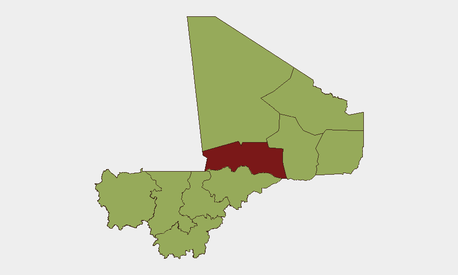
Timbuktu (risk score 86.1) remains the single highest-risk region, driven by sustained militant activity and military operations. Bamako (66.7), despite being the capital and seat of government, carries elevated risk due to its role as a flash point for geopolitical tension, expulsion orders, and the concentration of security force activity. The northern arc—Kidal, Gao, Ménaka, and Mopti—collectively represents the operational center of gravity for both government military campaigns and insurgent networks, with active air strikes, convoy ambushes, and IED deployment over the past 48 hours. Kayes, Taoudénit, Koulikoro, Ségou, and Sikasso regions, while ranked lower, remain at elevated baseline threat due to banditry, kidnapping networks, and fuel-supply instability affecting movement and supply chains.
How GeoBit Would Assist
Security teams operating in Mali should prioritize AOI Monitoring & Early Warning on Bamako and the Anefis–Gao corridor to detect curfew announcements and roadblock establishment in real time. Routing & Network Analysis and Conflict & Military battle-mapping capabilities enable rapid assessment of alternative overland routes and identification of military operations zones before they affect personnel or asset movements. Intel Sweep and multi-source OSINT fusion across X, local media, and security channels provide early signal of expulsion orders, detention activity, and armed-group tactical shifts that may precede broader security events.
7-Day Outlook
Continued military operations in the north are likely to persist over the next week, with ongoing risk of airstrikes and convoy ambushes. Geopolitical realignment following French expulsion may increase operational unpredictability and reduce official coordination capacity. Movement restrictions, including curfews and roadblocks in and around Bamako and northern supply routes, remain a high-probability near-term development.
Highest-Risk Areas — Ranked
| # | State / Region | Risk |
|---|---|---|
| 1 | Timbuktu | 86.1 |
| 2 | Bamako | 66.7 |
| 3 | Ménaka | 56.1 |
| 4 | Kayes | 56.1 |
| 5 | Taoudénit Region | 56.1 |
| 6 | Kidal | 56.1 |
| 7 | Gao | 56.1 |
| 8 | Koulikoro | 56.1 |
| 9 | Ségou Region | 56.1 |
| 10 | Sikasso Region | 56.1 |
| 11 | Mopti | 56.1 |
Sources
Previous Daily Briefs
A new Mali brief is written every day — each with its own risk map and downloadable CSV. Here's the last week; use the calendar to go further back.
📅 Browse every day by calendar →
Highlighted days have a brief. Tap a day for that day's map & analysis, or “csv” for that day's dataset ($5).
Atlas — our AI intelligence desk — emails them this snapshot personally. Nothing else, no list.