Situation Summary
Chad remains at composite threat level 71 (global rank #29), with no confirmed security incidents recorded in the last 48 hours. However, border regions—particularly along the Sudan, CAR, Libya, Niger, and Nigeria frontiers—continue to face elevated risk from armed-group activity, cross-border conflict spillover, and criminal operations. The recent Adré crossing closure (28 Jul) and RSF drone-strike activity on the Chad–Sudan border (21 Jul) underscore ongoing volatility in eastern border zones, though the capital and central regions maintain relative stability.
Key Developments
- Adré border crossing closure (28 Jul, eastern Chad–Sudan frontier): Chad authorities closed the Adré border crossing after Rapid Support Forces (RSF) detained two Chadian nationals; local residents blocked truck traffic in response. No public statement from Chadian authorities as of reporting.
- RSF drone strike on Chad–Sudan border (21 Jul, Bamna border area): A drone attributed to RSF killed two Chadian civilians and injured seven others, including near a water well on the Chadian side of the frontier.
- N'Djamena security operation: A major public security sweep detained 447 people, including 315 foreign nationals, though the operation's exact date is not publicly confirmed; timing suggests late July.
- Border-crossing disruptions: Sudan fighting has prompted closure of multiple Chad–Sudan crossing points, disrupting humanitarian and commercial traffic along the Adré corridor and affecting regional supply chains.
- Standing border-zone warnings: OSAC and Canadian travel advisories remain in effect for all border regions due to persistent risk from armed groups, minefields, kidnapping, and cross-border banditry—no new specific incidents reported in the last 48 hours, but the underlying threat environment is active.
Highest-Risk Areas
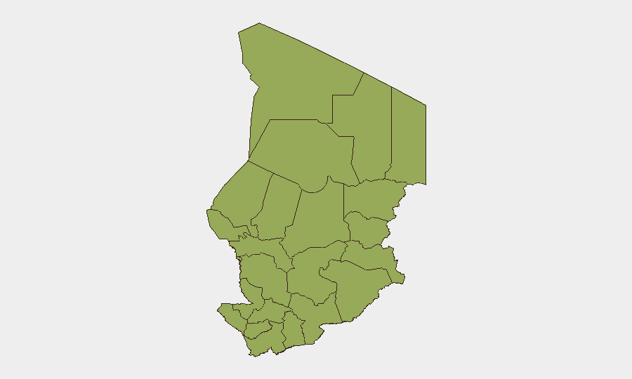
All twelve of Chad's regions carry identical composite risk scores (49.8), reflecting nationwide exposure to transnational threats. However, the eastern tier—Ennedi-Ouest, Wadi Fira, Ouaddaï, Sila, Salamat, and East Ennedi—faces the most direct spillover from Sudan's conflict, including RSF incursions, drone strikes, and refugee flows. The northern Kanem, Lac, and Tibesti regions remain vulnerable to Libyan armed-group activity and trafficking networks. Even N'Djamena, despite its administrative controls, remains a vector for foreign-fighter transit and underground militant recruitment.
How GeoBit Would Assist
Security teams should use AOI Monitoring & Early Warning to maintain persistent watch on the Adré corridor, Bamna border area, and key crossing points, with automated alerting for closure announcements or armed-group activity. Conflict & Military capabilities—including force-structure tracking and cross-border weapons-movement analysis—enable real-time assessment of RSF positioning and threat escalation. Routing & Network Analysis can identify alternative supply and personnel routes around disrupted borders, critical for duty-of-care planning in remote or border-proximate operations.
7-Day Outlook
The closure of Adré and continued RSF activity suggest border friction will persist through early August. No indicators of imminent large-scale violence within Chad proper, but cross-border dynamics—particularly Sudan conflict intensity and potential for further RSF incursions—will remain the primary driver of elevated regional risk. Organizations with staff or assets in eastern Chad or along commercial corridors should monitor closure announcements and maintain contingency plans for route diversion.
Highest-Risk Areas — Ranked
| # | State / Region | Risk |
|---|---|---|
| 1 | Ennedi-Ouest | 49.8 |
| 2 | Wadi Fira | 49.8 |
| 3 | Ouaddaï | 49.8 |
| 4 | Sila | 49.8 |
| 5 | Salamat | 49.8 |
| 6 | East Ennedi | 49.8 |
| 7 | Kanem | 49.8 |
| 8 | Lac | 49.8 |
| 9 | N'Djamena | 49.8 |
| 10 | Hadjer-Lamis | 49.8 |
| 11 | Chari-Baguirmi | 49.8 |
| 12 | Tibesti | 49.8 |
Sources
Previous Daily Briefs
A new Chad brief is written every day — each with its own risk map and downloadable CSV. Here's the last week; use the calendar to go further back.
📅 Browse every day by calendar →
Highlighted days have a brief. Tap a day for that day's map & analysis, or “csv” for that day's dataset ($5).
Atlas — our AI intelligence desk — emails them this snapshot personally. Nothing else, no list.