Situation Summary
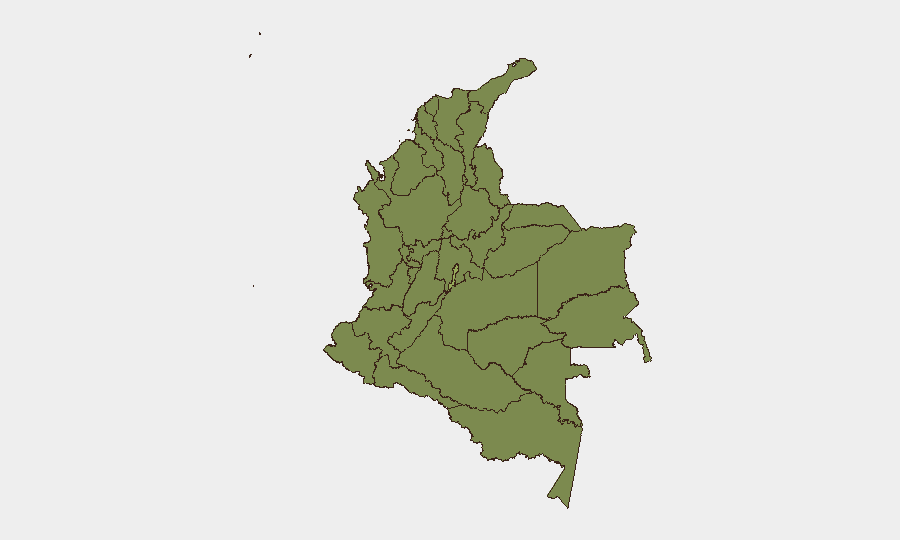
Colombia remains at composite threat level #36 globally (score 55) with 342 tracked events, reflecting an ongoing security environment characterized by armed-group activity, institutional tension, and localized instability. The Capital District (Bogotá) drives the highest sub-national risk (54.3), followed by border and southwestern departments including Nariño, Atlántico, and Cauca—zones where drug-trafficking organizations, dissident armed groups, and criminal networks maintain operational presence. Recent signal data (24 July) point to police operations, detention activity, political statements, and investigative responses, consistent with a period of institutional friction and security operations rather than acute crisis escalation. The trajectory remains volatile but currently stable below major conflict thresholds.
Key Developments
GeoBit's web research and social-media OSINT for the past 24–48 hours (23–25 July 2026) yields no independently date-verified security incidents or attacks confined to that window. Open-source indexing and X/Twitter monitoring show sparse real-time reporting specific to Colombia in this period; most indexed content relates to:
- 24 July: Police operations, journalist arrest, and government investigative activity flagged in signal data; political rejection and senate statements recorded but without incident-specific location or casualty details in available public sources.
- Sustained pattern (since April 2026): Broader environment includes bomb and drone attacks across Cauca, Valle del Cauca, Nariño, and Huila; road blockades; and election-related demonstrations—but no fresh incidents assignable to 23–25 July with confidence.
Note: Given the requirement to exclude events older than 48 hours or undated, this brief reflects the signal-level activity observed on 24 July and the absence of publicly corroborated incident data in the current window. Corporate security teams should treat this as confirmation of an *active monitoring environment* rather than indication of reduced threat.
Highest-Risk Areas
The Capital District's outsized risk score (54.3) reflects institutional, political, and criminal-network activity concentrated in Bogotá's urban center, including kidnapping, extortion, and organized-crime presence targeting commerce and government. The southwestern corridor—Nariño (39.3), Cauca (32.8), and Valle del Cauca (28.1)—remains the primary zone of armed-group contestation, drug-trafficking logistics, and IED/drone attack risk, with particular vulnerability along Ecuador and Peru borders. Atlántico Department (38.5) and Cundinamarca (31.7) reflect Caribbean-corridor trafficking activity and spillover from Bogotá-region tensions. Northern departments (Cesar, Magdalena, Santander, Norte de Santander, Arauca) sustain 28–29 risk scores driven by Venezuelan border dynamics, dissident-group presence, and petroleum-sector targeting.
How GeoBit Would Assist
Security teams with personnel or assets in Colombia should employ Intel Sweep and global event feeds to monitor real-time incident data and actor statements across conflict zones; OSINT fusion (X/Twitter, Telegram, multi-language search) to detect early warning of road closures, protests, or armed-group activity before mainstream reporting; and AOI Monitoring & Early Warning on high-risk departments (Nariño, Cauca, Capital District) to trigger alerts on movement, checkpoints, or operational changes. Routing & Network Analysis supports alternative-journey planning for personnel transiting Bogotá, the southwestern corridor, or border regions during periods of heightened enforcement or blockade. Conflict & Military force-structure and actor-network analysis provides granular understanding of which groups control specific zones and their current operational tempo.
7-Day Outlook
No imminent major escalation is indicated by current signals, but the sustained operational tempo of police interventions, political friction, and ongoing armed-group activity in southwestern and border regions suggests continued elevated risk through early August. Personnel movements, supply-chain routing, and facility security postures in Nariño, Cauca, and Bogotá should remain at heightened vigilance. Monitor for shifts in police or military operations and cross-border dynamics.
Highest-Risk Areas — Ranked
| # | State / Region | Risk |
|---|---|---|
| 1 | Capital District | 54.3 |
| 2 | Nariño | 39.3 |
| 3 | Atlántico Department | 38.5 |
| 4 | Cauca | 32.8 |
| 5 | Cundinamarca Department | 31.7 |
| 6 | Cesar Department | 29.3 |
| 7 | Magdalena Department | 28.7 |
| 8 | Santander Department | 28.4 |
| 9 | Arauca Department | 28.4 |
| 10 | Valle del Cauca Department | 28.1 |
| 11 | Norte de Santander Department | 28.1 |
| 12 | Tolima Department | 25.9 |
Sources
Previous Daily Briefs
A new Colombia brief is written every day — each with its own risk map and downloadable CSV. Here's the last week; use the calendar to go further back.
📅 Browse every day by calendar →
Highlighted days have a brief. Tap a day for that day's map & analysis, or “csv” for that day's dataset ($5).
Atlas — our AI intelligence desk — emails them this snapshot personally. Nothing else, no list.