Situation Summary
Eritrea remains a low-frequency threat environment globally (rank #81, composite score 24), with no discrete security incidents recorded inside the country during the past seven days. However, the immediate regional context is defined by Eritrean military deployments to Tigray, Ethiopia, where an estimated 5,000–8,000 Eritrean soldiers are currently positioned amid ongoing tensions between Addis Ababa and Asmara. The northwestern border region (Gash-Barka) and Southern Red Sea coast remain significantly elevated risk zones, though no new triggering events have materialized this week.
Key Developments
- 14–20 October 2026 — Tigray/Ethiopia–Eritrea border region: Eritrean military presence in Tigray, numbering between 5,000 and 8,000 troops, remained a focal point of regional concern. Reporting indicated heightened risk of direct Ethiopia–Eritrea confrontation, though deployments were primarily on Ethiopian territory and no new kinetic incidents were confirmed inside Eritrea during this window.
- 12 October 2026 (reported 15 October) — Zalambessa–Fatsi border corridor: Eritrean forces conducted a repositioning withdrawal from forward positions along the Ethiopia–Eritrea frontier. This movement occurred slightly outside the current seven-day window but remains operationally relevant context for understanding current military posture and tactical signaling.
No additional confirmed developments inside Eritrea were substantiated during 14–20 October 2026. Regional reporting cited fighting and infrastructure damage in Rama, Ethiopia, but did not identify new incidents in Eritrean territory.
Highest-Risk Areas
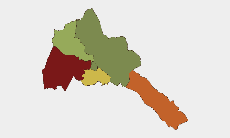
Gash-Barka (northwest border region, risk score 92) and the Southern Red Sea Region (score 75) account for the overwhelming majority of assessed subnational risk, driven by their proximity to the Ethiopia–Eritrea frontier and history of cross-border military activity. Debub Region (southern interior, score 68) follows, reflecting secondary exposure to conflict-zone dynamics and limited state security reach. By contrast, Maekel Region (central, home to capital Asmara, score 18) and Northern Red Sea Region (score 0) represent substantially lower operational risk. The concentration of risk in border zones reflects the primary security driver: bilateral tensions with Ethiopia and the presence of Eritrean military formations across disputed or contested boundaries.
How GeoBit Would Assist
A corporate security team with personnel or assets in Eritrea would employ AOI (Area-of-Interest) Monitoring & Early Warning to maintain persistent watch on Gash-Barka and the Southern Red Sea border corridor, with automated alerting on military movements or cross-border incidents. Battle Mapping, Force Structure, and Weapons-Capability Tracking would enable real-time situational awareness of Eritrean and Ethiopian military deployments and posture changes. OSINT Fusion & Corroboration across regional conflict reporting, social media, and satellite imagery would filter out-of-area noise and confirm whether developments genuinely affect operations in-country.
7-Day Outlook
Military posture along the Ethiopia–Eritrea frontier is likely to remain elevated but static absent new triggering incidents. The concentration of Eritrean forces outside national territory suggests no imminent direct threat to civilian infrastructure or foreign nationals in-country, though border-zone volatility could shift rapidly if bilateral tensions escalate. Organizations operating in Gash-Barka or the Southern Red Sea Region should maintain heightened vigilance and contingency protocols.
Highest-Risk Areas — Ranked
| # | State / Region | Risk |
|---|---|---|
| 1 | Gash-Barka | 92 |
| 2 | Southern Red Sea Region | 75 |
| 3 | Debub Region | 68 |
| 4 | Anseba | 55 |
| 5 | Maekel Region | 18 |
| 6 | Northen Red Sea Region | 0 |
Sources
Previous Weekly Briefs
A new Eritrea brief is written every Monday, covering the week — each with its own risk map and downloadable CSV. Use the calendar to go further back.
- October 13, 2026
- October 6, 2026
- September 29, 2026
- September 22, 2026
- September 15, 2026
- September 8, 2026
- September 2, 2026
📅 Browse past briefs by calendar →
Highlighted days have a brief. Tap a day for that day's map & analysis, or “csv” for that day's dataset ($5).
Atlas — our AI intelligence desk — emails them this snapshot personally. Nothing else, no list.