Situation Summary
Bolivia remains in acute political and civil unrest following recent coup-related disturbances, with security forces operating under a nationwide state of emergency (Decreto Supremo 5636) and conducting active dispersal operations in La Paz and El Alto. Cochabamba and Tarija departments rank as the highest-risk zones, driven by concurrent anti-government mobilizations and a critical water-supply wildfire emergency respectively. The security environment is characterized by unpredictable road disruptions, militarized urban cordons, and elevated potential for renewed confrontations at protest sites and mining sector meetings through mid-to-late July.
Key Developments
- La Paz city center, July 21: Military and police reinforced security cordons around Plaza Murillo following reports of prior looting and vandalism of justice and executive buildings, with continued risk of clashes as Central Obrera Boliviana (COB) contingents marched into central La Paz and authorities deployed additional units to prevent access to government buildings.
- La Paz & El Alto, July 21–22: Under the national state of emergency, security forces continued clearing roadblocks and dispersing demonstrations using expanded detention and restriction powers; travelers faced sporadic road closures, checkpoints, and short-notice operations on intercity routes.
- La Victoria, San Lorenzo municipality, Tarija, July 21: Firefighters extinguished two of four major forest fires threatening Tarija city's water supply; two active fires remained under firefighting operations, with temporary rural road restrictions and visibility issues affecting the San Lorenzo–Tarija corridor.
- Cumbre Minera (mining summit), nationwide, July 21–22: After incidents between government and Federación Nacional de Cooperativas Mineras (Fencomin), authorities cancelled a joint inaugural event and shifted to separate sector meetings beginning Wednesday, indicating ongoing mining-sector tension and protest risk at summit venues.
- Nationwide, July 21–22: European travel advisories updated to warn of heightened risk of renewed protests, road blockades, and supply disruptions, explicitly advising avoidance of demonstration areas and prioritization of air travel, reflecting continuing instability and possibility of unannounced blockades.
Highest-Risk Areas
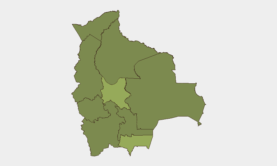
Cochabamba (risk 53.1) and Tarija (risk 50.8) significantly outpace other departments and drive national threat elevation. Cochabamba's score reflects ongoing anti-government mobilization and protest activity; Tarija's reflects both concurrent protest signals and the active large-scale wildfire emergency affecting critical water infrastructure and rural access. La Paz (31.2), though lower in rank, remains operationally critical as the seat of government and ongoing locus of militarized security responses, roadblocks, and demonstration activity. Santa Cruz and remaining departments show materially lower composite risk.
How GeoBit Would Assist
Security teams would deploy AOI Monitoring & Early Warning to track Plaza Murillo, key mining-sector meeting venues, and the La Victoria fire zone for renewed protest activity, roadblock deployment, and fire-line movement. Routing & Network Analysis would enable real-time alternative route planning around La Paz intercity corridors and Tarija rural roads given fluid closures and checkpoints. Conflict & Military force-structure tracking and OSINT fusion across Twitter, Telegram, and YouTube would provide early signals of new mobilizations, sector-specific grievances (particularly mining), and security-force posture changes ahead of announcements.
7-Day Outlook
Protest activity and road disruptions are likely to persist through late July, with the mining summit (July 23+) presenting elevated flashpoint risk for renewed confrontations. Water-supply wildfire suppression in Tarija should conclude within days, reducing infrastructure emergency but leaving communities and roads disrupted. Overall instability trajectory remains elevated; unannounced blockades and demonstrations remain credible risks through early August absent significant political de-escalation.
Highest-Risk Areas — Ranked
| # | State / Region | Risk |
|---|---|---|
| 1 | Cochabamba | 53.1 |
| 2 | Tarija | 50.8 |
| 3 | La Paz | 31.2 |
| 4 | Santa Cruz | 25.4 |
| 5 | Potosí | 23.1 |
| 6 | Pando | 23.1 |
| 7 | Beni | 23.1 |
| 8 | Oruro | 23.1 |
| 9 | Chuquisaca | 23.1 |
Previous Daily Briefs
A new Bolivia brief is written every day — each with its own risk map and downloadable CSV. Here's the last week; use the calendar to go further back.
📅 Browse every day by calendar →
Highlighted days have a brief. Tap a day for that day's map & analysis, or “csv” for that day's dataset ($5).
Atlas — our AI intelligence desk — emails them this snapshot personally. Nothing else, no list.