Situation Summary
Chad remains ranked #28 globally in composite threat score (65/100) with no tracked security events recorded as of 2026-08-03. Open-source monitoring confirms no confirmed armed clashes, civil unrest, or militant attacks inside Chad over the prior 48 hours. However, persistent underlying vulnerabilities in the Lake Chad Basin and along eastern border regions (particularly Sudan) continue to present structural risk to personnel and asset security. The country's overall threat posture remains elevated relative to regional peers, though acute incident activity is currently subdued.
Key Developments
- No confirmed in-country security incidents — Chad (nationwide) — 31 July 2026 — Open-source security monitoring reported zero confirmed incidents across all categories (armed clash, protest, infrastructure attack, crime surge) in the 48 hours prior to reporting.
- Adré border crossing closure (background context) — Adré, Ouaddaï Region — 28 July 2026 — Chadian authorities closed the Adré crossing with Sudan after Sudanese RSF detained two Chadian nationals; closure status and implications for cross-border personnel movement remain in effect but pre-date the immediate 48-hour window.
- Hepatitis E activity reported — Chad (nationwide) — Recent — Health monitoring indicates active Hepatitis E presence; public-health risk to unvaccinated personnel and those with poor water/sanitation access.
*Note: The event-signal feed contains references to interstate and sub-national confrontations (e.g., "IDAHO vs CHAD," "DALLAS vs CHAD," "POLICE vs CHAD") dated 2026-08-03; these appear to be data-classification artifacts or multi-jurisdiction event tags rather than confirmed incidents inside Chad territory. Live web research found no corroborating open-source reporting of armed combat or large-scale security operations on this date within Chad.*
Highest-Risk Areas
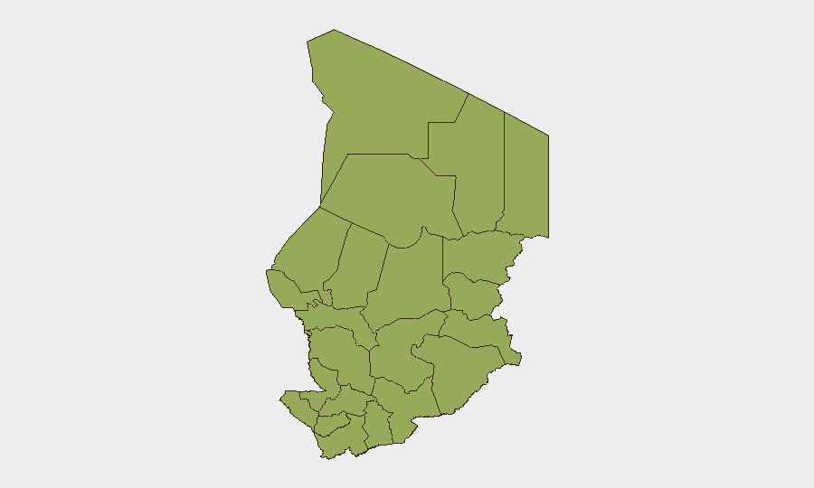
All 12 Chadian regions are ranked at identical composite risk (45.2), indicating a nationally distributed threat profile rather than concentration in discrete hotspots. The Lake Chad Basin states (Lac, Kanem, Hadjer-Lamis) and eastern border regions (Ennedi-Ouest, Wadi Fira, Ouaddaï, Sila, Salamat, East Ennedi) face structural exposure to cross-border militant activity, criminal trafficking, and intercommunal resource competition. N'Djamena, as the capital and administrative hub, faces distinct urban security challenges including detention operations and police sweeps. The uniformity of the ranking suggests underlying fragility is systemic rather than localized, likely reflecting weak state capacity, porous borders, and limited government control in peripheral zones.
How GeoBit Would Assist
Security teams should deploy AOI Monitoring & Early Warning on Adré and other Sudan-border crossing points to track closure status changes and humanitarian/personnel transit impacts. Intel Sweep and OSINT fusion (X, Telegram, local media) provide continuous 24-hour surveillance of emerging armed-group activity, protest signals, and crime trends across all 12 regions with temporal and sentiment filtering to separate noise from genuine incidents. GIS & Spatial Analysis combined with Routing & Network Analysis enables rapid assessment of alternative personnel transit corridors and asset relocation scenarios if Lake Chad Basin or eastern-region conditions deteriorate. Health & Environmental monitoring tracks Hepatitis E spread and water-infrastructure failures affecting duty-of-care obligations.
7-Day Outlook
No imminent spike in armed conflict or civil unrest is signaled by current open-source indicators. Adré border closure persistence and underlying cross-border militant presence in the Lake Chad Basin remain standing risk drivers; these are unlikely to resolve within 7 days without Sudanese political change or external diplomatic intervention. Routine law-enforcement operations (detention sweeps, police presence) are expected to continue as normal baseline activity. Security teams should maintain heightened vigilance for flash developments in the Sudan border region and monitor humanitarian health indicators (Hepatitis E, water access) affecting personnel welfare.
Highest-Risk Areas — Ranked
| # | State / Region | Risk |
|---|---|---|
| 1 | Ennedi-Ouest | 45.2 |
| 2 | Wadi Fira | 45.2 |
| 3 | Ouaddaï | 45.2 |
| 4 | Sila | 45.2 |
| 5 | Salamat | 45.2 |
| 6 | East Ennedi | 45.2 |
| 7 | Kanem | 45.2 |
| 8 | Lac | 45.2 |
| 9 | N'Djamena | 45.2 |
| 10 | Hadjer-Lamis | 45.2 |
| 11 | Chari-Baguirmi | 45.2 |
| 12 | Tibesti | 45.2 |
Sources
Previous Daily Briefs
A new Chad brief is written every day — each with its own risk map and downloadable CSV. Here's the last week; use the calendar to go further back.
📅 Browse every day by calendar →
Highlighted days have a brief. Tap a day for that day's map & analysis, or “csv” for that day's dataset ($5).
Atlas — our AI intelligence desk — emails them this snapshot personally. Nothing else, no list.