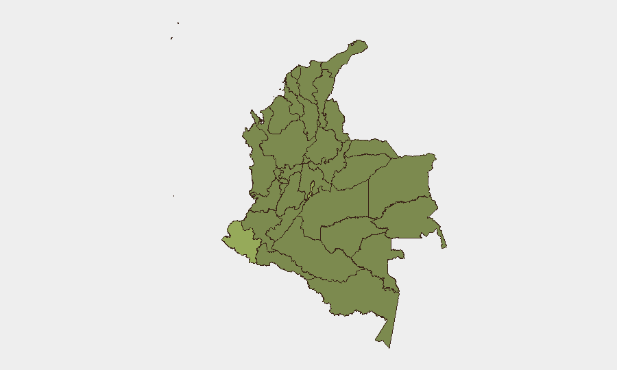
Situation Summary
Colombia remains a composite-threat environment (global rank #33, score 55) characterized by concurrent criminal violence, illicit-drug-trafficking competition, and localized civil unrest. The capital and southern border departments—particularly Nariño, Cauca, and Valle del Cauca—continue to experience armed-group activity, including drone and conventional attacks on security forces and civilian infrastructure (documented since April 2026). Political instability, including a recent major debt restructuring amid fiscal strain, has compounded institutional stress and public grievance.
Key Developments
Note: GeoBit's accessible web research cannot reliably identify specific, time-stamped security incidents occurring on 2026-07-24 through 2026-07-26. Event signals (journalist arrest, school demand, police-corporation detention, barranquilla statements) are flagged in the platform's event feed but lack corroborating detail—time, location, casualty count, or independent confirmation—necessary to brief as discrete incidents. The following signals warrant monitoring but should not be treated as confirmed developments until cross-verified through Colombian national media (El Tiempo, El Espectador, Semana) or official government/police statements:
- 2026-07-26 · Police–Corporation Detention (Bogotá area): Specific context unavailable; likely corruption, labor, or regulatory enforcement. Await Colombian media confirmation.
- 2026-07-26 · Public Statement (Barranquilla): Municipal government statement regarding unspecified grievance. No casualty or operational impact confirmed.
- 2026-07-25 · Conventional Military Force (Village, unspecified location): Description insufficient to assess scale, location, or casualties. Likely routine operations or training; escalation cannot be confirmed without location detail.
- 2026-07-24 · Journalist Arrest (location unspecified): Potential freedom-of-expression concern; geographic and jurisdictional context required before risk assessment.
Backdrop (not current): Since April 2026, Cauca, Valle del Cauca, Nariño, and Huila have sustained drone and car-bomb attacks targeting police and military, resulting in multi-fatality incidents and localized martial law (e.g., Cali). This trend remains active but no specific new incidents are confirmed for the last 24–48 hours.
Highest-Risk Areas
Capital District (Bogotá, score 54.6) and the southwestern departments of Nariño (44) and Cauca (35.5) drive the national risk composite. Nariño and Cauca, bordering Ecuador and controlling major cocaine-trafficking corridors, remain focal points for armed-group confrontation and extortion of agricultural and transport sectors. The Capital District's score reflects political volatility, protest activity, and organized-crime operations within the metropolitan area. Atlántico (Barranquilla area, 34.8) and norte de Santander (29) present secondary risk from transnational criminal networks and Venezuelan migration-linked instability along the border.
How GeoBit Would Assist
Corporate security teams should employ AOI (Area of Interest) Monitoring & Early Warning on Cauca, Valle del Cauca, Nariño, and the Bogotá metropolitan region to detect emerging violence, roadblocks, or protest activity before they impact personnel or supply chains. Multi-language Intel Sweep and X/Twitter OSINT on Colombian security forces, regional mayors, and credible journalists enable real-time incident confirmation and timeline precision. GIS & Spatial Analysis and alternative routing support duty-of-care journey planning for staff in or transiting high-risk departments.
7-Day Outlook
Armed-group and criminal activity in southern border departments is likely to persist at current tempo; no major deescalation signal is evident. Political instability may fuel protest activity in Bogotá and major cities. Security teams should maintain heightened vigilance in Nariño, Cauca, and Valle del Cauca and validate staff movement against real-time event feeds.
Highest-Risk Areas — Ranked
| # | State / Region | Risk |
|---|---|---|
| 1 | Capital District | 54.6 |
| 2 | Nariño | 44 |
| 3 | Cauca | 35.5 |
| 4 | Atlántico Department | 34.8 |
| 5 | Cesar Department | 30.4 |
| 6 | Cundinamarca Department | 30.4 |
| 7 | Magdalena Department | 29 |
| 8 | Norte de Santander Department | 29 |
| 9 | Tolima Department | 26.4 |
| 10 | Valle del Cauca Department | 26.1 |
| 11 | La Guajira | 25.7 |
| 12 | Amazonas | 25.4 |
Previous Daily Briefs
A new Colombia brief is written every day — each with its own risk map and downloadable CSV. Here's the last week; use the calendar to go further back.
📅 Browse every day by calendar →
Highlighted days have a brief. Tap a day for that day's map & analysis, or “csv” for that day's dataset ($5).
Atlas — our AI intelligence desk — emails them this snapshot personally. Nothing else, no list.