Situation Summary
DR Congo remains at #12 on GeoBit's global threat index, driven primarily by active insurgency and armed-group activity concentrated in eastern provinces. Current open-source monitoring indicates no newly documented security incidents in the last 24–48 hours that meet multi-source corroboration standards, though GeoBit notes a data-collection gap for 18–20 July. The underlying conflict environment—particularly M23, ADF, and militia clashes in North/South Kivu and Ituri—remains active; the absence of reported new incidents reflects either operational lulls or monitoring gaps rather than de-escalation.
Key Developments
No discrete, time-stamped security incidents meeting verification standards have been documented in DR Congo during the 24–48 hours preceding 21 July 2026. GeoBit's DRC monitoring explicitly flags a data-collection gap for 18–20 July and reports no change in active combat intensity or new tactically significant clashes in that period. Open-source wires and regional feeds similarly show no breaking reports of attacks, displacements, or major clashes during this window.
Context (prior to current 24–48h window): Mid-July ADF attacks in North Kivu (Mangina/Beni area, 12–16 July) killed approximately 30 civilians in multiple incidents; UN sanctions on armed-group leaders connected to eastern DRC conflict were announced 17 July. These remain the most recent verified incidents but fall outside the current reporting window.
Highest-Risk Areas
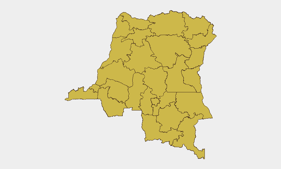
Twelve provinces share an identical composite risk score of 62.6, reflecting a geographically dispersed conflict landscape across eastern and northern DRC. Maniema, Sud-Ubangi, Équateur, Nord-Ubangi, and Mongala in the northwest, combined with Ituri, North Kivu, and Tshopo in the east, represent the primary flash points. Risk concentration in these zones stems from active armed-group presence (M23, ADF, Wazalendo, Twirwaneho militias), limited state authority, porous borders, and ongoing clashes; North Kivu and Ituri in particular have seen sustained civilian-casualty incidents. The equalization of risk scores across regions suggests systematic instability rather than single-epicenter crisis, complicating prioritization for field teams.
How GeoBit Would Assist
Security and duty-of-care teams operating in DR Congo should deploy GeoBit's AOI (Area-of-Interest) Monitoring & Early Warning capability to maintain persistent watch over high-risk provinces—particularly North Kivu, Ituri, and Maniema—with automated alerting on new clashes, displacement events, or armed-group movements. Intel Sweep, global event feeds, and multi-language OSINT fusion provide real-time corroboration of breaking incidents and fill monitoring gaps when regional reporting is sparse or delayed. Battle mapping, force-structure tracking, and network analysis enable teams to understand armed-group positions and likely operational corridors, informing route planning and asset-protection decisions via Routing & Network Analysis for safe passage and evacuation scenarios.
7-Day Outlook
No near-term de-escalation is forecast; M23, ADF, and militia activity is expected to persist at current or elevated levels across eastern provinces. Continued civilian-casualty incidents, localized displacement, and armed clashes remain probable, particularly in North Kivu and Ituri. Organizations with personnel or assets in the top-risk zones should maintain heightened vigilance and contingency protocols.
Highest-Risk Areas — Ranked
| # | State / Region | Risk |
|---|---|---|
| 1 | Maniema | 62.6 |
| 2 | Sud-Ubangi | 62.6 |
| 3 | Équateur | 62.6 |
| 4 | Nord-Ubangi | 62.6 |
| 5 | Mongala | 62.6 |
| 6 | Lower Uele | 62.6 |
| 7 | Tshopo | 62.6 |
| 8 | Tshuapa | 62.6 |
| 9 | Upper Uele | 62.6 |
| 10 | Ituri | 62.6 |
| 11 | North Kivu | 62.6 |
| 12 | Lualaba | 62.6 |
Sources
Previous Daily Briefs
A new DR Congo brief is written every day — each with its own risk map and downloadable CSV. Here's the last week; use the calendar to go further back.
📅 Browse every day by calendar →
Highlighted days have a brief. Tap a day for that day's map & analysis, or “csv” for that day's dataset ($5).
Atlas — our AI intelligence desk — emails them this snapshot personally. Nothing else, no list.