Situation Summary
Canada's composite threat score remains moderate (21/100) with 410 tracked events, but acute security incidents in the past 48 hours—including a mass shooting in British Columbia, a major botnet arrest, and infrastructure disruption—have elevated near-term risk. Ontario and Quebec account for approximately 70% of sub-national risk concentration, driven by density-dependent crime, cyber activity, and transport-safety concerns. The national picture reflects distributed low-intensity threats rather than systemic destabilization, though specific localities face acute public-safety exposure.
Key Developments
- British Columbia mass shooting, July 24, 2026: At least eight people killed in an active shooting incident; suspected shooter deceased. Major law-enforcement response ongoing; localized public-safety and emergency-services strain expected to persist 48–72 hours.
- Ottawa cybercrime arrest, July 24–25, 2026: Canadian authorities arrested a 23-year-old suspected operator of "Kimwolf," an IoT botnet responsible for sustained DDoS attacks on Canadian and international internet infrastructure over six months. Marks significant but incomplete degradation of this threat actor's capability.
- Weyburn, Saskatchewan aviation incident, July 24, 2026: Small aircraft crashed into power lines southwest of Weyburn; pilot seriously injured, hospitalized. Localized power infrastructure disruption and emergency response activity ongoing.
- Quebec heavy-truck safety crisis, July 24, 2026: Provincial government announced new regulatory and training requirements following a series of serious collisions involving inexperienced drivers. New enforcement and inspection measures expected on key provincial routes; commercial transport operators should anticipate delays and heightened scrutiny.
- Iran maritime attacks, July 24, 2026: Foreign Affairs Minister Anita Anand condemned Iranian attacks on commercial shipping in the Strait of Hormuz region. Elevated risk flag for Canadian-flagged vessels, crews, and nationals transiting the region; potential knock-on impact on supply-chain routing and maritime insurance costs.
- Nationwide event signal escalation: GeoBit event feeds recorded multiple "public statement," "threaten," and "small arms combat" signals across Canada on July 23–25, indicating elevated political and social tension and increased law-enforcement activity.
Highest-Risk Areas
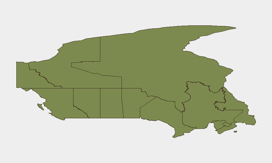
Ontario (31.3) and Quebec (28.3) together represent nearly 60 of Canada's composite threat score, reflecting high population density, urban crime concentrations, and cyber-activity clustering in Toronto and Montreal corridors. British Columbia (17.8) has spiked due to the July 24 mass shooting and historically elevated gang-related violence in Vancouver and Lower Mainland areas. Alberta (7.1) and all Atlantic and northern territories carry minimal acute risk; however, infrastructure and transportation vulnerabilities in less-populated regions (Nunavut, Northwest Territories) create logistical fragility in emergency response.
How GeoBit Would Assist
Security teams with personnel or assets in Ontario and Quebec should deploy AOI Monitoring & Early Warning on high-density urban and commercial corridors, with real-time alerting on crowd activity, protests, and law-enforcement operations. Cyber & Infrastructure Risk Assessment combined with Network & Actor Analysis enables continuous tracking of botnet activity and DDoS threat actors post-arrest; organizations with critical infrastructure should cross-reference Shodan and threat feeds for IoT exposure. Routing & Network Analysis supports real-time supply-chain and personnel movement planning around Quebec transport restrictions and British Columbia emergency zones.
7-Day Outlook
Short-term risk will remain elevated in British Columbia (ongoing investigation and public anxiety) and Quebec (transport enforcement and driver-competency inspections). Cyber-threat landscape will likely stabilize modestly following the Kimwolf arrest, but operational security teams should assume continued botnet and DDoS activity from secondary actors. No systemic national escalation is forecast unless additional mass-casualty or political events materialize; routine monitoring of Ontario and Quebec metropolitan areas remains essential.
Highest-Risk Areas — Ranked
| # | State / Region | Risk |
|---|---|---|
| 1 | Ontario | 31.3 |
| 2 | Quebec | 28.3 |
| 3 | British Columbia | 17.8 |
| 4 | Alberta | 7.1 |
| 5 | Nunavut | 3.4 |
| 6 | Saskatchewan | 3 |
| 7 | Northwest Territories | 2.7 |
| 8 | Manitoba | 2.2 |
| 9 | Newfoundland and Labrador | 1.7 |
| 10 | Prince Edward Island | 1.7 |
| 11 | Nova Scotia | 1.6 |
| 12 | New Brunswick | 1.5 |
Sources
Previous Daily Briefs
A new Canada brief is written every day — each with its own risk map and downloadable CSV. Here's the last week; use the calendar to go further back.
📅 Browse every day by calendar →
Highlighted days have a brief. Tap a day for that day's map & analysis, or “csv” for that day's dataset ($5).
Atlas — our AI intelligence desk — emails them this snapshot personally. Nothing else, no list.