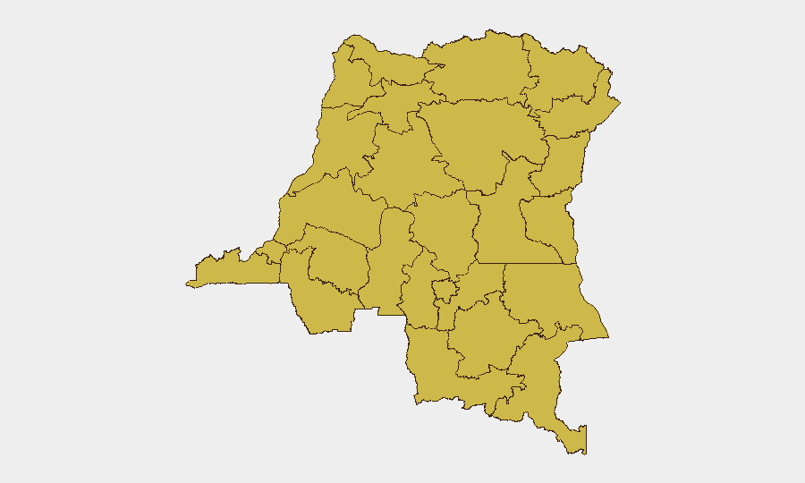
Situation Summary
DR Congo remains at elevated threat level (#13 globally, composite score 87), driven primarily by active insurgency in eastern provinces. The current 24–48 hour window shows no newly documented security incidents; however, a monitoring data gap (18–20 July) prevents full confidence in the all-clear assessment. Recent mid-July activity—including ADF attacks in North Kivu (12–16 July, ~30 civilian deaths) and ongoing M23/pro-government clashes—indicates persistent operational tempo in the east, with potential for escalation following UN sanctions announcements on 17 July targeting eastern armed-group leaders.
Key Developments
- Data Gap, Eastern Provinces (18–20 July): Open-source security monitoring explicitly reports no newly time-stamped incidents for 24–48 hours preceding 21 July 2026; however, a concurrent visibility gap for 18–20 July suggests either operational lull or incomplete real-time coverage rather than confirmed de-escalation.
- No Discrete Incidents, National Level (21–22 July): Major international news wires and social-media OSINT feeds report no breaking attacks, clashes, or infrastructure disruptions attributable to insurgent or militia activity in the last two days.
- Sanction Environment, National (17 July context): UN sanctions on AFC and M23 leadership announced 17 July may influence insurgent posture or retaliation risk in coming days; assess as background driver rather than immediate trigger.
- Ebola-Related Security Constraints (Ituri/North Kivu, mid-month context): Ongoing health-response insecurity and attacks on treatment facilities continue to fragment government presence and create ungoverned space; not new but persistent friction point in high-risk zones.
Highest-Risk Areas
Twelve provinces are ranked at composite risk 61.2, with Maniema, Sud-Ubangi, Équateur, and Nord-Ubangi listed first; Ituri and North Kivu remain operational epicenters for insurgency (ADF, M23, Twirwaneho). Risk concentration reflects active armed groups, weak state control, and ongoing armed clashes. The uniformity of sub-national scores across eastern and northern provinces indicates systemic instability rather than localized pockets, requiring enterprise-wide geographic awareness rather than single-province focus for personnel and supply-chain planning.
How GeoBit Would Assist
Teams with personnel or assets in DR Congo should employ AOI Monitoring & Early Warning on high-risk provinces (particularly Ituri, North Kivu, South Kivu) to detect real-time incident clustering and armed-group movement; pair with Intel Sweep and multi-language OSINT fusion to fill data gaps and cross-validate incident reports across local news, Telegram networks, and regional security channels. Conflict & Military battle mapping and force-structure tracking will illuminate M23, ADF, and pro-government deployments, while Routing & Network Analysis supports contingency planning for alternative supply routes or evacuation pathways should primary corridors become compromised. Satellite & Imagery analysis on key facilities (offices, warehouses, residential compounds) in Maniema, Ituri, and North Kivu provinces provides physical-security baseline and threat-approach visibility.
7-Day Outlook
No imminent escalation is signaled in the 24–48 hour window, but mid-July ADF activity and recent UN sanctions create latent risk of retaliation or faction jockeying in the next 5–7 days. Persistent data gaps and the consistent 61.2 risk score across eastern provinces suggest surveillance and early-warning systems remain essential; any uptick in armed-group mobilization, checkpoint activity, or cross-border movement should trigger rapid re-assessment of personnel movement and supply logistics in affected zones.
Highest-Risk Areas — Ranked
| # | State / Region | Risk |
|---|---|---|
| 1 | Maniema | 61.2 |
| 2 | Sud-Ubangi | 61.2 |
| 3 | Équateur | 61.2 |
| 4 | Nord-Ubangi | 61.2 |
| 5 | Mongala | 61.2 |
| 6 | Lower Uele | 61.2 |
| 7 | Tshopo | 61.2 |
| 8 | Tshuapa | 61.2 |
| 9 | Upper Uele | 61.2 |
| 10 | Ituri | 61.2 |
| 11 | North Kivu | 61.2 |
| 12 | Lualaba | 61.2 |
Sources
Previous Daily Briefs
A new DR Congo brief is written every day — each with its own risk map and downloadable CSV. Here's the last week; use the calendar to go further back.
📅 Browse every day by calendar →
Highlighted days have a brief. Tap a day for that day's map & analysis, or “csv” for that day's dataset ($5).
Atlas — our AI intelligence desk — emails them this snapshot personally. Nothing else, no list.