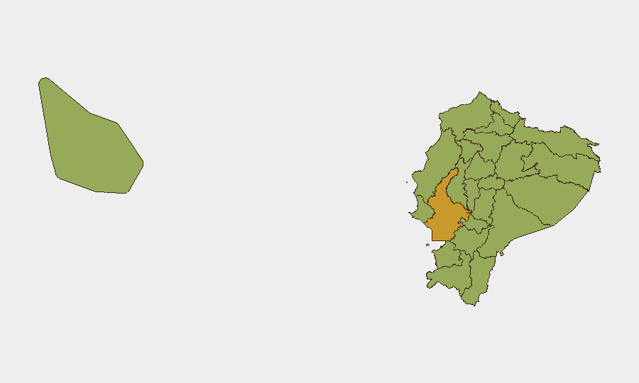
Situation Summary
Ecuador faces an acute surge in organized armed violence across its major urban centers, with 94 tracked threat events and a composite national risk score of 61 (rank #35 globally). The past 48 hours have seen at least eight fatal armed incidents spanning Quito, Guayaquil, Manabí, and surrounding regions, including unprecedented gang violence in the capital—a decapitated body displayed on a major bridge signals intensifying territorial disputes and loss of state control in key zones. Guayas Province (risk 72.4) remains the dominant driver, but violence has visibly spread to provincial cities and secondary urban areas, indicating diffusion rather than containment of organized crime activity.
Key Developments
- Quito, Av. Simón Bolívar (Llano Chico) – 29 Jul 2026 (morning): A decapitated body was discovered hanging from a bridge with the head found separately nearby; local media attributed the incident to gang-related "ajuste de cuentas" (score-settling), marking an escalation in visibility and brutality of organized crime violence in the capital.[6]
- Quito, Calle Necochea / El Panecillo corridor – 29 Jul 2026 (13:17): A gun attack killed one person and injured another; police, fire, and emergency services responded with traffic restrictions imposed on connecting avenues during investigation.[7]
- Quito, La Michelena (south) – Night of 28 Jul 2026: A Colombian citizen was shot dead and another wounded in an armed attack at a commercial premises; confirmed by National Police as part of ongoing homicide investigations in southern Quito.[6]
- Quito, La Ferroviaria and Carcelén – 29 Jul 2026: Anti-crime raids resulted in the arrest of seven individuals, including three minors affiliated with gang Los Lobos, found in possession of rifles and firearms; confirms active gang recruitment and weaponization in the capital.[6]
- Guayaquil, northern upscale restaurant – Evening 28–29 Jul 2026: Two armed assailants robbed a high-end restaurant, killing a private security guard; reflects ongoing pattern of violent armed robberies targeting commercial establishments in the city.[8]
- Manabí Province, El Carmen (Portoviejo & Luis Félix López streets) – Night of 30 Jul 2026 (approx. 20:00): Armed gunmen opened fire on civilians playing cards near the market, killing three and wounding two, including a 66-year-old; demonstrates organized crime violence spreading to secondary urban centers outside the coast.[10]
- Nationwide (Guayaquil, Durán, Quito) – Night 28 Jul to early 29 Jul 2026: Five homicides recorded in less than 12 hours across multiple cities in separate armed attacks; reflects sustained, coordinated pressure from organized crime on major urban centers.[2]
Highest-Risk Areas
Guayas Province dominates risk assessment at 72.4, driven by sustained violence in Guayaquil and surrounding municipalities (Durán). However, the current event cycle shows violent incidents spreading into Pichincha Province (capital, Quito) and secondary zones such as Manabí, indicating geographic diffusion of organized armed conflict. Frontier provinces—Sucumbíos, Carchi, Esmeraldas, Orellana—remain elevated at 42.4 due to drug-trafficking infrastructure and transnational gang presence; the violence observed in urban centers suggests cartel competition for territorial and commercial control is now manifesting in both coastal and highland population centers.
How GeoBit Would Assist
Security teams should deploy AOI Monitoring & Early Warning on Quito's highest-incident corridors (Necochea, Llano Chico, La Ferroviaria, Carcelén, La Michelena) and Guayaquil's commercial and hospitality zones to detect emerging patterns in armed robbery and homicide clusters. Network & Actor Analysis of gang affiliations (Los Lobos, others) combined with OSINT fusion (Telegram, social media gang signals, local media monitoring) would provide early indication of territorial shifts and retaliation cycles. Routing & Network Analysis enables corporate security teams to identify safer alternate routes for staff and asset movement in high-incident zones.
7-Day Outlook
Violence is likely to remain elevated or escalate as competing organized crime factions contest territory and resources across coastal and highland regions. Government security operations (as evidenced by recent raids in Quito) may temporarily suppress street-level incidents but are unlikely to address underlying cartel competition; vigilance for retaliation incidents and secondary crime waves (robberies, extortion) is warranted over the next week.
Highest-Risk Areas — Ranked
| # | State / Region | Risk |
|---|---|---|
| 1 | Guayas Province | 72.4 |
| 2 | Loja Province | 43 |
| 3 | Sucumbíos Province | 42.4 |
| 4 | Orellana Province | 42.4 |
| 5 | Manabí Province | 42.4 |
| 6 | Galápagos | 42.4 |
| 7 | Esmeraldas Province | 42.4 |
| 8 | Carchi Province | 42.4 |
| 9 | Imbabura Province | 42.4 |
| 10 | Santo Domingo de los Tsáchilas Province | 42.4 |
| 11 | Pichincha Province | 42.4 |
| 12 | Napo Province | 42.4 |
Sources
Previous Daily Briefs
A new Ecuador brief is written every day — each with its own risk map and downloadable CSV. Here's the last week; use the calendar to go further back.
📅 Browse every day by calendar →
Highlighted days have a brief. Tap a day for that day's map & analysis, or “csv” for that day's dataset ($5).
Atlas — our AI intelligence desk — emails them this snapshot personally. Nothing else, no list.