Situation Summary
Canada remains a stable, low-threat environment globally (rank #121, composite score 7), but regional disparities are pronounced. Ontario and Quebec drive the majority of tracked security signals, reflecting both population density and genuine upticks in violent crime, infrastructure incidents, and cyber threats. The past 48 hours have registered targeted violent crime (Winnipeg assault), critical infrastructure disruption (Saskatchewan power-grid impact), emerging cyber-operational activity (IoT botnet arrest), and policy-level responses to transport safety failures (Quebec). The overall trajectory is stable but fragmented by geography and threat category.
Key Developments
- Weyburn, Saskatchewan – July 25 | Small-aircraft crash into electrical power lines southwest of Weyburn caused serious injury to the pilot and localized infrastructure damage; short-term disruption to power and ground transport in the immediate region.
- Elmwood, Winnipeg, Manitoba – July 25 | A 39-year-old male charged with aggravated assault following serious injury to a child in a residential home; police investigation ongoing, indicating escalated violent-crime risk in the neighbourhood.
- Quebec Province-Wide – July 25 | Provincial authorities announced safety-enforcement measures targeting inexperienced heavy-truck operators following a cluster of recent collisions; reflects elevated transport-accident risk on provincial highways and major corridors.
- Ottawa, Ontario – July 24–25 | Canadian law-enforcement arrested a 23-year-old resident suspected of operating "Kimwolf," a large-scale IoT botnet deployed in DDoS attacks over the preceding six months; indicates active, Canada-based cyber-operational threat with international targeting scope.
- National Travel Alert – Ongoing, monitored July 25 | Government of Canada maintains avoidance advisory for Iran due to volatile security conditions, drone and missile strikes, and elevated surveillance/arrest risk for foreign nationals; relevant to Canadian business travel and supply-chain routes via the region.
- U.S. Worldwide Caution – Still in effect | U.S. State Department Worldwide Caution (active since March 2026) continues to flag threats against U.S. facilities and Western-associated locations globally; affects Canadian travelers near U.S. assets and shared airspace.
Highest-Risk Areas
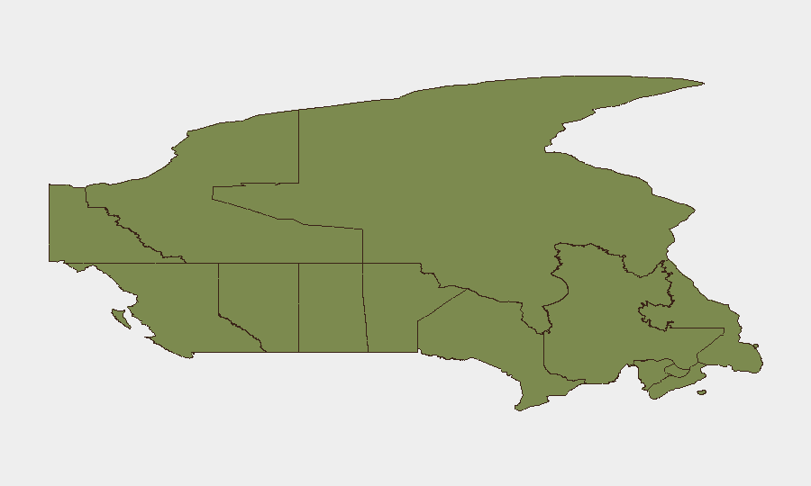
Ontario (31.4) and Quebec (24.3) account for approximately two-thirds of Canada's tracked security events, driven by urban density, complex infrastructure interdependencies, and elevated violent-crime and cyber-threat signals. British Columbia (21.1) follows, reflecting mixed patterns of property crime and organized-activity indicators. Alberta, Yukon, and Northwest Territories show moderate risk (7–7.4), while maritime provinces and prairie regions remain low-risk; the concentration in central Canada reflects both reporting density and genuine operational threat clustering in high-population corridors.
How GeoBit Would Assist
Security teams would deploy AOI Monitoring & Early Warning to track Ontario and Quebec hotspots in real-time, triggering alerts on violent crime, infrastructure incidents, and cyber-actor movements. Network & Actor Analysis capabilities would map the Kimwolf botnet's operational footprint and identify upstream command-and-control infrastructure and associated threat actors. Routing & Network Analysis would support business-continuity planning by identifying alternative supply-chain and personnel-transit routes around infrastructure risks (e.g., power outages, transport-safety zones) and geopolitical travel advisories.
7-Day Outlook
No major escalation is anticipated; however, localized violent-crime incidents and infrastructure disruptions will likely continue at current frequency in Ontario and Quebec. The Quebec heavy-truck safety initiative may temporarily reduce transport-corridor incidents. Cyber-operational focus should remain on IoT-botnet command networks and any linked Canadian operators; international DDoS activity may persist unless attribution and takedown operations accelerate.
Highest-Risk Areas — Ranked
| # | State / Region | Risk |
|---|---|---|
| 1 | Ontario | 31.4 |
| 2 | Quebec | 24.3 |
| 3 | British Columbia | 21.1 |
| 4 | Alberta | 7.4 |
| 5 | Yukon | 7 |
| 6 | Northwest Territories | 6.8 |
| 7 | Saskatchewan | 5 |
| 8 | Nunavut | 4 |
| 9 | Manitoba | 1.9 |
| 10 | Prince Edward Island | 1.9 |
| 11 | Nova Scotia | 1.9 |
| 12 | Newfoundland and Labrador | 1.7 |
Sources
Previous Daily Briefs
A new Canada brief is written every day — each with its own risk map and downloadable CSV. Here's the last week; use the calendar to go further back.
📅 Browse every day by calendar →
Highlighted days have a brief. Tap a day for that day's map & analysis, or “csv” for that day's dataset ($5).
Atlas — our AI intelligence desk — emails them this snapshot personally. Nothing else, no list.