Situation Summary
DR Congo remains at #11 globally on GeoBit's threat ranking (composite score 90), driven primarily by active insurgency in eastern provinces. The security environment in North Kivu, Ituri, and South Kivu remains volatile, with M23-aligned and pro-government forces engaged in intermittent clashes. However, the current 24–48 hour window shows no newly documented multi-source-verified incidents, though a data-collection gap on 18–20 July means the absence of reports may reflect monitoring constraints rather than genuine reduction in threat activity.
Key Developments
- No newly verified incidents in the last 24–48 hours. GeoBit's multi-source corroboration standards did not confirm discrete security events in the target window as of 21 July 2026.
- Data-collection gap, 18–20 July. Monitoring gaps during this period mean current threat picture is incomplete; absence of incident reports does not indicate security improvement.
- Underlying eastern conflict environment remains active. North Kivu, Ituri, and South Kivu continue to experience clashes between M23-aligned forces and pro-government units, though no specific new incidents were time-stamped and verified in the last 48 hours.
Note: Background context includes ongoing M23 reinforcement activity and clashes near Masisi-Walikale (North Kivu) and continued engagements in South Kivu highlands, but these reports predate the 24–48 hour window and should not be treated as current developments.
Highest-Risk Areas
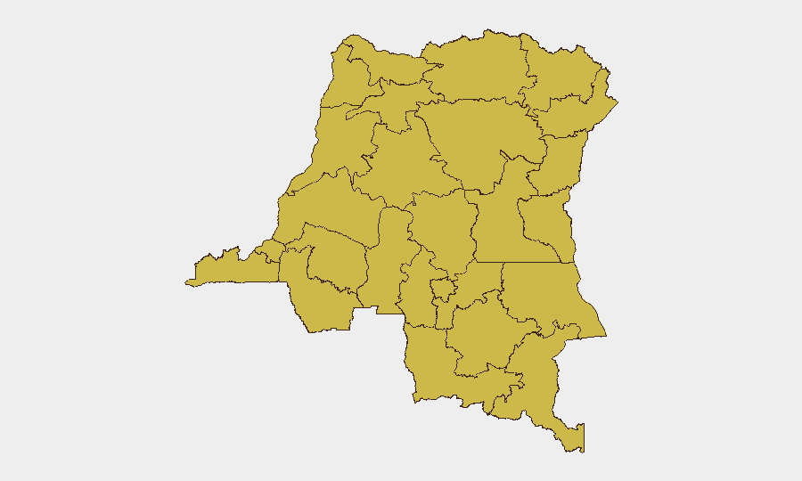
Twelve provinces share identical composite risk scores (63), including all of eastern DR Congo's conflict hotspots: North Kivu, South Kivu, Ituri, and Maniema. The clustering reflects the geographic spread and persistence of armed group activity across the eastern corridor, where M23, Allied Democratic Forces (ADF), and other non-state actors maintain operational presence. Nord-Ubangi, Sud-Ubangi, and northern river provinces (Équateur, Mongala, Tshuapa, Tshopo) carry equal scores, indicating a nationwide risk profile; this distribution suggests instability is not confined to the east but reflects weak state capacity and governance challenges across DRC's periphery. Personnel and assets in any of these zones face elevated exposure to armed group activity, intercommunal violence, and extortion.
How GeoBit Would Assist
Security and risk teams should deploy AOI Monitoring & Early Warning on specific facilities, transit routes, and provincial capitals in high-risk zones (North Kivu, Ituri, Maniema) to detect emerging threats and force movements in near-real time. Battle mapping, force-structure analysis, and Network & Actor Analysis would provide granular understanding of armed group disposition, leadership changes, and operational patterns to inform movement planning and site hardening. Intel Sweep, multi-language OSINT, and Telegram/radio SIGINT would fill monitoring gaps and flag localized incidents—such as roadblocks, clinic attacks, or displacement events—that may not reach international news wires but directly affect duty-of-care obligations.
7-Day Outlook
No significant escalation or de-escalation is anticipated in the near term. The absence of new verified incidents in the current window should not be mistaken for reduced threat; ongoing data gaps and the persistent operational environment in the east suggest threat level remains elevated and operationally fluid. Security teams should maintain heightened vigilance and assume active insurgent and criminal networks continue operations, particularly in North Kivu and Ituri provinces.
Highest-Risk Areas — Ranked
| # | State / Region | Risk |
|---|---|---|
| 1 | Maniema | 63 |
| 2 | Sud-Ubangi | 63 |
| 3 | Équateur | 63 |
| 4 | Nord-Ubangi | 63 |
| 5 | Mongala | 63 |
| 6 | Lower Uele | 63 |
| 7 | Tshopo | 63 |
| 8 | Tshuapa | 63 |
| 9 | Upper Uele | 63 |
| 10 | Ituri | 63 |
| 11 | North Kivu | 63 |
| 12 | Lualaba | 63 |
Sources
Previous Daily Briefs
A new DR Congo brief is written every day — each with its own risk map and downloadable CSV. Here's the last week; use the calendar to go further back.
📅 Browse every day by calendar →
Highlighted days have a brief. Tap a day for that day's map & analysis, or “csv” for that day's dataset ($5).
Atlas — our AI intelligence desk — emails them this snapshot personally. Nothing else, no list.