Situation Summary
Central African Republic remains a fragmented, low-intensity conflict environment with chronic instability across multiple regions rather than a single active crisis. The country ranks #30 globally in GeoBit's composite threat assessment, with no tracked events in the current 24–48-hour window. Recent political and security statements (22–23 July) indicate heightened concern over a localized spike in intercommunal violence and armed infiltration, prompting calls for tighter movement controls around the capital, but no major fresh incidents have been confirmed in the last two days across open sources.
Key Developments
- Bangui (Ombella-M'Poko) – 22 July 2026 – The Union des Forces Démocratiques de l'Opposition (UFDO) issued an emergency security communiqué citing a "regain de violence" in multiple regions and proposing systematic vehicle and personnel checkpoints at key entry points (Damara, Boali, Mbaïki) to restrict armed infiltration toward the capital. This signals heightened threat perception among political actors and potential implementation of checkpoint operations affecting travel routes.
- National-level security posture (23 July 2026) – Bangui-based reporting documents a "dégradation de la situation sécuritaire" and calls for reinforced security around strategic towns and enhanced community surveillance. No specific new attack was reported, but the alert reflects elevated risk assessment among local stakeholders.
- Boali (Ombella-M'Poko) – late July 2026 – Intercommunal clashes reportedly occurred in the past week (prior to 23 July announcement), resulting in casualties and material damage. Exact date is not specified, placing this slightly outside the strict 24–48-hour window, but it remains the most recent documented violent incident contributing to current security deterioration.
- No confirmed fresh attacks, organized crime incidents, or civil unrest events – Open-source monitoring has not identified time-stamped, multi-source-confirmed security incidents in CAR within the last 24–48 hours. Intelligence gaps and reporting delays are typical for the country; current alerts are primarily precautionary and reactive to prior spikes.
Highest-Risk Areas
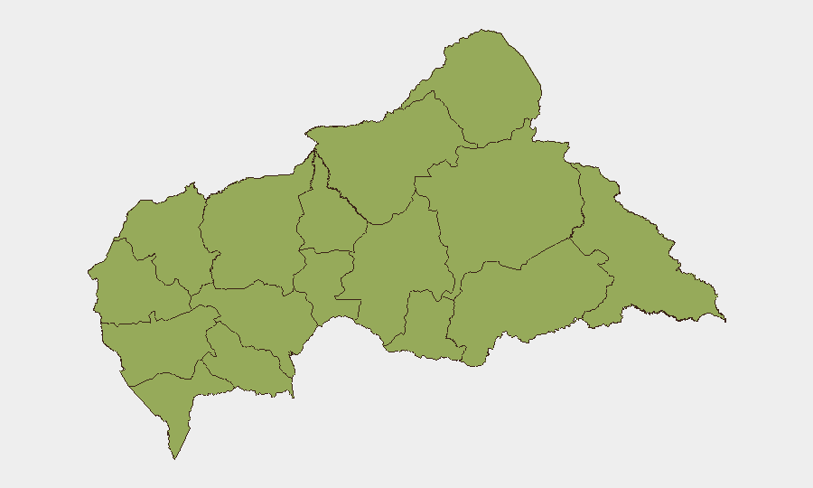
All twelve sub-national regions tracked by GeoBit carry identical composite risk scores (46.9), reflecting the geographically diffuse and chronic nature of insecurity. Vakaga (north), Haut-Mbomou and Mbomou (southeast), and Bamingui-Bangoran (northeast) are historically drivers of armed-group activity and intercommunal violence. Ouham-Pendé and Ouham (northwest) remain vulnerable to infiltration and banditry. The capital prefecture (Ombella-M'Poko) and surrounding approach routes (Boali, Damara, Mbaïki) are now flagged as concern areas for infiltration of armed personnel and criminal elements, prompting the announced checkpoint measures.
How GeoBit Would Assist
Corporate security and duty-of-care teams should leverage AOI Monitoring & Early Warning to establish persistent watch over Bangui and key approach routes for checkpoint activity, vehicle movements, and security announcements. Intel Sweep and multi-language OSINT capabilities (including Telegram, local radio SIGINT, and Bangui-based news outlets) provide real-time alerting on political/security statements and localized violence before mainstream reporting. Routing & Network Analysis enables identification of alternative routes around newly announced checkpoints and risk-segmented journey planning.
7-Day Outlook
Movement controls around Bangui are likely to be implemented or reinforced in the near term, creating operational friction on civilian and commercial traffic. Intercommunal tensions in Ombella-M'Poko and surrounding prefectures may persist or escalate if underlying grievances remain unaddressed. Organizations with staff or supply chains dependent on CAR routes should plan for extended transit times and possible temporary closures at checkpoint sites.
Highest-Risk Areas — Ranked
| # | State / Region | Risk |
|---|---|---|
| 1 | Bamingui-Bangoran | 46.9 |
| 2 | Vakaga | 46.9 |
| 3 | Haute-Kotto | 46.9 |
| 4 | Haut-Mbomou | 46.9 |
| 5 | Mbomou | 46.9 |
| 6 | Nana-Mambéré | 46.9 |
| 7 | Ouham-Pendé | 46.9 |
| 8 | Mambéré-Kadéï | 46.9 |
| 9 | Sangha-Mbaéré | 46.9 |
| 10 | Ouham | 46.9 |
| 11 | Nana-Grébizi | 46.9 |
| 12 | Kémo | 46.9 |
Sources
Previous Daily Briefs
A new Central African Republic brief is written every day — each with its own risk map and downloadable CSV. Here's the last week; use the calendar to go further back.
📅 Browse every day by calendar →
Highlighted days have a brief. Tap a day for that day's map & analysis, or “csv” for that day's dataset ($5).
Atlas — our AI intelligence desk — emails them this snapshot personally. Nothing else, no list.