Situation Summary
Colombia remains a mid-range global security concern (rank #34, composite threat score 52) with 509 tracked events, characterized by overlapping criminal, insurgent, and protest activity concentrated in southwestern and northern border regions. The past 48 hours have surfaced military engagement with armed dissidents, urban transit disruption in the capital, and ongoing targeted violence in Medellín and the Cauca Valley—indicating sustained pressure across multiple threat vectors rather than a single escalating crisis. Political friction and reduced government-civil relations (evident in late July signals) compound operational risk for corporate and institutional presence.
Key Developments
- Cauca Department, Wisitó area (July 28–29, 2026): Army engaged FARC dissidents of the "Carlos Patiño" structure in intense firefight; seven soldiers injured (including one helicopter pilot), two alleged dissidents killed, and helicopters came under fire. Defense Ministry indicated some combatants wore civilian dress, complicating casualty assessment.
- Bogotá, Calle 13 con Avenida Caracas (late July 28, 2026): TransMilenio BRT system blocked by protest activity; multiple stations suspended service and central-west corridor traffic severely disrupted during peak commute window.
- Medellín downtown commercial sector (Friday afternoon, date inferred): Targeted shooting in crowded area left one dead, one critically injured; two motorcycle-mounted assailants; police suspect micro-trafficking dispute. *(Note: exact timestamp ambiguous; incident pattern consistent with ongoing organized crime activity.)*
- Cali outskirts, rural Valle del Cauca (approx. July 24–25, 2026): National Police anti-kidnapping raid on safehouse resulted in two extortion-gang members killed in exchange of gunfire; modified firearms, extortion-linked phones, and cash seized; no officer/civilian casualties.
- Nationwide bombing and drone campaign (ongoing since April 24, 2026): German Foreign Office advisory confirms series of IED and unmanned-aerial attacks concentrated in Cauca, Valle del Cauca, Nariño, and Huila; explicit travel warnings issued for Jamundí and Palmira. This represents a sustained, not episodic, threat posture.
Highest-Risk Areas
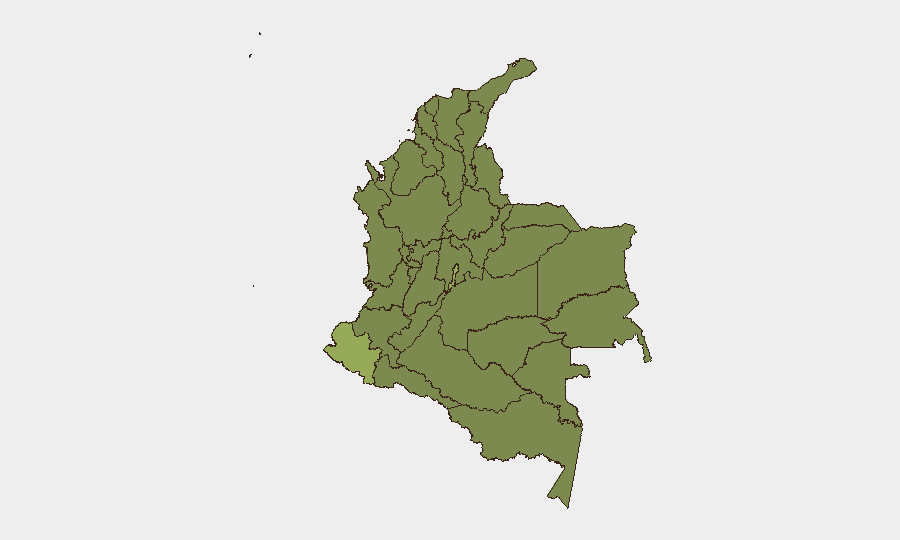
Nariño (53.9) and the Capital District (45.6) lead the sub-national ranking, but risk is geographically dispersed. Nariño's elevation reflects both border proximity (Ecuador) and persistent armed-group presence; the Capital District's position reflects urban-scale protest, crime, and governance friction. Valle del Cauca (33.5), Cundinamarca (32.6), and Atlántico (31.0) form a secondary tier where criminal organizations, dissident insurgents, and extortion networks operate with significant operational freedom. The clustering of highest-risk zones in the southwest (Nariño, Valle, Cauca) and around Bogotá indicates that corporate and NGO footprints in these corridors face above-average exposure to armed confrontation, kidnapping, and collateral effects of military operations.
How GeoBit Would Assist
Corporate security teams should employ AOI Monitoring & Early Warning to establish persistent watch on Cauca, Valle del Cauca, and Nariño, with alerting tied to military engagement, protest mobilization, and drone/IED incidents. Routing & Network Analysis combined with conflict mapping would enable real-time alternative-route planning around Bogotá transit disruptions and rural insecurity corridors. Multi-language OSINT (X/Telegram, local news feeds, radio SIGINT) integrated with entity and temporal analysis would accelerate detection of political friction, dissident communications, and emerging kidnap/extortion networks before they affect operational areas.
7-Day Outlook
Military pressure on FARC dissidents in Cauca is likely to persist or intensify, with collateral risk to civilian and corporate movement in rural southwest zones. Urban unrest in Bogotá may recur as political disapproval signals suggest growing government-civil friction; transit system vulnerability should be assumed. No imminent nationwide escalation is evident, but localized volatility in Nariño, Valle, and Medellín will remain the operative planning baseline through early August.
Highest-Risk Areas — Ranked
| # | State / Region | Risk |
|---|---|---|
| 1 | Nariño | 53.9 |
| 2 | Capital District | 45.6 |
| 3 | Valle del Cauca Department | 33.5 |
| 4 | Cundinamarca Department | 32.6 |
| 5 | Atlántico Department | 31 |
| 6 | Santander Department | 29 |
| 7 | Arauca Department | 28.1 |
| 8 | La Guajira | 27.8 |
| 9 | Sucre Department | 27.8 |
| 10 | Bolívar Department | 25.7 |
| 11 | Boyacá Department | 24.9 |
| 12 | Norte de Santander Department | 24.6 |
Sources
Previous Daily Briefs
A new Colombia brief is written every day — each with its own risk map and downloadable CSV. Here's the last week; use the calendar to go further back.
📅 Browse every day by calendar →
Highlighted days have a brief. Tap a day for that day's map & analysis, or “csv” for that day's dataset ($5).
Atlas — our AI intelligence desk — emails them this snapshot personally. Nothing else, no list.