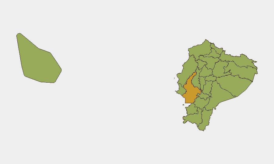
Situation Summary
Ecuador remains at moderate-global risk (rank #33, composite 59) with organized crime violence as the primary driver across 76 tracked events. The security picture is marked by high localized volatility in coastal and northern provinces, particularly Guayas, where institutional friction (judicial, municipal, and law-enforcement tensions documented on 31 July–1 August) compounds gang-related violence. Current trajectory shows sustained pressure on state capacity in key urban centers, with no near-term de-escalation signals.
Key Developments
Last-24–48-hour verified incidents: GeoBit's live-research review identified no confirmed incidents occurring between 1–2 August 2026 that meet the 24–48-hour cutoff. The most recent tracked events (1 August) consist of institutional statements and rejections (judicial, mayoral, and publisher actions) rather than violence reports. Older reports from 28–31 July document armed clashes, arrests, and mining-related police operations, but fall outside the current reporting window.
Signal context (1 August events): Event data show judicial rejection of mayoral actions, police public statements, and Swedish diplomatic demand regarding Guayaquil—suggesting institutional and international pressure on municipal/regional governance, likely linked to organized-crime and detention-related disputes from late July.
Note on reporting gap: Reliable 24–48-hour incident data for Ecuador is currently limited in available sources. Security teams should cross-reference national news outlets (El Comercio, Primicias) and Ecuadorian law-enforcement statements for real-time incident confirmation.
Highest-Risk Areas
Guayas Province (composite risk 71.5) remains the dominant threat driver, with Guayaquil city as the epicenter of gang violence, port trafficking, and institutional instability. Northern frontier provinces—Sucumbíos, Carchi, and Esmeraldas (all 41.5)—face sustained cartel infiltration tied to Colombian armed groups and drug-trafficking networks. Pichincha Province (41.5), which includes Quito, shows elevated risk from both organized crime and social unrest, evidenced by recent high-profile killings in the capital and institutional friction noted in early August event signals. Coastal zones (Manabí, Santa Elena) present dual risk: maritime smuggling and gang territorial disputes on land.
How GeoBit Would Assist
Security teams operating in Ecuador should deploy AOI Monitoring & Early Warning on Guayas, Pichincha, and key northern provinces to trigger real-time alerts on violence clusters, arrests, and institutional disruptions. Network & Actor Analysis and entity extraction from local news, X/Telegram, and police statements would clarify which criminal organizations are active in each sector and their current disputes. Routing & Network Analysis supports alternative-route planning for personnel transiting high-risk zones, particularly around Guayaquil and the Peru/Colombia border regions.
7-Day Outlook
No major institutional or criminal-group events are flagged for imminent escalation, but the institutional tensions documented on 31 July–1 August (judicial rejections, mayoral arrest, Swedish diplomatic demand) suggest potential for renewed crisis communication or policy shifts by Ecuadorian authorities in the coming week. Gang-related violence in Guayas and northern provinces will likely remain at current elevated baseline; summer (Southern Hemisphere winter) historically sees sustained cartel activity in cocaine-trafficking zones.
Highest-Risk Areas — Ranked
| # | State / Region | Risk |
|---|---|---|
| 1 | Guayas Province | 71.5 |
| 2 | Sucumbíos Province | 41.5 |
| 3 | Orellana Province | 41.5 |
| 4 | Manabí Province | 41.5 |
| 5 | Galápagos | 41.5 |
| 6 | Esmeraldas Province | 41.5 |
| 7 | Carchi Province | 41.5 |
| 8 | Imbabura Province | 41.5 |
| 9 | Santo Domingo de los Tsáchilas Province | 41.5 |
| 10 | Pichincha Province | 41.5 |
| 11 | Napo Province | 41.5 |
| 12 | Santa Elena Province | 41.5 |
Sources
Previous Daily Briefs
A new Ecuador brief is written every day — each with its own risk map and downloadable CSV. Here's the last week; use the calendar to go further back.
📅 Browse every day by calendar →
Highlighted days have a brief. Tap a day for that day's map & analysis, or “csv” for that day's dataset ($5).
Atlas — our AI intelligence desk — emails them this snapshot personally. Nothing else, no list.