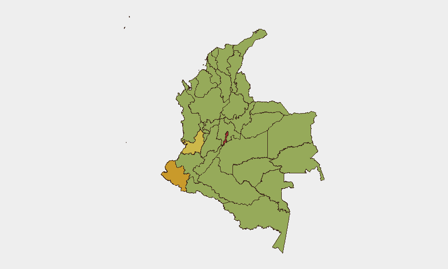
Situation Summary
Colombia remains at composite threat rank #30 globally, driven primarily by active insurgency and criminal-conflict overlap. The last 48 hours have seen a marked spike in violent incidents across urban and rural zones—including drone attacks on police infrastructure, armed clashes in conflict-affected departments, and targeted homicides in major cities. This pattern reflects the persistent co-existence of guerrilla operations in peripheral zones (Cauca, Chocó) and organized-crime violence in urban centers (Bogotá, Medellín), with no immediate indication of de-escalation.
Key Developments
- Tadó, Chocó – 29 July (overnight): Explosive drone attack on local police station caused structural damage; attributed to guerrilla or dissident actors. Chocó remains a high-threat zone for remotely-delivered attacks.
- Rural Cauca (El Tambo, Wiisitó corregimiento) – 29 July: Heavy armed clashes between National Army and FARC dissidents resulted in seven soldiers and six civilians wounded, signaling sustained guerrilla capability in the department.
- Medellín (Plaza Botero) – 29 July: Police interdicted a planned explosives attack on the city center's major tourist plaza; device neutralized before detonation and linked to organized armed groups.
- Medellín (downtown commercial sector) – 29 July: Motorcycle-mounted targeted attack killed one, critically injured another in crowded shopping corridor; apparent execution-style hit by organized crime.
- Near Cali, Valle del Cauca – 29 July (morning): Anti-kidnapping police operation against extortion safehouse resulted in two suspected extortionists killed; no officer casualties.
- Bogotá (Usaquén/Soratama) – 29 July: Ride-hailing driver shot during violent robbery; two perpetrators arrested and charged with aggravated homicide, robbery, and weapons violations.
- El Espinal, Tolima – 29 July: Prison break involving 12 inmates; six remain at large, including one double-homicide suspect, elevating violent-crime risk in the region.
- Medellín (citywide) – 28–10 August: Task Force Medellín 2026 (binational Colombian–U.S. security cell) fully activated around Colombiamoda fair and Feria de las Flores; enhanced biometric screening in place.
Highest-Risk Areas
Capital District (78.7) and Nariño (71.2) drive the highest composite risk scores, with Bogotá and Medellín experiencing concentrated violent crime and insurgent targeting simultaneously. Valle del Cauca (66.5), Cauca (49.6), and Chocó (49.0) remain conflict hotspots where guerrilla and dissident forces maintain operational control and capability for armed assault and drone strikes. Cundinamarca and Atlántico departments score elevated but secondary risk; however, the prison break in Tolima and ongoing extortion operations in the rural Cauca Valley highlight that secondary zones also present acute incident risk. The clustering of drone attacks and armed clashes in southwestern departments (Nariño, Cauca, Chocó) reflects persistent territorial control by non-state armed groups.
How GeoBit Would Assist
Security teams operating in Colombia should deploy AOI Monitoring & Early Warning on Capital District, Medellín, and Cauca conflict zones to receive real-time alerting on armed clashes, explosive attacks, and kidnapping activity. Conflict & Military battle mapping and force-structure tracking enable duty-of-care teams to understand FARC-dissident disposition and operational tempo in rural areas. Multi-language OSINT, Telegram & X monitoring, and event-feed fusion provide rapid corroboration of emerging incidents (as seen with the drone and explosives events) to inform immediate protective action.
7-Day Outlook
Over the next seven days, expect continued elevated urban-crime violence in Bogotá and Medellín, particularly around the Colombiamoda fair through 10 August. Rural conflict intensity in Cauca and Chocó is likely to remain high as dissident forces maintain pressure on security forces. No significant de-escalation indicators are apparent; security posture should remain elevated across all high-risk zones.
Highest-Risk Areas — Ranked
| # | State / Region | Risk |
|---|---|---|
| 1 | Capital District | 78.7 |
| 2 | Nariño | 71.2 |
| 3 | Valle del Cauca Department | 66.5 |
| 4 | Cundinamarca Department | 57.6 |
| 5 | Atlántico Department | 55 |
| 6 | Santander Department | 53.8 |
| 7 | La Guajira | 52.5 |
| 8 | Amazonas | 52.2 |
| 9 | Bolívar Department | 50.4 |
| 10 | Cauca | 49.6 |
| 11 | Norte de Santander Department | 49.3 |
| 12 | Chocó Department | 49 |
Sources
Previous Daily Briefs
A new Colombia brief is written every day — each with its own risk map and downloadable CSV. Here's the last week; use the calendar to go further back.
📅 Browse every day by calendar →
Highlighted days have a brief. Tap a day for that day's map & analysis, or “csv” for that day's dataset ($5).
Atlas — our AI intelligence desk — emails them this snapshot personally. Nothing else, no list.