Situation Summary
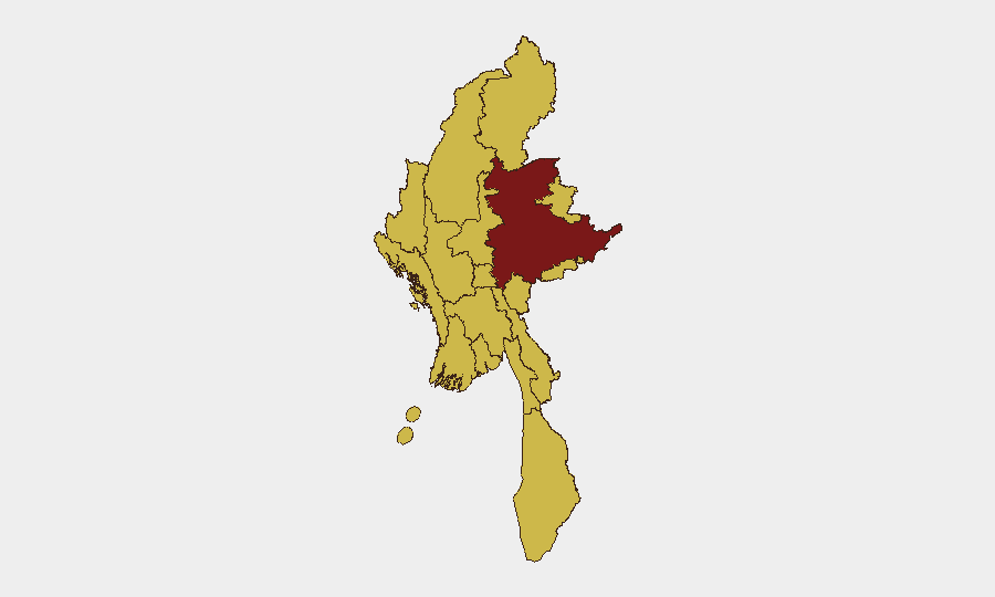
Myanmar remains in active civil war with sustained juju military air operations, artillery, and ground campaigns across peripheral states and regions. The conflict has produced a severe humanitarian crisis with widespread displacement, and information controls severely limit real-time open-source incident confirmation. Overall threat ranking places Myanmar at #22 globally; however, sub-national risk concentration in Shan State (96.8) and secondary concentration across Yangon, Tanintharyi, Chin, Sagaing, Kachin, and other border regions indicates highly uneven geographic exposure.
Key Developments
No independently multi-sourced, time-stamped incidents meeting confirmation criteria have been reliably documented in the last 24–48 hours. Open-source monitoring confirms this constraint is structural: junta information controls and restricted independent media access prevent real-time incident verification across Myanmar. The most recent geo-specific confirmed events date to 11–14 July 2026, including airstrikes in Myawaddy (Kayin State), Mahlaing (Mandalay Region), and Gwa (Rakhine State), and mid-July reports of airstrikes in Sagaing and Magway Regions and assaults on political prisoners in Mandalay. Current event signals (dated 17–18 July) include disapprovals by prosecutors and ministries, investigations of refugee populations and police conduct, public statements by UNHCR and Myanmar authorities, and reported ethnic cleansing and physical assault incidents, but these do not carry precise location or corroborated incident timestamps within 24–48 hours and cannot be treated as confirmed developments. Duty-of-care teams should monitor these signals as indicators of ongoing tension and alleged conduct violations; however, operational decisions should not rest on single-source or unverified claims from this window.
Highest-Risk Areas
Shan State dominates the risk landscape at 96.8, reflecting sustained armed conflict, cross-border spillover, and limited state control. Yangon (70.6) stands as the only urban concentration point in the top tier, indicating political, civil unrest, and security-force activity risk within the capital. A second tier of six regions—Tanintharyi, Chin, Sagaing, Kachin, Wa State (Northern Region), and Rakhine—cluster at 66.8, all representing peripheral, conflict-affected, or minority-area zones where junta military pressure, ethnic armed organization activity, and humanitarian displacement are concentrated. Magway, Mandalay, Ayeyarwady, and Naypyitaw complete the ranking at 66.8, indicating distributed secondary risk across interior and administrative zones. Border proximity, minority population concentration, and armed-group presence are primary risk drivers across all high-ranked areas.
How GeoBit Would Assist
Security and risk teams with people or assets in Myanmar should employ Intel Sweep and global event feeds for continuous monitoring of conflict, civil unrest, and alleged conduct violations; OSINT fusion and corroboration to cross-verify reports in an environment of severe information control; AOI Monitoring & Early Warning with persistent geographic watch on highest-risk states (Shan, Yangon, Chin, Sagaing, Kachin, Rakhine) and key facilities; and Satellite & Imagery analysis to track military movements, displacement camps, and infrastructure damage independent of official or junta-controlled narratives. Battle mapping and force-structure tracking support operational understanding of armed-group and military deployments. Alternative route and network analysis assist in journey planning for personnel movement between high-risk zones.
7-Day Outlook
Sustained junta military operations and armed-group activity across border regions are expected to continue. Humanitarian displacement and civilian-impact reports will likely accumulate, but official confirmation delays and information-control constraints will persist. Risk to corporate personnel and assets remains highest in Shan, Yangon, and secondary conflict zones; movement planning and supply-chain resilience should account for transport disruption and airspace closure.
Highest-Risk Areas — Ranked
| # | State / Region | Risk |
|---|---|---|
| 1 | Shan State | 96.8 |
| 2 | Yangon | 70.6 |
| 3 | Tanintharyi Region | 66.8 |
| 4 | Chin | 66.8 |
| 5 | Sagaing Region | 66.8 |
| 6 | Kachin State | 66.8 |
| 7 | Wa State (Northern Region) | 66.8 |
| 8 | Magway | 66.8 |
| 9 | Mandalay | 66.8 |
| 10 | Rakhine | 66.8 |
| 11 | Ayeyarwady | 66.8 |
| 12 | Naypyitaw Union Territory | 66.8 |
Sources
Previous Daily Briefs
A new Myanmar brief is written every day — each with its own risk map and downloadable CSV. Here's the last week; use the calendar to go further back.
📅 Browse every day by calendar →
Highlighted days have a brief. Tap a day for that day's map & analysis, or “csv” for that day's dataset ($5).
Atlas — our AI intelligence desk — emails them this snapshot personally. Nothing else, no list.