Situation Summary
Central African Republic remains a complex, fragmented operating environment with persistent armed-group activity across northern and eastern provinces, but no major escalation or sudden incident has been confirmed in the past 48 hours. The national composite threat score of 67 places CAR at #30 globally; security conditions vary sharply by prefecture, with all twelve highest-risk regions clustered at identical sub-national scores (46.8), suggesting uniform underlying exposure to armed-group presence, banditry, and resource competition rather than localized crisis. Recent incidents—including the 30 June armed attack on Am Dafock (Sudan border) and earlier killings in Zémio and Bangui—remain current in regional threat matrices but fall outside the immediate 24–48 hour window; no discrete new events have been verified in the last two days.
Key Developments
- No discrete incidents verified in the last 24–48 hours. Web and open-source feeds do not confirm fresh violence, displacement, or armed-group activity within this window.
- Security-community policy signals, 22–23 July. UFDO called for emergency checkpoint restoration at Damara, Boali, and Mbaïki access routes to Bangui, citing deteriorating perimeter control; this is a reaction to broader threat perception rather than a specific triggering event, but signals heightened concern among Bangui-based stakeholders.
- Background escalation context (June–early July). Am Dafock attack (30 June, UN-reported casualties including 3 Zambian MINUSCA peacekeepers), assassination of Abbé Crépin Martial Monga (Zémio), and armed actions in Bangui remain active in the regional threat baseline and may motivate further group activity or reprisal operations.
- Operational posture unchanged. MINUSCA and national security forces continue routine presence; no emergency mobilization or declared alert status has been reported in the current 24–48 hour window.
Highest-Risk Areas
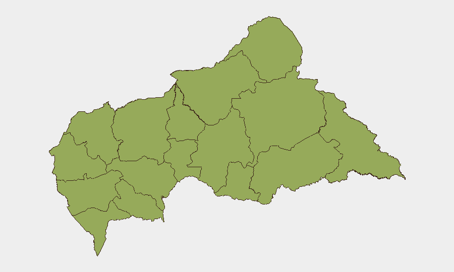
All twelve tracked regions—Bamingui-Bangoran, Vakaga, Haute-Kotto, Haut-Mbomou, Mbomou, Nana-Mambéré, Ouham-Pendé, Mambéré-Kadéï, Sangha-Mbaéré, Ouham, Nana-Grébizi, and Kémo—score identically at 46.8, indicating uniform exposure to armed-group presence, informal taxation, and occasional intercommunal tension. The prevalence of identical scores across all high-risk zones reflects structural fragmentation: no single region dominates threat geography, but rather a nationwide pattern of low state capacity, multiple armed factions, porous borders (especially Sudan and South Sudan), and competition for mineral and timber resources. Northern and eastern prefectures (Vakaga, Haute-Kotto, Haut-Mbomou) historically experience higher incidence of cross-border incursion; western and southwestern zones (Mambéré-Kadéï, Sangha-Mbaéré) see resource-driven conflict. Bangui itself, while lower in sub-national ranking, remains a flashpoint for political violence and criminal activity.
How GeoBit Would Assist
Teams operating in CAR should deploy AOI Monitoring & Early Warning on high-risk prefectures (especially border zones and resource-extraction corridors) to generate alerts on emerging armed-group movement or incident signals. Network & Actor Analysis and multi-language OSINT (including Telegram, X, and local news feeds) enable continuous tracking of faction statements, recruitment rhetoric, and operational intent. Routing & Network Analysis supports duty-of-care teams in identifying safe egress corridors and alternative supply chains around known conflict concentrations.
7-Day Outlook
No major escalation is forecast for the coming week, but the underlying fragility—multiple armed actors, thin peacekeeping presence, and recurring resource disputes—means localized clashes remain probable. Organizations should maintain heightened posture on checkpoint control, inter-faction rhetoric, and border-area activity; any sudden uptick in armed-group coordination or political signaling warrants immediate reassessment.
Highest-Risk Areas — Ranked
| # | State / Region | Risk |
|---|---|---|
| 1 | Bamingui-Bangoran | 46.8 |
| 2 | Vakaga | 46.8 |
| 3 | Haute-Kotto | 46.8 |
| 4 | Haut-Mbomou | 46.8 |
| 5 | Mbomou | 46.8 |
| 6 | Nana-Mambéré | 46.8 |
| 7 | Ouham-Pendé | 46.8 |
| 8 | Mambéré-Kadéï | 46.8 |
| 9 | Sangha-Mbaéré | 46.8 |
| 10 | Ouham | 46.8 |
| 11 | Nana-Grébizi | 46.8 |
| 12 | Kémo | 46.8 |
Previous Daily Briefs
A new Central African Republic brief is written every day — each with its own risk map and downloadable CSV. Here's the last week; use the calendar to go further back.
📅 Browse every day by calendar →
Highlighted days have a brief. Tap a day for that day's map & analysis, or “csv” for that day's dataset ($5).
Atlas — our AI intelligence desk — emails them this snapshot personally. Nothing else, no list.