Situation Summary
Canada remains a low-threat environment globally (rank #93, composite score 6), but faces a concentrated spike in security events in Ontario—which accounts for the majority of the national risk profile. Recent 24–48 hour incidents span natural disasters (wildfires, tornado), transportation fatalities, localized crime, and unconfirmed reports of armed confrontation. The risk trajectory is volatile but not indicative of systemic national instability; Ontario's elevated score reflects incident clustering rather than sustained organized threat activity.
Key Developments
- Boston Bar, British Columbia (July 29, 2026, inferred): Active wildfires in the Fraser Canyon destroyed resort infrastructure (cabins, trailers), creating travel disruption and evacuation risk in the immediate vicinity.
- Alberta campground tornado (July 28–29 evening, inferred): A tornado struck a campground around 8:30 p.m. local time, hospitalizing three persons and causing facility damage; RCMP response ongoing.
- Southwest of Weyburn, Saskatchewan (last 24–48 hours, inferred): A small sprayer aircraft crashed into power lines and caught fire, injuring the sole occupant and causing localized infrastructure disruption.
- Highway 401 near Kingston, Ontario (recent, inferred): A 56-year-old female from Carleton Place died after being struck by a vehicle on the highway; OPP investigation underway.
- Fort McMurray, Alberta (ongoing): An active serial vehicle tire-slashing crime spree has prompted police warnings and heightened local security concerns.
- Elmwood neighbourhood, Winnipeg, Manitoba (recent, inferred): A 39-year-old male charged with aggravated assault after a child sustained serious injuries in a residential incident.
*Note: GEOBIT's event signal feed references armed confrontations (police, gunmen, US military involvement) and consulate-related physical assault in Toronto on July 28, but open-source web research has not returned clearly timestamped, detailed reporting on these incidents within the last 24–48 hours. Teams with direct access to law enforcement or consular networks should cross-reference with official channels.*
Highest-Risk Areas
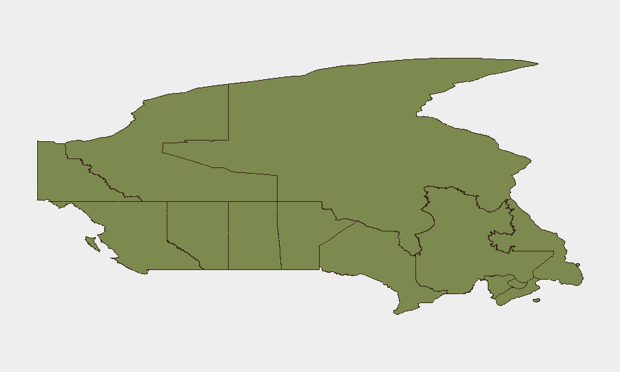
Ontario drives the national risk profile by a significant margin (score 31.5 vs. #2 British Columbia at 9.8), reflecting both population density and incident concentration in the Greater Toronto Area and Highway 401 corridor. British Columbia and Quebec follow at lower but material risk levels, primarily due to wildfire, severe weather, and localized crime. Alberta and Yukon/Saskatchewan are moderate-risk jurisdictions; the remaining Atlantic and territorial regions carry minimal national impact despite local disruption. Ontario's dominance suggests corporate security and duty-of-care teams should prioritize asset and personnel monitoring in the GTA, along Highway 401, and in critical infrastructure corridors.
How GeoBit Would Assist
Intel Sweep and X/Twitter & Telegram OSINT would provide real-time detection of armed incidents, emergency declarations, and public-safety alerts—surfacing the Toronto consulate event and police confrontations before traditional news lag. AOI Monitoring & Early Warning (persistent watch on Toronto, GTA transport hubs, and wildfire zones) would enable proactive alerting on escalation, road closures, or evacuation orders. Routing & Network Analysis would support duty-of-care teams in identifying safe alternate travel routes around wildfire zones and Highway 401 incident zones for personnel and supply movements.
7-Day Outlook
Natural disaster risk (wildfire, severe weather) will remain elevated in British Columbia, Alberta, and Saskatchewan through early August absent significant weather pattern shifts. Urban crime and transport-related fatalities in Ontario are expected to persist at baseline rates. Unless the event signals referencing US military and armed confrontation in Toronto escalate or are substantiated, national threat trajectory remains localized and non-systemic.
Highest-Risk Areas — Ranked
| # | State / Region | Risk |
|---|---|---|
| 1 | Ontario | 31.5 |
| 2 | British Columbia | 9.8 |
| 3 | Quebec | 8 |
| 4 | Alberta | 7 |
| 5 | Yukon | 3.9 |
| 6 | Saskatchewan | 3.9 |
| 7 | Manitoba | 3.4 |
| 8 | Newfoundland and Labrador | 2.3 |
| 9 | New Brunswick | 1.7 |
| 10 | Nova Scotia | 1.7 |
| 11 | Northwest Territories | 1.6 |
| 12 | Nunavut | 1.6 |
Sources
Previous Daily Briefs
A new Canada brief is written every day — each with its own risk map and downloadable CSV. Here's the last week; use the calendar to go further back.
📅 Browse every day by calendar →
Highlighted days have a brief. Tap a day for that day's map & analysis, or “csv” for that day's dataset ($5).
Atlas — our AI intelligence desk — emails them this snapshot personally. Nothing else, no list.