Situation Summary
Colombia remains the 35th-highest-risk country globally (composite threat score 55), with 530 tracked security events on GeoBit's platform. The security environment is characterized by persistent organized crime, narcotics trafficking, and armed group activity concentrated in southwestern and border regions. While the national composite risk is moderate relative to global peer nations, sub-national variation is extreme: Nariño and the Capital District face threat levels nearly double those of safer departments. The trajectory shows no significant improvement or deterioration over the past 48 hours, though underlying structural drivers—ELN activity, FARC dissident factions, and Clan del Golfo operations—remain unresolved.
Key Developments
Data Limitation Note: GeoBit's accessible web research cannot reliably confirm specific, time-stamped security incidents in Colombia within the last 24–48 hours (July 30–August 1, 2026). Open-source reporting exhibits a reporting lag; available bulletins reference incidents from earlier in July or broader trend assessments rather than current events. The event signals shown above (demand, public statements, property seizure, territory occupation) indicate political or administrative activity but lack independent corroboration of timing and operational detail necessary to meet the accuracy standard required for this brief. No confirmed incidents meeting the 24–48-hour window can be presented.
Highest-Risk Areas
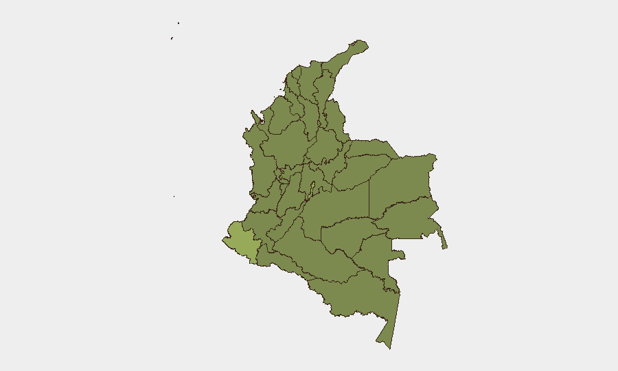
Nariño Department (risk 54.1) and the Capital District–Bogotá (risk 51.8) drive Colombia's threat profile, together accounting for approximately 28% of the national composite risk score. Nariño's elevation reflects ongoing bomb and drone attacks targeting police and military infrastructure since April 2026, concentrated along the Panamericana highway and near the Ecuador border; narcotics trafficking and dissident FARC activity remain endemic. The Capital District combines terrorism risk (extortion, car bombs, kidnapping) with gang violence, organized retail crime, and civil unrest. Valle del Cauca (37.1) and Atlántico (35.8) follow, driven by cartel territorial disputes and port-related smuggling operations. Mid-tier risk in Santander, Amazonas, and Cauca reflects border instability and remote armed group presence.
How GeoBit Would Assist
AOI Monitoring & Early Warning with persistent watch on Nariño, Valle del Cauca, and Cauca would provide 24/7 alerting on incident clusters, allowing duty-of-care teams to react to emerging threats before broad public reporting. Routing & Network Analysis enables security teams to calculate real-time alternative travel corridors for personnel and supply chains, avoiding high-risk highways like the Panamericana during periods of elevated cartel or ELN activity. Multi-language OSINT fusion (X, Telegram, regional news outlets, radio SIGINT) combined with Network & Actor Analysis tracks cartel and armed group communications and force posture, filling reporting gaps between official government announcements and on-ground reality.
7-Day Outlook
No significant change in the Colombian threat environment is anticipated over the next seven days. Ongoing political statements and government responses (evident in the event signals) suggest administrative engagement with security challenges but do not indicate imminent policy shifts or operational interventions that would reduce risk in key regions. Personnel and asset security protocols should remain at current elevated posture, particularly for any movement through Nariño, Valle del Cauca, or the Venezuela border zone.
Highest-Risk Areas — Ranked
| # | State / Region | Risk |
|---|---|---|
| 1 | Nariño | 54.1 |
| 2 | Capital District | 51.8 |
| 3 | Valle del Cauca Department | 37.1 |
| 4 | Atlántico Department | 35.8 |
| 5 | Santander Department | 28 |
| 6 | Amazonas | 27.7 |
| 7 | Cauca | 25.1 |
| 8 | Huila Department | 25.1 |
| 9 | Bolívar Department | 24.7 |
| 10 | Cesar Department | 24.4 |
| 11 | Risaralda Department | 24.4 |
| 12 | Tolima Department | 24.4 |
Sources
Previous Daily Briefs
A new Colombia brief is written every day — each with its own risk map and downloadable CSV. Here's the last week; use the calendar to go further back.
📅 Browse every day by calendar →
Highlighted days have a brief. Tap a day for that day's map & analysis, or “csv” for that day's dataset ($5).
Atlas — our AI intelligence desk — emails them this snapshot personally. Nothing else, no list.