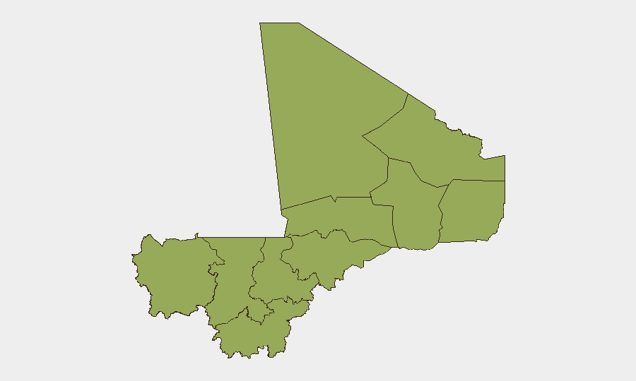
Situation Summary
Mali remains under a state of emergency with persistent terrorism and insurgency as the primary security drivers. The composite national threat score of 67 places Mali at #26 globally, with Bamako significantly elevated above other regions. No independently verified incident-level security events were confirmed in the past 24–48 hours, though the security environment remains volatile and unpredictable across the Sahel corridor.
Key Developments
- No verified new incidents in the last 24–48 hours. Independent monitoring sources confirm no authenticated attacks, clashes, arrests, civil unrest, or infrastructure damage in Mali during this period.
- 18 July 2026 convoy ambush near Anefis, Gao region (background context). A military convoy was ambushed with follow-on airstrikes reported; casualty figures remain disputed. This incident is outside the current 24–48 hour window but illustrates the persistent threat in northern transit corridors.
- Bamako remains the highest-risk focal point. The capital's composite risk score (76.9) is substantially higher than all other regions, reflecting concentration of political activity, administrative functions, and security operations.
- Northern and central regions show uniform secondary-tier risk. Ten regions (Ménaka, Kayes, Taoudénit, Kidal, Gao, Koulikoro, Ségou, Sikasso, Timbuktu, Mopti) cluster at risk score 46.9, indicating widespread but not acute conditions relative to Bamako.
- State of emergency and movement restrictions remain in effect. Roadblocks, terrorism risk, and kidnapping threat persist across the country, constraining freedom of movement and increasing operational friction for corporate assets.
Highest-Risk Areas
Bamako's risk profile (76.9) substantially exceeds all other regions and reflects the concentration of state administration, military headquarters, and high-value targets. The ten-region secondary tier (risk 46.9 each)—spanning Gao, Timbuktu, Ménaka, and Mopti in the north and center—represents the active insurgency and Sahel trafficking corridor. Kayes and Koulikoro in the west round out secondary concern. The risk gradient suggests that while operational presence in Bamako faces the highest absolute threat density, movement and supply-chain exposure across the northern tier creates sustained vulnerability for any organization with distributed assets.
How GeoBit Would Assist
Security and risk teams should deploy AOI Monitoring & Early Warning on Bamako and the ten secondary-risk regions to maintain persistent watch and receive alerting on incident emergence. Intel Sweep and multi-language OSINT (X/Twitter, Telegram, YouTube) enable rapid confirmation or refutation of rumor-level reports that typically precede formal incident disclosure in Mali's information environment. Alternative Route & Network Analysis supports duty-of-care planning by identifying secure transit corridors and identifying chokepoints where roadblocks and kidnapping risk are elevated. Periodic Conflict & Military force-structure tracking provides early indication of garrison movements or command changes that may signal operational shifts.
7-Day Outlook
No imminent escalation is signaled by the current event dataset; however, the uniform elevated baseline across northern and central regions means security incidents can emerge rapidly with limited warning. Teams should maintain heightened vigilance during the next 7 days and assume that any field movement outside Bamako carries baseline Sahel-tier risk (terrorism, banditry, roadblocks). Contingency planning for rapid personnel relocation or asset protection should remain active.
Highest-Risk Areas — Ranked
| # | State / Region | Risk |
|---|---|---|
| 1 | Bamako | 76.9 |
| 2 | Ménaka | 46.9 |
| 3 | Kayes | 46.9 |
| 4 | Taoudénit Region | 46.9 |
| 5 | Kidal | 46.9 |
| 6 | Gao | 46.9 |
| 7 | Koulikoro | 46.9 |
| 8 | Ségou Region | 46.9 |
| 9 | Sikasso Region | 46.9 |
| 10 | Timbuktu | 46.9 |
| 11 | Mopti | 46.9 |
Sources
Previous Daily Briefs
A new Mali brief is written every day — each with its own risk map and downloadable CSV. Here's the last week; use the calendar to go further back.
📅 Browse every day by calendar →
Highlighted days have a brief. Tap a day for that day's map & analysis, or “csv” for that day's dataset ($5).
Atlas — our AI intelligence desk — emails them this snapshot personally. Nothing else, no list.