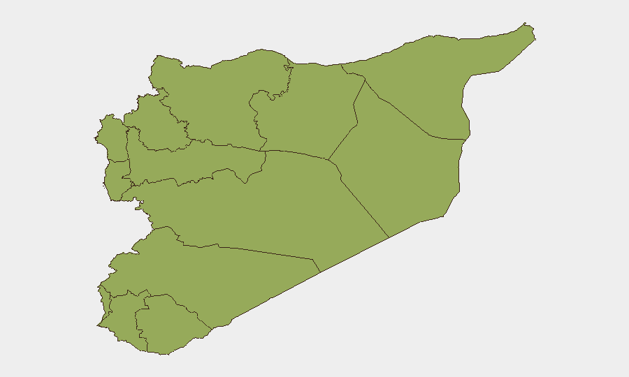
Situation Summary
Syria remains the 15th-highest-threat country globally (composite score 77) with 121 tracked security events, driven by ongoing active conflict across multiple governorates and fragmented territorial control. The past 48 hours have seen six fatalities across disparate provinces—spanning accidental weapons incidents, targeted shootings, and tribal clashes—indicating a pattern of low-intensity but geographically diffuse violence affecting both government and interim-controlled areas. Damascus Governorate remains the highest-risk sub-national zone (84), followed by coastal and northern regions with scores in the 54–58 range. The security environment shows no sign of consolidation; instead, incidents suggest persistent weapons proliferation, weak capacity for accident prevention, and unresolved factional tensions.
Key Developments
- Manbij, eastern Aleppo countryside (27 July): A member of interim-government forces killed by accidental hand-grenade explosion in al-Sarb neighborhood, indicating ordnance-handling risks and localized instability within nominally stabilized areas.
- Al-Harah, northern Daraa (27 July): Internal Security Forces member fatally shot in accidental discharge, underscoring weapons proliferation and safety gaps even among state security personnel.
- Sabina, Damascus countryside (27 July): Young man shot dead near al-Jisr transport station, suggesting criminal or retaliatory violence concentrated at public transit chokepoints.
- Al-Qutayfah, Damascus countryside (27 July): Second targeted shooting by two armed assailants on motorcycles, consistent with organized criminal or revenge-motivated attacks on local roads.
- Al-Izbah, northern Deir ez-Zor (27 July): Armed tribal clashes over local disputes resulted in at least one fatality, reflecting ongoing inter-tribal tensions in the oil-producing region affecting road and asset security.
- Al-Raha, Sweida (27 July): Young woman killed by gunshot wound to the head under unclear circumstances, pointing to investigative gaps and unresolved violent incidents in southern regions.
- Multi-province event signal (27 July): Concurrent military force activity, military-base public statement, and investigation triggers suggest heightened state-level military movements or response protocols across multiple provinces.
Highest-Risk Areas
Damascus Governorate's dominant risk score (84) reflects capital concentration of state forces, political institutions, and international presence—making it a focal point for both state-control enforcement and potential flashpoint violence. Tartus, Dar'a, and Aleppo governorates (57.7–55) represent secondary-tier risks driven by proximity to active conflict zones, tribal and factional overlap, and limited governmental monopoly on force. The UNDOF zone and Al-Quneitra (both 54) remain volatile due to Israeli–Syrian border dynamics and de-escalation-zone fragility. Coastal Lattakia (54) hosts Russian military installations and remains strategically sensitive. The consistent 54-point floor across nine northern and eastern governorates indicates systemic insecurity rather than concentrated hotspots, with tribal clashes, smuggling networks, and ISIS-residual activity sustaining baseline violence.
How GeoBit Would Assist
Security teams should leverage AOI Monitoring & Early Warning to track high-risk sub-national zones (particularly Damascus, Dar'a, and Aleppo) with persistent alerting for security-force mobilizations and event clustering. Network & Actor Analysis combined with multi-language OSINT (X/Telegram/YouTube feeds) would identify emergent tribal disputes, criminal networks, and interim-authority command changes ahead of violence. Routing & Network Analysis should inform alternative journey planning for personnel operating in Damascus countryside and Deir ez-Zor, avoiding transit stations and known clashes zones until tactical environment assessment improves.
7-Day Outlook
No major de-escalation is anticipated in the near term; fragmented territorial control and weak state capacity will continue driving localized, incident-level violence across multiple provinces. Current military-signal activity (27 July) may indicate state reinforcement or inter-agency response, but is unlikely to materially alter the baseline threat trajectory within seven days. Organizations with staff or assets in Damascus, Dar'a, and Aleppo should maintain heightened posture and review contingency protocols.
Highest-Risk Areas — Ranked
| # | State / Region | Risk |
|---|---|---|
| 1 | Damascus Governorate | 84 |
| 2 | Tartus Governorate | 57.7 |
| 3 | Dar'a Governorate | 57.1 |
| 4 | Aleppo Governorate | 55 |
| 5 | Deir ez-Zor Governorate | 54.5 |
| 6 | Lattakia Governorate | 54 |
| 7 | UNDOF | 54 |
| 8 | Al-Quneitra Governorate | 54 |
| 9 | Idleb Governorate | 54 |
| 10 | Hama Governorate | 54 |
| 11 | Ar-Raqqa Governorate | 54 |
| 12 | Homs Governorate | 54 |
Sources
Previous Daily Briefs
A new Syria brief is written every day — each with its own risk map and downloadable CSV. Here's the last week; use the calendar to go further back.
📅 Browse every day by calendar →
Highlighted days have a brief. Tap a day for that day's map & analysis, or “csv” for that day's dataset ($5).
Atlas — our AI intelligence desk — emails them this snapshot personally. Nothing else, no list.