Situation Summary
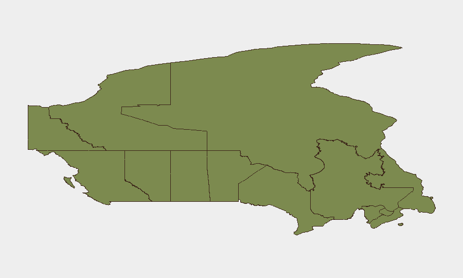
Canada remains a low-threat environment globally (rank #124, composite score 6) but shows material concentration of risk in Ontario, which accounts for approximately 60% of tracked national threat events. The past 48 hours have surfaced a cluster of localized incidents spanning wildfire damage, infrastructure disruption, violent crime, property crime, and environmental enforcement—distributed across six provinces but posing no systemic national security risk. Overall trajectory remains stable, with incident frequency and severity consistent with typical summer seasonal patterns.
Key Developments
- Boston Bar, British Columbia – 30 July. Two fast-moving wildfires in the Fraser Canyon damaged structures at a resort, destroying cabins and trailers and triggering local evacuations; CBC and regional outlets reported active fire growth and ongoing response operations.
- Fort McMurray, Alberta – 30 July. RCMP and local media issued alerts regarding a serial tire-slashing crime spree affecting numerous vehicles; localized property-crime risk has risen sharply in the city.
- Weyburn, Saskatchewan – 30 July. A crop-sprayer aircraft crashed into power lines and ignited southwest of Weyburn, seriously injuring the pilot and causing localized infrastructure disruption; transport and safety authorities responded.
- Pigeon Lake, Alberta – 30 July. RCMP confirmed that a tornado touched down at a campground, hospitalizing three people and damaging RVs and campground infrastructure; emergency response was activated.
- Kingston, Ontario – 30 July. OPP reported a fatal collision on Highway 401 near Kingston when a 56-year-old woman from Carleton Place was struck by a car after exiting her damaged vehicle; the incident highlighted road-safety risk and created temporary traffic disruption.
- Elmwood neighbourhood, Winnipeg, Manitoba – 30 July. Winnipeg Police charged a 39-year-old man with aggravated assault following serious injury to a child in a residential setting; a major crime investigation was launched.
- Western Alberta (Fox Creek area) – 30 July. The Alberta Energy Regulator fined a Calgary-based oil and gas operator nearly CAD 438,000 for an extended oil emulsion leak, signaling infrastructure-integrity and environmental-risk concerns in the energy sector.
- Region of Waterloo, Ontario – 30 July. The Region of Waterloo filed notice of appeal against a court decision on a homeless encampment in Kitchener, signaling ongoing social-policy tension and potential protest or civil-unrest risk.
Highest-Risk Areas
Ontario dominates the national risk profile (score 31.4), driven by density of population, commercial activity, and law-enforcement reporting. Alberta (13.8) and Quebec (13.7) follow at similar levels, with Alberta showing uptick from property crime and weather-related incidents and Quebec maintaining baseline risk from urban and administrative activity. British Columbia (12.5) rounds the top tier, primarily from environmental hazards. The disparity reflects Ontario's concentration of assets, population, and economic infrastructure rather than systemic instability across the country.
How GeoBit Would Assist
Security and duty-of-care teams would use Intel Sweep and multi-language OSINT fusion to consolidate incident feeds across provincial law-enforcement, utility, and emergency-response channels, enabling rapid synthesis of emerging localized threats. AOI Monitoring & Early Warning on critical asset locations (corporate facilities, supply-chain nodes, personnel concentrations) in Ontario and Alberta would flag weather, crime, and infrastructure-disruption signals before impact. Routing & Network Analysis would support real-time rerouting of personnel or shipments around wildfire zones, power outages, and road closures.
7-Day Outlook
Near-term risk is expected to remain moderate and localized. Wildfire season in British Columbia and Alberta will continue to present seasonal property and infrastructure risk; summer weather volatility may produce additional tornado or severe-weather events. Crime and social-policy tensions in Ontario and Waterloo region warrant continued monitoring for escalation.
Highest-Risk Areas — Ranked
| # | State / Region | Risk |
|---|---|---|
| 1 | Ontario | 31.4 |
| 2 | Alberta | 13.8 |
| 3 | Quebec | 13.7 |
| 4 | British Columbia | 12.5 |
| 5 | Yukon | 7.6 |
| 6 | Saskatchewan | 5.7 |
| 7 | Manitoba | 4.2 |
| 8 | Nunavut | 2.2 |
| 9 | Nova Scotia | 1.9 |
| 10 | Northwest Territories | 1.6 |
| 11 | Newfoundland and Labrador | 1.4 |
| 12 | New Brunswick | 1.4 |
Sources
Previous Daily Briefs
A new Canada brief is written every day — each with its own risk map and downloadable CSV. Here's the last week; use the calendar to go further back.
📅 Browse every day by calendar →
Highlighted days have a brief. Tap a day for that day's map & analysis, or “csv” for that day's dataset ($5).
Atlas — our AI intelligence desk — emails them this snapshot personally. Nothing else, no list.