Situation Summary
Central African Republic remains deeply fragmented across regional fault lines, with no major discrete incidents confirmed in the past 24–48 hours but persistent structural insecurity across the northeast and southeast periphery. Since June, cross-border incursions in Vakaga prefecture (north) and LRA-linked abductions in Haute-Kotto and Mbomou (east and southeast) have kept MINUSCA forces in heightened posture, particularly around northern bases. The absence of reported events in the immediate window should not be read as stability; rather, it reflects a data gap common in remote, conflict-affected terrain where verification lags real-time activity. Overall trajectory remains fragile, with sporadic violence and criminal activity the norm rather than exception.
Key Developments
No discrete, independently verified incidents with specific dates and locations have been confirmed for Central African Republic in the 24–48 hour window of 27–29 July 2026. Open-source feeds, social-media OSINT, and professional reporting show no reliably time-stamped new events meeting the threshold for inclusion in this briefing. The most recent confirmed incidents—the Am-Dafock attack in Vakaga on 30 June and LRA kidnappings in June–July—fall outside the current window. An aircraft incident at Bangui M'Poko airport on or around 27 July involving an arms shipment has been reported, but lacks precise time-stamping of the incident itself and does not constitute a direct ground-security threat.
GeoBit assessment: This represents a reporting lag typical of high-risk peripheral areas, not an improvement in security conditions. Teams should expect that threats identified in June and early July (cross-border activity in the north, LRA presence in the southeast) remain active but unconfirmed in real-time.
Highest-Risk Areas
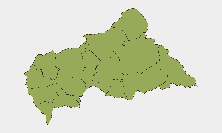
The twelve provinces listed above carry identical composite scores (44.7), reflecting a uniform distribution of structural risk rather than concentration in one region. In practice, the northeast corridor (Vakaga, Bamingui-Bangoran, Haute-Kotto) and southeast cluster (Haut-Mbomou, Mbomou) drive the highest operational threat: Vakaga faces recurring cross-border militia incursions from Sudan and Chad; Haute-Kotto and Mbomou harbor LRA splinter cells and criminal armed groups exploiting the absence of state presence. Bangui and immediate surroundings, though not ranked in the top tier, remain constrained by sporadic intercommunal violence and petty crime. Movement in any of the twelve ranked provinces should be assumed high-risk and require advance coordination with MINUSCA.
How GeoBit Would Assist
AOI Monitoring & Early Warning with persistent watch on Vakaga, Haute-Kotto, and Mbomou would provide near-real-time alerting of cross-border movement and armed-group activity that precedes public reporting by days. OSINT Fusion (X/Telegram, radio SIGINT, YouTube) across multiple languages would flag militia communications and kidnapping networks before they translate into personnel risk. Battle Mapping and Force-Structure Analysis would allow duty-of-care teams to track MINUSCA positioning, LRA cell locations, and arms-trafficking routes, enabling evidence-based routing and evacuation planning.
7-Day Outlook
No major escalation is signaled for the next week, but the northeast remains tactically volatile as Sudan's northern instability continues to drive cross-border pressure into Vakaga. LRA activity in the southeast is expected to persist at current low-intensity levels (sporadic abductions, extortion). Teams should maintain heightened vigilance in travel corridors and monitor MINUSCA status updates for any rapid repositioning in the north.
Highest-Risk Areas — Ranked
| # | State / Region | Risk |
|---|---|---|
| 1 | Bamingui-Bangoran | 44.7 |
| 2 | Vakaga | 44.7 |
| 3 | Haute-Kotto | 44.7 |
| 4 | Haut-Mbomou | 44.7 |
| 5 | Mbomou | 44.7 |
| 6 | Nana-Mambéré | 44.7 |
| 7 | Ouham-Pendé | 44.7 |
| 8 | Mambéré-Kadéï | 44.7 |
| 9 | Sangha-Mbaéré | 44.7 |
| 10 | Ouham | 44.7 |
| 11 | Nana-Grébizi | 44.7 |
| 12 | Kémo | 44.7 |
Sources
Previous Daily Briefs
A new Central African Republic brief is written every day — each with its own risk map and downloadable CSV. Here's the last week; use the calendar to go further back.
📅 Browse every day by calendar →
Highlighted days have a brief. Tap a day for that day's map & analysis, or “csv” for that day's dataset ($5).
Atlas — our AI intelligence desk — emails them this snapshot personally. Nothing else, no list.