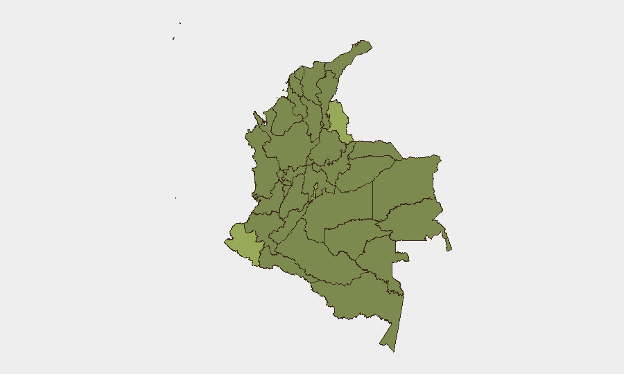
Situation Summary
Colombia remains a composite threat level #37 globally, with 615 tracked security events and a composite threat score of 46. Recent activity (31 July–2 August) shows heightened operational tempo across multiple threat domains—attempted bombings in major cities, armed robbery escalations, reinforced military checkpoints on critical transport corridors, and continued terrorist attacks in southwestern departments. The threat landscape is currently active and dispersed rather than consolidated, creating unpredictable risk across tourism zones, commercial areas, and transport networks.
Key Developments
- Medellín, Antioquia (1 August): Police intercepted and neutralized an explosive device near Plaza Botero in downtown Medellín, frustrating a planned attack. Central tourist and commercial districts now under heightened security posture with expected increased police presence and temporary cordons.
- Bogotá, Cundinamarca (1 August): Armed robbery in northern commercial zone escalated into a gunfight between assailants and police, resulting in at least one suspect injured and arrests. Localized traffic disruption and ongoing street-crime risk in mixed-use neighborhoods reported.
- Cúcuta, Norte de Santander (31 July–1 August aftermath): Following a recent truck-bomb explosion at a police station injuring multiple officers and civilians, border-zone authorities remain in heightened alert status. Further attacks assessed as plausible in this high-volatility border corridor.
- Panamericana Corridor, Valle del Cauca (1 August): Military and police deployments reinforced with intermittent vehicle checks and controls in response to ongoing risk of armed-group roadblocks and attacks. Travel disruption and exposure to militant activity remain probable on this key commercial route.
- Cauca and Valle del Cauca Departments (31 July–1 August): Foreign advisories updated to reflect continuing bomb and drone attack patterns affecting infrastructure and transport routes. Authorities warn of further incidents expected in coming days.
- Troncal del Caribe (Route 90), Southwest Corridor (1 August): Security-related roadblock closure reported between Calabazo and Los Linderos. Further closures and disruptions anticipated as armed-group activity persists in southwestern departments.
- Multi-department Terrorism & Civil Unrest Alert (1 August): U.S., Canadian, and other official advisories reiterate heightened risks of terrorism, crime, and kidnapping specifically in border areas with Venezuela, Ecuador, and Panama, with focus on recent late-July attacks in southwestern zones.
Highest-Risk Areas
Nariño (55.1) and Norte de Santander (42.6) lead the sub-national ranking, driven by border volatility with Venezuela and Ecuador, armed-group control of rural corridors, and recent bombing incidents. Capital District (40.2) and Atlántico (38.6) reflect urban crime and organized-crime activity, while Cauca (31.7) and Valle del Cauca (30.8) remain elevated due to terrorist attacks, roadblocks, and drone/bomb activity on critical transport corridors. Southwest and border departments collectively account for the majority of "do not travel" designations in current advisories.
How GeoBit Would Assist
GeoBit's AOI Monitoring & Early Warning capability enables persistent watch on Nariño, Norte de Santander, and transport corridors (Panamericana, Troncal del Caribe) with real-time alerting on roadblocks, military activity, or incident clusters. Routing & Network Analysis supports alternative journey planning for staff or supply chains avoiding high-risk segments; conflict and event mapping combined with sentiment and temporal analysis identify emerging hotspots and attack windows. OSINT fusion across news, official advisories, and social-media signals provides 24–48-hour lead time on security shifts.
7-Day Outlook
Active threat tempo is expected to persist through early August, with continued probability of armed-group operations in southwestern departments and border zones. Medellín and Bogotá will likely maintain elevated police presence and checkpoint density for 3–5 days following recent bombing interception. Road closures and transport disruptions on the Panamericana and coastal corridors should be anticipated as routine operational risk.
Highest-Risk Areas — Ranked
| # | State / Region | Risk |
|---|---|---|
| 1 | Nariño | 55.1 |
| 2 | Norte de Santander Department | 42.6 |
| 3 | Capital District | 40.2 |
| 4 | Atlántico Department | 38.6 |
| 5 | Cauca | 31.7 |
| 6 | Valle del Cauca Department | 30.8 |
| 7 | Cesar Department | 28.4 |
| 8 | Santander Department | 27.9 |
| 9 | Bolívar Department | 25.9 |
| 10 | Huila Department | 25.8 |
| 11 | Sucre Department | 25.3 |
| 12 | Archipiélago de San Andrés, Providencia y Santa Catalina Department | 25.1 |
Sources
Previous Daily Briefs
A new Colombia brief is written every day — each with its own risk map and downloadable CSV. Here's the last week; use the calendar to go further back.
📅 Browse every day by calendar →
Highlighted days have a brief. Tap a day for that day's map & analysis, or “csv” for that day's dataset ($5).
Atlas — our AI intelligence desk — emails them this snapshot personally. Nothing else, no list.