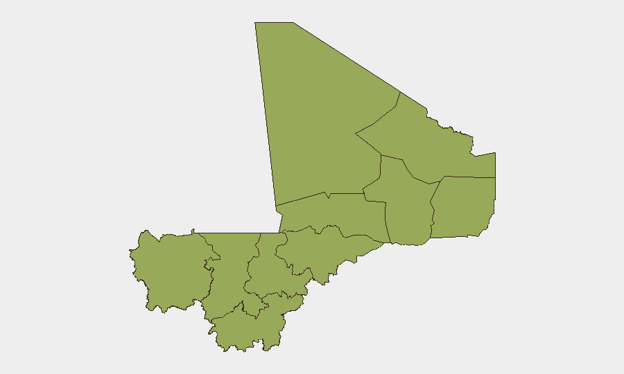
Situation Summary
Mali remains at elevated insurgency-driven threat level (composite score 70, rank #29 globally), characterized by persistent jihadist and separatist activity across the Sahel and northern regions. The country has experienced significant armed clashes in July 2026, including coordinated multi-location attacks on military and detention facilities earlier in the month; however, no independently verified incident-level security events have been confirmed in the past 24–48 hours across monitored open sources. The underlying risk environment remains volatile despite the current short-term absence of newly reported attacks.
Key Developments
No independently verified incident-level security events (attacks, armed clashes, arrests, or infrastructure disruption) have been confirmed across Mali in the past 24–48 hours by credible open-source monitoring.
This assessment is based on cross-referenced threat feeds, mainstream media, and Mali-focused security intelligence products current as of 27 July 2026. Traditionally high-risk areas including Timbuktu, Ménaka, Gao, and Mopti show no reported activity in this window.
*For operational context (outside the 24–48 hour window):*
- Early–mid July 2026: Coordinated jihadist and Tuareg separatist attacks struck multiple locations including Anefis, Gao, Aguelhok, Sévaré, and Kenieroba prison, resulting in confirmed casualties among Malian and allied forces.
- ~20 July 2026: Major ambush between Anefis and Gao resulted in significant losses among Malian and Russian-aligned personnel.
- Late July (pre-27th): Malian military operations resulted in reported retaking of contested terrain and associated casualties.
Highest-Risk Areas
Bamako dominates the sub-national risk ranking (79.3) due to its concentration of government, diplomatic, and economic assets, coupled with ambient risk of civil unrest, protest activity, and sporadic crime. The remaining ten ranked regions—led by Sikasso (53) and a cohort including Ménaka, Kayes, Taoudénit, Kidal, Gao, Koulikoro, Ségou, Timbuktu, and Mopti (all 49.3)—reflect the distributed nature of insurgency-driven threat across the Sahel, with particular concentration in the north and east where jihadist and separatist groups operate. Bamako's elevated score reflects urban-specific risks distinct from the rural insurgency profile of northern regions.
How GeoBit Would Assist
Security teams operating in or monitoring Mali should deploy AOI Monitoring & Early Warning on high-risk sub-national zones (Bamako, Ménaka, Gao, Timbuktu, Kidal) to receive real-time alert on armed activity, clashes, or arrest operations. Intel Sweep and OSINT fusion (including X/Telegram monitoring, multi-language search, and entity extraction) enable rapid corroboration of unverified social-media reports and confirmation of incident claims before operational response. Battle mapping and force-structure tracking provide commanders and security planners with up-to-date understanding of armed-group disposition and military repositioning across contested northern areas.
7-Day Outlook
No imminent large-scale attack signature has emerged in current open-source monitoring, but the July pattern of coordinated multi-location strikes and the sustained operational tempo of both jihadist and separatist actors suggest continued risk of secondary clashes, ambushes, or detention-facility incidents over the next week. Duty-of-care teams should maintain heightened situational awareness in Bamako and northern regions and sustain real-time monitoring of armed-group communication channels and military movements.
Highest-Risk Areas — Ranked
| # | State / Region | Risk |
|---|---|---|
| 1 | Bamako | 79.3 |
| 2 | Sikasso Region | 53 |
| 3 | Ménaka | 49.3 |
| 4 | Kayes | 49.3 |
| 5 | Taoudénit Region | 49.3 |
| 6 | Kidal | 49.3 |
| 7 | Gao | 49.3 |
| 8 | Koulikoro | 49.3 |
| 9 | Ségou Region | 49.3 |
| 10 | Timbuktu | 49.3 |
| 11 | Mopti | 49.3 |
Sources
Previous Daily Briefs
A new Mali brief is written every day — each with its own risk map and downloadable CSV. Here's the last week; use the calendar to go further back.
📅 Browse every day by calendar →
Highlighted days have a brief. Tap a day for that day's map & analysis, or “csv” for that day's dataset ($5).
Atlas — our AI intelligence desk — emails them this snapshot personally. Nothing else, no list.