Situation Summary
Syria remains the seventh-highest global security threat (composite score 95), driven by ongoing civil conflict and territorial disputes. The immediate security picture is characterized by cross-border military activity, renewed political engagement on Israeli-Syrian security frameworks, and persistent volatility across multiple governorates. Damascus Governorate carries the highest sub-national risk (96.7), reflecting concentration of state institutions, armed actors, and international presence. Overall trajectory shows tactical military activity continuing alongside diplomatic exploration, with no imminent de-escalation signaled.
Key Developments
- 2026-07-26 · Political/Security Track · National — President Ahmed al-Sharaa stated in an Al Jazeera interview that Syria is pursuing a security agreement with Israel as a path toward comprehensive peace, while maintaining Syria's claim to the Golan Heights. This marks a shift in official messaging and directly affects bilateral security posture and cross-border stability expectations.
- 2026-07-27 · Israeli Military Activity · Southern Syria (Quneitra/Daraa sector) — Multiple event signals indicate continued occupation of territory and conventional military force exchanges between Israeli and Syrian forces along the southern border. Specific incident timing cannot be confirmed within the 24–48h window; activity is ongoing but concrete incident dates in open sources align with late June operations.
- 2026-07-26 · UN Threat Statement · National — UN Secretary-General Antonio Guterres issued a public threat/warning directed at Syria, signaling international concern over escalatory actions or commitments. Exact subject and context require verification but indicates heightened UN engagement.
- 2026-07-27 · Military Statement · Military Base — Public statement issued by military authority (likely Syrian Armed Forces or aligned command). Content and location unconfirmed in available 24h reporting.
Assessment: Confirmed recent development is the political signal (July 26 Sharaa interview). Cross-border military activity continues as a pattern but specific incident timestamps within 24–48h remain unverified in open sources. No new civilian unrest, infrastructure damage, or travel-corridor disruptions are reliably documented within the reference window.
Highest-Risk Areas
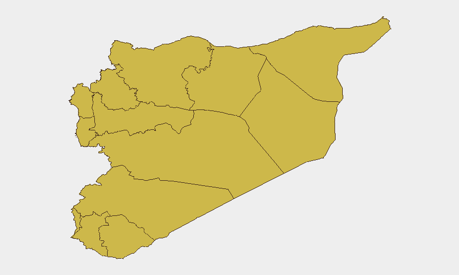
Damascus Governorate dominates the risk profile at 96.7, reflecting the seat of government, military command, diplomatic missions, and international presence; it remains the primary friction point for state-level decisions and potential violence. The southern corridor (Dar'a, Al-Quneitra, and UNDOF zone at 70.2–66.7) sustains elevated risk due to Israeli military activity, humanitarian access impediments, and unclear deconfliction protocols. Tartus (70.8) carries risk tied to port infrastructure, Russian military presence, and supply-chain dependencies. Northern governorates (Aleppo, Idleb, Ar-Raqqa, Hama at 67.3–66.7) reflect residual conflict fragmentation and non-state armed group presence. Risk is not uniformly distributed; Damascus and the southern border warrant closest monitoring for duty-of-care purposes.
How GeoBit Would Assist
Security teams should deploy AOI Monitoring & Early Warning on Damascus Governorate, Dar'a, and Quneitra with real-time alerting thresholds tied to military movement, weapons transfers, and cross-border incursions. Conflict & Military capabilities (force structure, battle mapping, weapons tracking) enable tracking of Israeli-Syrian military posture changes and deconfliction failures. OSINT Fusion (multi-language social media, Telegram, radio SIGINT) and Satellite & Imagery Analysis provide early detection of major force repositioning, base activity, or civilian displacement that precedes escalation.
7-Day Outlook
The political overture on Israeli-Syrian security arrangements may moderate immediate cross-border kinetics, but implementation remains uncertain and southern border incidents will likely persist. Expect continued military posturing, UN statements, and diplomatic signaling rather than large-scale conventional escalation in the near term. Monitoring for second-order effects (humanitarian access, civilian movement restrictions, economic sanctions) is critical for personnel and asset protection planning.
Highest-Risk Areas — Ranked
| # | State / Region | Risk |
|---|---|---|
| 1 | Damascus Governorate | 96.7 |
| 2 | Tartus Governorate | 70.8 |
| 3 | Dar'a Governorate | 70.2 |
| 4 | Aleppo Governorate | 67.3 |
| 5 | Deir ez-Zor Governorate | 67.3 |
| 6 | Lattakia Governorate | 67 |
| 7 | UNDOF | 66.7 |
| 8 | Al-Quneitra Governorate | 66.7 |
| 9 | Idleb Governorate | 66.7 |
| 10 | Hama Governorate | 66.7 |
| 11 | Ar-Raqqa Governorate | 66.7 |
| 12 | Homs Governorate | 66.7 |
Sources
Previous Daily Briefs
A new Syria brief is written every day — each with its own risk map and downloadable CSV. Here's the last week; use the calendar to go further back.
📅 Browse every day by calendar →
Highlighted days have a brief. Tap a day for that day's map & analysis, or “csv” for that day's dataset ($5).
Atlas — our AI intelligence desk — emails them this snapshot personally. Nothing else, no list.