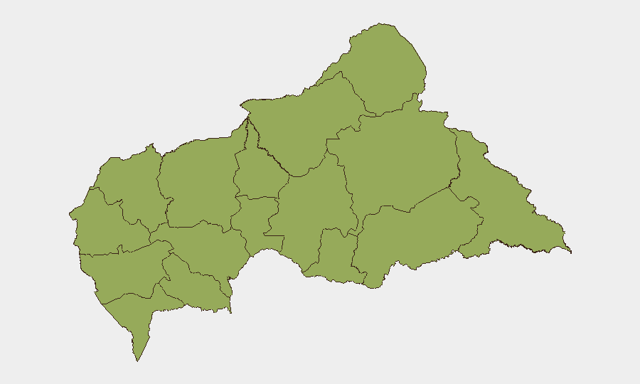
Situation Summary
Central African Republic remains ranked #29 globally on the GeoBit composite threat index (score 66), reflecting endemic armed-group fragmentation, weak state capacity, and persistent intercommunal violence across roughly two-thirds of the country's territory. No discrete security incidents meeting verification criteria (specific location, dated within 24–48 hours, multi-source confirmation) have been logged in open-source channels for 28–29 July 2026. The security environment is characterized by structural rather than acute threats; the most significant recent policy development is the 29 July UN Security Council renewal of sanctions against CAR armed groups and individuals (Resolution 2827, extending through July 2027).
Key Developments
- UN Security Council sanctions renewal (29 July 2026, New York/nationwide CAR effect). Resolution 2827 unanimously extended asset freezes, travel bans, and weapons-supply restrictions targeting CAR armed groups and individuals operating nationwide through 31 July 2027; the expert panel mandate extended to 31 August 2027. This is a governance measure rather than a ground incident, but directly constrains conflict actors' financial and logistical networks.
- Open-source coverage gap (28–29 July 2026). No reliably verified, location-specific security incidents—clashes, mass-casualty events, displacement, or criminal activity—are documented in the current 48-hour window. Coverage gaps of this type may reflect operational pauses, reporting delays, or reduced social-media/NGO presence in remote areas.
- Structural risk concentration in border and remote regions. All twelve sub-national provinces score identically (45.8 composite risk), indicating threat diffusion rather than geographic concentration. Vakaga, Haut-Mbomou, and Mbomou (northeast and southeast borders) remain historically active for armed-group presence and intercommunal tensions; Am-Dafok/Birao corridor and Zémio area (southeast) saw documented activity in late June–early July but no new incidents are confirmed for the current window.
Highest-Risk Areas
All twelve of CAR's provinces carry identical composite risk scores (45.8), reflecting nationwide exposure to armed-group activity, criminal networks, and weak governance. Vakaga (northeast, bordering Chad and Sudan), Haut-Mbomou and Mbomou (southeast, bordering South Sudan and DR Congo), and the Am-Dafok/Birao corridor are historical flashpoints for intercommunal violence and group activity; these areas also experience seasonal displacement and limited humanitarian access. The uniformity of the provincial risk ranking underscores that CAR lacks a single "safe" administrative zone; threat differentiation is driven by proximity to borders, presence of armed-group leadership, and seasonal factors rather than by regional governance capacity.
How GeoBit Would Assist
Security and duty-of-care teams operating in or monitoring CAR should employ AOI Monitoring & Early Warning on high-risk provinces (particularly Vakaga, Haut-Mbomou, Mbomou, and the Am-Dafok zone) to capture incident-level signals (clashes, displacement, criminal activity) with sub-48-hour latency. Multi-language OSINT (X/Twitter, Telegram, radio SIGINT, and local reporting) can supplement gaps in NGO and UN coverage in remote areas. Network & Actor Analysis and entity extraction tools help track leadership changes, splinter groups, and sanctions-designation compliance among armed organizations, enabling teams to anticipate shifts in local security dynamics and supply-chain disruption.
7-Day Outlook
No acute escalation or mass-casualty events are forecast for the next seven days based on current signals. The renewal of UN sanctions may create short-term pressure on armed-group financing and recruitment, but structural fragmentation and border-area instability are unlikely to abate. Monitoring should focus on displacement patterns, cross-border incidents, and any signs of armed-group regrouping or retaliation against humanitarian access.
Highest-Risk Areas — Ranked
| # | State / Region | Risk |
|---|---|---|
| 1 | Bamingui-Bangoran | 45.8 |
| 2 | Vakaga | 45.8 |
| 3 | Haute-Kotto | 45.8 |
| 4 | Haut-Mbomou | 45.8 |
| 5 | Mbomou | 45.8 |
| 6 | Nana-Mambéré | 45.8 |
| 7 | Ouham-Pendé | 45.8 |
| 8 | Mambéré-Kadéï | 45.8 |
| 9 | Sangha-Mbaéré | 45.8 |
| 10 | Ouham | 45.8 |
| 11 | Nana-Grébizi | 45.8 |
| 12 | Kémo | 45.8 |
Sources
Previous Daily Briefs
A new Central African Republic brief is written every day — each with its own risk map and downloadable CSV. Here's the last week; use the calendar to go further back.
📅 Browse every day by calendar →
Highlighted days have a brief. Tap a day for that day's map & analysis, or “csv” for that day's dataset ($5).
Atlas — our AI intelligence desk — emails them this snapshot personally. Nothing else, no list.