Situation Summary
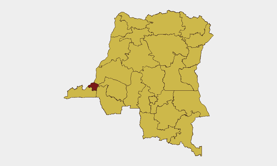
DR Congo remains the 10th-highest-threat country globally (composite score 95), driven primarily by persistent insurgency across multiple regions. The security environment in the eastern provinces—particularly North Kivu, South Kivu, and Ituri—remains actively deteriorated, with Armed Forces of the Democratic Republic (FARDC) and allied groups engaged in continuous counter-insurgency operations against M23, ADF, and other armed groups. Kinshasa itself presents the single highest sub-national risk score (96.5), reflecting political instability and administrative tensions. The overall trajectory shows no near-term de-escalation; displacement and civilian casualties continue as the primary humanitarian consequence.
Key Developments
- Mambasa Territory, Ituri — 26–27 July 2026: ADF attacks killed at least 31–32 civilians across multiple villages over a 72-hour period, with subsequent displacement of residents reported by Radio Okapi and international wire services (AFP, Xinhua). This represents one of the most significant localized civilian casualty events in recent weeks within the region.
- North Kivu / South Kivu — 24 July 2026: Ongoing M23 / Wazalendo / pro-government force clashes reported in Kalehe, southern Masisi, and the Masisi-Walikale border zone, indicating sustained tactical friction in the eastern conflict corridor.
- Minembwe, South Kivu — 24 July 2026: Critical Threats reporting confirmed continued fighting involving M23-aligned fighters and pro-government forces around Minembwe town, underlining persistent territorial contestation in South Kivu.
- Kinshasa — 30 July 2026: Administrative sanctions proceeding initiated against a lawyer, signaling ongoing political and legal tensions in the capital (event classification: Admin Sanctions).
- No verified 24-hour incidents in Kinshasa or western provinces: Open-source feeds have not yielded discrete, time-stamped security incidents (kidnapping, armed robbery, protest violence, or armed clashes) in the western / central heartland over the immediate reporting window. Kinshasa's risk score likely reflects cumulative instability and trajectory rather than acute incident activity in the last 48 hours.
Highest-Risk Areas
Kinshasa (96.5) dominates the sub-national ranking and represents the primary outlier, reflecting concentrated political risk, administrative friction, and duty-of-care exposure for multinational staff and assets. The nine provinces ranked 2–12 (Maniema, Sud-Ubangi, Équateur, Nord-Ubangi, Mongala, Lower Uele, Tshopo, Tshuapa, Upper Uele, Ituri, and North Kivu) all score identically at 66.5, indicating that the national insurgency threat is geographically distributed across the eastern and northern periphery. Ituri and North Kivu show the most acute active-conflict signatures (ADF and M23 respectively), while the northern provinces reflect endemic armed-group presence and limited state capacity.
How GeoBit Would Assist
Security and risk teams should leverage AOI Monitoring & Early Warning on Kinshasa (political/administrative incidents), Ituri (ADF activity), and North/South Kivu (M23 / Wazalendo clashes) to detect escalation before it affects operations. Intel Sweep and OSINT fusion across local media, Radio Okapi feeds, and Telegram channels will provide 24–48-hour lead time on displacement events and civilian casualty spikes. Network & Actor Analysis and force-structure tracking enable real-time mapping of FARDC, M23, and ADF dispositions to inform routing, access planning, and duty-of-care decisions.
7-Day Outlook
ADF and M23 activity in the east is expected to remain high-intensity and episodic, with periodic spikes in civilian casualties and displacement. Kinshasa political risk will likely remain elevated pending electoral or administrative developments. No ceasefire or major military reversal is anticipated in the near term.
Highest-Risk Areas — Ranked
| # | State / Region | Risk |
|---|---|---|
| 1 | Kinshasa | 96.5 |
| 2 | Maniema | 66.5 |
| 3 | Sud-Ubangi | 66.5 |
| 4 | Équateur | 66.5 |
| 5 | Nord-Ubangi | 66.5 |
| 6 | Mongala | 66.5 |
| 7 | Lower Uele | 66.5 |
| 8 | Tshopo | 66.5 |
| 9 | Tshuapa | 66.5 |
| 10 | Upper Uele | 66.5 |
| 11 | Ituri | 66.5 |
| 12 | North Kivu | 66.5 |
Sources
Previous Daily Briefs
A new DR Congo brief is written every day — each with its own risk map and downloadable CSV. Here's the last week; use the calendar to go further back.
📅 Browse every day by calendar →
Highlighted days have a brief. Tap a day for that day's map & analysis, or “csv” for that day's dataset ($5).
Atlas — our AI intelligence desk — emails them this snapshot personally. Nothing else, no list.