Situation Summary
Mali remains a high-threat environment (global rank #14, composite score 76) driven primarily by active insurgency across the north and centre. No independently verified incident-level security events were recorded in the past 24–48 hours; however, the country sustains elevated operational risk from terrorism, kidnapping, banditry, and armed group activity. Recent clashes (notably around Anéfis, 18–19 July) underscore continuing volatility in the Gao region and northern zones, and transport/logistics strain persists nationwide.
Key Developments
- Bamako, 28 July — Senegal's president visited Mali for talks on security cooperation and freight transport, indicating ongoing regional concern over supply-chain and logistics disruption tied to the security environment. This is a policy-level engagement rather than a new incident.
- Bamako (national government), 28 July — Mali's foreign minister stated the government had received no official US communication regarding potential airstrikes on JNIM and other militant groups. This reflects ongoing diplomatic developments around counter-insurgency strategy but is not an operational incident.
- No new on-the-ground incidents, 24–48h window — Open-source monitoring and multi-language OSINT confirm no confirmed attacks, clashes, major arrests, infrastructure damage, or mass unrest in the past two days. Risk remains elevated, but the immediate tactical picture is static.
Highest-Risk Areas
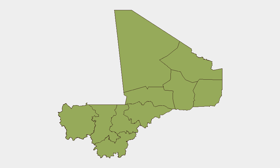
Bamako (risk 83.1) stands significantly above all other regions, reflecting political volatility, arrest activity, and governance instability alongside terrorist threat. The northern and central tier—Gao, Timbuktu, Mopti, Ménaka, and Kidal (all 53.1)—carries severe insurgency and armed-group risk; recent fighting near Anéfis and coordinated July-19 attacks on multiple towns demonstrate recurring tactical activity in these zones. Sikasso Region (57.4) and Kayes (53.1) in the west and southwest respectively present secondary but material risk from banditry and militant activity. Koulikoro and Ségou link Bamako to the north; logistics disruption and roadblock risk on these corridors affect travel and supply operations.
How GeoBit Would Assist
Security teams with personnel or assets in Mali should employ Intel Sweep and multi-language OSINT to track insurgent group movements and tactical announcements across X, Telegram, and local sources in real time. AOI (Area-of-Interest) Monitoring with alerting on Bamako, Gao, Timbuktu, and key transport corridors (Kayes–Koulikoro–Ségou–Mopti) provides persistent early warning of clashes, arrests, and security incidents. Routing & Network Analysis supports duty-of-care teams in identifying safe alternative corridors and journey-planning during periods of roadblock escalation or regional unrest.
7-Day Outlook
No major escalation is forecast for the next seven days based on current signals, but the underlying threat vector remains high. Continued insurgent activity in the north and centre, particularly around Gao, Ménaka, and Timbuktu, should be anticipated; logistical strain and checkpoint delays are likely to persist. Any shift in US or regional military posture toward JNIM or other groups could trigger tactical retaliation or increased activity in urban or transport zones.
Highest-Risk Areas — Ranked
| # | State / Region | Risk |
|---|---|---|
| 1 | Bamako | 83.1 |
| 2 | Sikasso Region | 57.4 |
| 3 | Ménaka | 53.1 |
| 4 | Kayes | 53.1 |
| 5 | Taoudénit Region | 53.1 |
| 6 | Kidal | 53.1 |
| 7 | Gao | 53.1 |
| 8 | Koulikoro | 53.1 |
| 9 | Ségou Region | 53.1 |
| 10 | Timbuktu | 53.1 |
| 11 | Mopti | 53.1 |
Sources
Previous Daily Briefs
A new Mali brief is written every day — each with its own risk map and downloadable CSV. Here's the last week; use the calendar to go further back.
📅 Browse every day by calendar →
Highlighted days have a brief. Tap a day for that day's map & analysis, or “csv” for that day's dataset ($5).
Atlas — our AI intelligence desk — emails them this snapshot personally. Nothing else, no list.